TopoQuest Logo
Do you find TopoQuest useful?
Help keep TopoQuest running and adding new maps/features by donating!
Bitcoin:  19c7KJd3qBynnjoSw5npx9KScwjBe4ifkT
Litecoin:  LXs6TkuXGGXo1vDsWCkWVdjQX94eUKd6ui
Home View Maps Find Maps Find Places Resources & Links


Arkansas Flat, Oregon Topographic Map

USGS Map Title: Arkansas Flat, OR
USGS Map MRC: 42120B7
DRG (GeoTIFF) Download: o42120b7.tif


Neighboring USGS Topographic Map Quads:


  Paradise Mountain, OR  
42120C8
 

  Quartz Valley, OR  
42120C7
 

  Cougar Peak, OR  
42120C6
 

  Barnes Valley, OR  
42120B8
 

  Arkansas Flat, OR  
42120B7
 

  Drews Reservoir, OR  
42120B6
 

  Antler Point, OR  
42120A8
 

  Strawberry Butte, OR  
42120A7
 

  Dog Lake, OR  
42120A6


Map MRC Location:

N43°
W121°
N43°
W120°
H8 H7 H6 H5 H4 H3 H2 H1
G8 G7 G6 G5 G4 G3 G2 G1
F8 F7 F6 F5 F4 F3 F2 F1
E8 E7 E6 E5 E4 E3 E2 E1
D8 D7 D6 D5 D4 D3 D2 D1
C8 C7 C6 C5 C4 C3 C2 C1
B8 B7 B6 B5 B4 B3 B2 B1
A8 A7 A6 A5 A4 A3 A2 A1
N42°
W121°
N42°
W120°

Arkansas Flat, OR USGS 1:24K Topographic Map Preview:
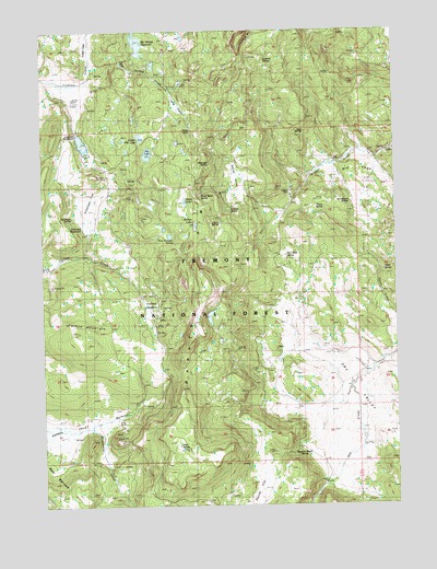
Arkansas Flat, OR USGS Topographic Map
Click on map above to begin viewing in our Map Viewer.

This topographic map contains these locations and features:
Feature Name Type Latitude Longitude GNIS ID View Map
Albertson SpringSpringN42.2149°W120.8165°1116804View Map
Arkansas DamDamN42.1968°W120.8598°1133451View Map
Arkansas FlatFlatN42.2013°W120.8605°1117037View Map
Arkansas ReservoirReservoirN42.1983°W120.8604°1117038View Map
Arkansas SpringSpringN42.2009°W120.8654°1117039View Map
Aspen Ridge TrailheadLocaleN42.2322°W120.8582°2548757View Map
Bachelor CreekStreamN42.1452°W120.8644°1117122View Map
Barnes RimCliffN42.1704°W120.8250°1137534View Map
Bear WallowsFlatN42.1331°W120.8736°1136046View Map
Big CoveBasinN42.2129°W120.7652°1117595View Map
Big Swamp CreekStreamN42.2410°W120.8603°1117684View Map
Big Swamp DamDamN42.2432°W120.8428°1131559View Map
Big Swamp ReservoirReservoirN42.2466°W120.8417°1117686View Map
Blue Monday SpringSpringN42.1947°W120.8295°1117851View Map
Buzzard Roost SpringSpringN42.1392°W120.7857°1118423View Map
Court SpringSpringN42.1991°W120.8133°1119396View Map
Creed FieldFlatN42.2457°W120.8608°1159094View Map
Davis LakeLakeN42.2050°W120.8253°1119712View Map
Deer SpringSpringN42.1406°W120.8282°1119838View Map
Dry ValleyBasinN42.1568°W120.7750°1120182View Map
Harry SpringSpringN42.2031°W120.7758°1121632View Map
Holmes MeadowSwampN42.1760°W120.8374°1121932View Map
Horsehead SpringSpringN42.2044°W120.7670°1122025View Map
Hoyts HoleBendN42.2240°W120.8291°1122091View Map
July SpringSpringN42.2060°W120.7903°1122551View Map
June SpringSpringN42.2234°W120.7829°1122562View Map
Juniper MountainSummitN42.1671°W120.8619°1136427View Map
Lapham DamDamN42.2232°W120.8628°1131380View Map
Lapham RanchLocaleN42.2321°W120.8669°1122958View Map
Lapham ReservoirReservoirN42.2205°W120.8617°1122959View Map
Long PrairieSwampN42.2298°W120.8274°1123445View Map
Lookout SpringSpringN42.2427°W120.8018°1123472View Map
Lower Pitt LakeLakeN42.2219°W120.8411°1123579View Map
Pitt LakeLakeN42.2175°W120.8384°1125450View Map
Pitt Lake DamDamN42.2168°W120.8400°1133647View Map
Red Rock SpringSpringN42.1898°W120.7895°1125903View Map
Road Bend SpringSpringN42.2069°W120.8193°1126076View Map
Secret ValleyValleyN42.2029°W120.7941°1126722View Map
Squaw FlatFlatN42.1277°W120.8022°1150271View Map
Strawberry CreekStreamN42.1449°W120.8605°1150480View Map
Sullivan SpringSpringN42.2027°W120.8093°1127708View Map
Upset SpringSpringN42.1868°W120.7551°1128481View Map
Utley RanchLocaleN42.1471°W120.8511°1159095View Map
Walker LakeLakeN42.2010°W120.8250°1128594View Map
Wilson CreekStreamN42.1915°W120.8608°1131135View Map

Note: Coordinates in the location and feature list above are referenced to NAD83 datum.


Copyright (C) 2008-2024 Ryan Niemi / Sunset Dynamics ... All Rights Reserved