TopoQuest Logo
Do you find TopoQuest useful?
Help keep TopoQuest running and adding new maps/features by donating!
Bitcoin:  19c7KJd3qBynnjoSw5npx9KScwjBe4ifkT
Litecoin:  LXs6TkuXGGXo1vDsWCkWVdjQX94eUKd6ui
Home View Maps Find Maps Find Places Resources & Links


Elwood, Oregon Topographic Map

USGS Map Title: Elwood, OR
USGS Map MRC: 45122B3
DRG (GeoTIFF) Download: o45122b3.tif


Neighboring USGS Topographic Map Quads:


  Redland, OR  
45122C4
 

  Estacada, OR  
45122C3
 

  Cherryville, OR  
45122C2
 

  Colton, OR  
45122B4
 

  Elwood, OR  
45122B3
 

  Bedford Point, OR  
45122B2
 

  Fernwood, OR  
45122A4
 

  Soosap Peak, OR  
45122A3
 

  Wanderers Peak, OR  
45122A2


Map MRC Location:

N46°
W123°
N46°
W122°
H8 H7 H6 H5 H4 H3 H2 H1
G8 G7 G6 G5 G4 G3 G2 G1
F8 F7 F6 F5 F4 F3 F2 F1
E8 E7 E6 E5 E4 E3 E2 E1
D8 D7 D6 D5 D4 D3 D2 D1
C8 C7 C6 C5 C4 C3 C2 C1
B8 B7 B6 B5 B4 B3 B2 B1
A8 A7 A6 A5 A4 A3 A2 A1
N45°
W123°
N45°
W122°

Elwood, OR USGS 1:24K Topographic Map Preview:
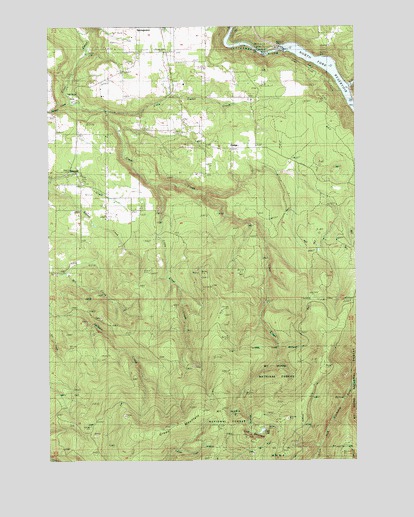
Elwood, OR USGS Topographic Map
Click on map above to begin viewing in our Map Viewer.

This topographic map contains these locations and features:
Feature Name Type Latitude Longitude GNIS ID View Map
Clear LakeLakeN45.1334°W122.2896°1139802View Map
Colton Rural Fire Protection District 70 Station 123BuildingN45.2052°W122.3626°2577017View Map
D K QuarryMineN45.1269°W122.2929°2754379View Map
DodgePopulated PlaceN45.2148°W122.3023°1141102View Map
Dodge Community ChurchChurchN45.2156°W122.2981°2439634View Map
Dodge Post Office (historical)Post OfficeN45.2148°W122.3023°1165168View Map
East Fork South Fork Clackamas RiverStreamN45.1476°W122.2523°1133949View Map
ElwoodPopulated PlaceN45.2082°W122.3701°1141846View Map
Elwood CemeteryCemeteryN45.2047°W122.3623°1154444View Map
Elwood Post Office (historical)Post OfficeN45.2082°W122.3701°1165213View Map
Goat MountainSummitN45.1315°W122.2967°1142785View Map
Green MountainRidgeN45.1360°W122.3229°1143040View Map
Hillockburn Guard StationLocaleN45.1715°W122.2529°1143603View Map
Lacy Post Office (historical)Post OfficeN45.2318°W122.3262°1165503View Map
Little Cedar CreekStreamN45.2257°W122.3545°1145124View Map
Little Clear CreekStreamN45.2043°W122.3337°1145127View Map
Metzler Park Recreation SiteParkN45.2285°W122.3662°1155878View Map
North Fork Clackamas RiverStreamN45.2323°W122.2545°1146928View Map
North Fork DamDamN45.2415°W122.2829°1158850View Map
North Fork ReservoirReservoirN45.2398°W122.2664°1154442View Map
Sams PondsReservoirN45.2207°W122.2845°1154441View Map
Springwater Golf CourseLocaleN45.2481°W122.3493°2740141View Map
Swagger CreekStreamN45.2282°W122.3701°1150720View Map

Note: Coordinates in the location and feature list above are referenced to NAD83 datum.


Copyright (C) 2008-2024 Ryan Niemi / Sunset Dynamics ... All Rights Reserved