TopoQuest Logo
Do you find TopoQuest useful?
Help keep TopoQuest running and adding new maps/features by donating!
Bitcoin:  19c7KJd3qBynnjoSw5npx9KScwjBe4ifkT
Litecoin:  LXs6TkuXGGXo1vDsWCkWVdjQX94eUKd6ui
Home View Maps Find Maps Find Places Resources & Links


Arenzville West, Illinois Topographic Map

USGS Map Title: Arenzville West, IL
USGS Map MRC: 39090H4
DRG (GeoTIFF) Download: o39090h4.tif


Neighboring USGS Topographic Map Quads:


  Rushville South, IL  
40090A5
 

  Beardstown, IL  
40090A4
 

  Clear Lake, IL  
40090A3
 

  Cooperstown, IL  
39090H5
 

  Arenzville West, IL  
39090H4
 

  Arenzville East, IL  
39090H3
 

  Meredosia, IL  
39090G5
 

  Chapin, IL  
39090G4
 

  Concord, IL  
39090G3


Map MRC Location:

N40°
W91°
N40°
W90°
H8 H7 H6 H5 H4 H3 H2 H1
G8 G7 G6 G5 G4 G3 G2 G1
F8 F7 F6 F5 F4 F3 F2 F1
E8 E7 E6 E5 E4 E3 E2 E1
D8 D7 D6 D5 D4 D3 D2 D1
C8 C7 C6 C5 C4 C3 C2 C1
B8 B7 B6 B5 B4 B3 B2 B1
A8 A7 A6 A5 A4 A3 A2 A1
N39°
W91°
N39°
W90°

Arenzville West, IL USGS 1:24K Topographic Map Preview:
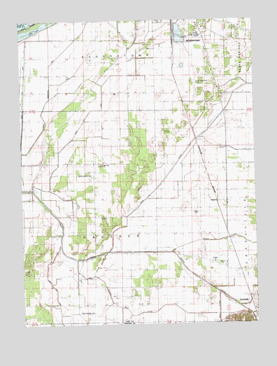
Arenzville West, IL USGS Topographic Map
Click on map above to begin viewing in our Map Viewer.

This topographic map contains these locations and features:
Feature Name Type Latitude Longitude GNIS ID View Map
Arenz School (historical)SchoolN39.9798°W90.3860°403595View Map
Black Oak CemeteryCemeteryN39.9412°W90.4568°1802252View Map
Black Oak ChurchChurchN39.9412°W90.4568°1720392View Map
Blackoak School (historical)SchoolN39.9412°W90.4568°404526View Map
Clear CreekStreamN39.9053°W90.4540°406209View Map
Drainage DitchCanalN39.9725°W90.3926°407375View Map
Edgewood School (historical)SchoolN39.9781°W90.4560°407780View Map
Greater Beardstown AirportAirportN39.9785°W90.4047°427048View Map
Hackman CemeteryCemeteryN39.8978°W90.3937°1720415View Map
HagenerPopulated PlaceN39.9259°W90.3973°422771View Map
Hagener TownhallBuildingN39.9192°W90.4576°1720416View Map
Kinsey RLA AirportAirportN39.8798°W90.4707°427023View Map
Korsmeyer School (historical)SchoolN39.9023°W90.4987°411612View Map
Krohe AirportAirportN39.9355°W90.4627°427047View Map
Mannel BranchStreamN39.8839°W90.3876°412899View Map
North Lake DitchCanalN39.9739°W90.4971°414622View Map
Old Channel Mud CreekStreamN39.9045°W90.4796°415004View Map
Pankey Pond DitchCanalN39.8873°W90.4823°415343View Map
Prairie CreekStreamN39.9050°W90.4210°416123View Map
Saint Peters ChurchChurchN39.9009°W90.3985°417752View Map
Saint Peters Lutheran CemeteryCemeteryN39.9006°W90.3965°1808750View Map
Schneider CemeteryCemeteryN39.9537°W90.4198°1720450View Map
South Beardstown DitchCanalN39.9831°W90.4821°418712View Map
Swan Lake School (historical)SchoolN39.9639°W90.4971°419461View Map
Township of HagenerCivilN39.9167°W90.4696°429093View Map
Valley DitchCanalN39.9520°W90.4723°420200View Map
Valley Pumping StationLocaleN39.9312°W90.4937°425594View Map
Wagle CemeteryCemeteryN39.9212°W90.4071°1720460View Map
Wagoner BridgeBridgeN39.9020°W90.4682°425609View Map
Wagoner School (historical)SchoolN39.8964°W90.4737°420374View Map
West Point School (historical)SchoolN39.8973°W90.4193°420895View Map

Note: Coordinates in the location and feature list above are referenced to NAD83 datum.


Copyright (C) 2008-2024 Ryan Niemi / Sunset Dynamics ... All Rights Reserved