TopoQuest Logo
Do you find TopoQuest useful?
Help keep TopoQuest running and adding new maps/features by donating!
Bitcoin:  19c7KJd3qBynnjoSw5npx9KScwjBe4ifkT
Litecoin:  LXs6TkuXGGXo1vDsWCkWVdjQX94eUKd6ui
Home View Maps Find Maps Find Places Resources & Links


Elaterite Basin, Utah Topographic Map

USGS Map Title: Elaterite Basin, UT
USGS Map MRC: 38110B1
DRG (GeoTIFF) Download: o38110b1.tif


Neighboring USGS Topographic Map Quads:


  Head Spur, UT  
38110C2
 

  Cleopatras Chair, UT  
38110C1
 

  Turks Head, UT  
38109C8
 

  Gordon Flats, UT  
38110B2
 

  Elaterite Basin, UT  
38110B1
 

  Spanish Bottom, UT  
38109B8
 

  Clearwater Canyon, UT  
38110A2
 

  Teapot Rock, UT  
38110A1
 

  Cross Canyon, UT  
38109A8


Map MRC Location:

N39°
W111°
N39°
W110°
H8 H7 H6 H5 H4 H3 H2 H1
G8 G7 G6 G5 G4 G3 G2 G1
F8 F7 F6 F5 F4 F3 F2 F1
E8 E7 E6 E5 E4 E3 E2 E1
D8 D7 D6 D5 D4 D3 D2 D1
C8 C7 C6 C5 C4 C3 C2 C1
B8 B7 B6 B5 B4 B3 B2 B1
A8 A7 A6 A5 A4 A3 A2 A1
N38°
W111°
N38°
W110°

Elaterite Basin, UT USGS 1:24K Topographic Map Preview:
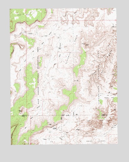
Elaterite Basin, UT USGS Topographic Map
Click on map above to begin viewing in our Map Viewer.

This topographic map contains these locations and features:
Feature Name Type Latitude Longitude GNIS ID View Map
Bagpipe ButteSummitN38.1562°W110.1125°1429074View Map
Big Water CanyonValleyN38.2368°W110.0658°1427686View Map
Big Water SpringSpringN38.2141°W110.0687°1425573View Map
Black LedgeBenchN38.1925°W110.1226°1425682View Map
Brimhall PointCapeN38.2347°W110.0001°1425972View Map
Cave ArchArchN38.1522°W110.0496°1434937View Map
China NeckGapN38.1436°W110.0807°1454619View Map
Elaterite BasinBasinN38.2192°W110.0693°1427770View Map
Elaterite ButteSummitN38.2172°W110.0374°1425227View Map
Ernies CountryAreaN38.1375°W110.0260°1427837View Map
Flint CoveValleyN38.1378°W110.1121°1428010View Map
Maze OverlookParkN38.2330°W110.0037°1434936View Map
North TrailTrailN38.2278°W110.1090°1450449View Map
North Trail CanyonValleyN38.2220°W110.0862°1430870View Map
Tapestry SlabRidgeN38.1750°W110.0174°1454628View Map
The FinsPillarN38.1469°W110.0090°1433307View Map
The GapGapN38.1850°W110.0485°1433313View Map
The Golden StairsTrailN38.1430°W110.0735°1433316View Map
The MazeAreaN38.2083°W110.0007°1433359View Map
The Mother and ChildPillarN38.1397°W110.0721°1434939View Map
The WallCliffN38.1717°W110.0118°1434942View Map
The WallPillarN38.1680°W110.0193°1436582View Map
Tibbett ArchArchN38.1564°W110.0057°1454999View Map
West Fork Big Water CanyonValleyN38.2351°W110.0682°1434071View Map
Whitmore ArchArchN38.1383°W110.0451°1434940View Map
Wide ValleyValleyN38.1355°W110.0128°1434941View Map

Note: Coordinates in the location and feature list above are referenced to NAD83 datum.


Copyright (C) 2008-2024 Ryan Niemi / Sunset Dynamics ... All Rights Reserved