TopoQuest Logo
Do you find TopoQuest useful?
Help keep TopoQuest running and adding new maps/features by donating!
Bitcoin:  19c7KJd3qBynnjoSw5npx9KScwjBe4ifkT
Litecoin:  LXs6TkuXGGXo1vDsWCkWVdjQX94eUKd6ui
Home View Maps Find Maps Find Places Resources & Links


El Paso Peaks, California Topographic Map

USGS Map Title: El Paso Peaks, CA
USGS Map MRC: 35117D6
DRG (GeoTIFF) Download: o35117d6.tif


Neighboring USGS Topographic Map Quads:


  Inyokern SE, CA  
35117E7
 

  Ridgecrest South, CA  
35117E6
 

  Spangler Hills West, CA  
35117E5
 

  Garlock, CA  
35117D7
 

  El Paso Peaks, CA  
35117D6
 

  Klinker Mountain, CA  
35117D5
 

  Saltdale SE, CA  
35117C7
 

  Johannesburg, CA  
35117C6
 

  Red Mountain, CA  
35117C5


Map MRC Location:

N36°
W118°
N36°
W117°
H8 H7 H6 H5 H4 H3 H2 H1
G8 G7 G6 G5 G4 G3 G2 G1
F8 F7 F6 F5 F4 F3 F2 F1
E8 E7 E6 E5 E4 E3 E2 E1
D8 D7 D6 D5 D4 D3 D2 D1
C8 C7 C6 C5 C4 C3 C2 C1
B8 B7 B6 B5 B4 B3 B2 B1
A8 A7 A6 A5 A4 A3 A2 A1
N35°
W118°
N35°
W117°

El Paso Peaks, CA USGS 1:24K Topographic Map Preview:
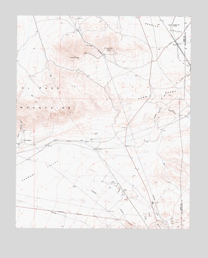
El Paso Peaks, CA USGS Topographic Map
Click on map above to begin viewing in our Map Viewer.

This topographic map contains these locations and features:
Feature Name Type Latitude Longitude GNIS ID View Map
Benson WellWellN35.4247°W117.7481°239231View Map
El Paso PeaksSummitN35.4761°W117.7098°241908View Map
Fiddler GulchValleyN35.4050°W117.7176°242223View Map
Garden City StationLocaleN35.4952°W117.6389°242596View Map
Goler HeightsPopulated PlaceN35.4269°W117.7459°1656530View Map
Haggin WellWellN35.4983°W117.7076°243108View Map
Hardcash GulchValleyN35.4372°W117.6501°243212View Map
KGBM-FM (Randsburg)TowerN35.4780°W117.7003°1665070View Map
KRAJ-FM (Johannesburg)TowerN35.4775°W117.7003°1665045View Map
KZIQ-FM (Ridgecrest)TowerN35.4775°W117.7003°1665074View Map
Laurel MountainSummitN35.4800°W117.6828°1656560View Map
Phoenix GulchValleyN35.4394°W117.6337°247432View Map
RandPopulated PlaceN35.4219°W117.6926°1656604View Map
Rinaldis WellWellN35.4908°W117.7062°248196View Map
SearlesPopulated PlaceN35.4838°W117.6353°252979View Map
Teagle (historical)Populated PlaceN35.4361°W117.6414°1670293View Map
Valverde MineMineN35.3797°W117.6387°1670296View Map
Willow SpringSpringN35.4825°W117.6965°1670297View Map
Willow Spring WellWellN35.4822°W117.6959°251657View Map
Yellow Aster MillLocaleN35.4216°W117.7481°251853View Map

Note: Coordinates in the location and feature list above are referenced to NAD83 datum.


Copyright (C) 2008-2024 Ryan Niemi / Sunset Dynamics ... All Rights Reserved