TopoQuest Logo
Do you find TopoQuest useful?
Help keep TopoQuest running and adding new maps/features by donating!
Bitcoin:  19c7KJd3qBynnjoSw5npx9KScwjBe4ifkT
Litecoin:  LXs6TkuXGGXo1vDsWCkWVdjQX94eUKd6ui
Home View Maps Find Maps Find Places Resources & Links


Durant, Iowa Topographic Map

USGS Map Title: Durant, IA
USGS Map MRC: 41090E8
DRG (GeoTIFF) Download: o41090e8.tif


Neighboring USGS Topographic Map Quads:


  Lime City, IA  
41091F1
 

  Bennett, IA  
41090F8
 

  Dixon, IA  
41090F7
 

  Wilton, IA  
41091E1
 

  Durant, IA  
41090E8
 

  Walcott, IA  
41090E7
 

  Muscatine, IA  
41091D1
 

  Illinois City, IL  
41090D8
 

  Montpelier, IA  
41090D7


Map MRC Location:

N42°
W91°
N42°
W90°
H8 H7 H6 H5 H4 H3 H2 H1
G8 G7 G6 G5 G4 G3 G2 G1
F8 F7 F6 F5 F4 F3 F2 F1
E8 E7 E6 E5 E4 E3 E2 E1
D8 D7 D6 D5 D4 D3 D2 D1
C8 C7 C6 C5 C4 C3 C2 C1
B8 B7 B6 B5 B4 B3 B2 B1
A8 A7 A6 A5 A4 A3 A2 A1
N41°
W91°
N41°
W90°

Durant, IA USGS 1:24K Topographic Map Preview:
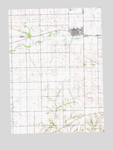
Durant, IA USGS Topographic Map
Click on map above to begin viewing in our Map Viewer.

This topographic map contains these locations and features:
Feature Name Type Latitude Longitude GNIS ID View Map
Big Elkhorn CreekStreamN41.6011°W90.9321°454608View Map
Center Grove School (historical)SchoolN41.5684°W90.8754°465060View Map
City of DurantCivilN41.6015°W90.9119°2394581View Map
Crab Apple School (historical)SchoolN41.5467°W90.8832°465065View Map
Doran CemeteryCemeteryN41.5584°W90.9668°2000615View Map
DurantPopulated PlaceN41.5997°W90.9107°456075View Map
Durant (historical)LocaleN41.6003°W90.9096°2001627View Map
Durant Ambulance Service IncorporatedBuildingN41.6003°W90.9099°2599806View Map
Durant CemeteryCemeteryN41.5966°W90.8973°456076View Map
Durant City HallBuildingN41.6025°W90.9138°2001623View Map
Durant City LibraryBuildingN41.6025°W90.9138°2001622View Map
Durant City Wastewater PlantLocaleN41.5944°W90.9089°2728285View Map
Durant Elementary SchoolSchoolN41.6040°W90.9117°2719991View Map
Durant Fire StationBuildingN41.6003°W90.9101°2001624View Map
Durant High SchoolSchoolN41.6038°W90.9131°2001631View Map
Durant Medical CenterHospitalN41.6003°W90.9110°2001628View Map
Durant Middle SchoolSchoolN41.6042°W90.9127°2719992View Map
Durant Police DepartmentBuildingN41.6023°W90.9183°2001625View Map
Durant Post OfficePost OfficeN41.6006°W90.9074°2001626View Map
Dutton ParkParkN41.6011°W90.9029°464912View Map
Gloria Dei Lutheran ChurchChurchN41.6031°W90.9146°2001630View Map
KFMH-FM (Muscatine)TowerN41.6061°W90.9932°467339View Map
Laurel Hill School (historical)SchoolN41.5453°W90.9971°465104View Map
Little Elkhorn CreekStreamN41.5911°W90.9679°458464View Map
Melpine CemeteryCemeteryN41.5223°W90.9293°458956View Map
Melpine Post Office (historical)Post OfficeN41.5081°W90.9224°466617View Map
Melpine School (historical)SchoolN41.5078°W90.9207°465125View Map
Prairie School (historical)SchoolN41.5353°W90.9588°465143View Map
Prospect Hill School (historical)SchoolN41.5811°W90.9290°465145View Map
Saint Pauls Episcopal ChurchChurchN41.5984°W90.9126°2001629View Map
Sunnyside SchoolSchoolN41.5520°W90.9201°462102View Map
Township of WiltonCivilN41.5598°W90.9692°469008View Map
Wahkonsa Country ClubLocaleN41.6028°W90.9551°2001632View Map

Note: Coordinates in the location and feature list above are referenced to NAD83 datum.


Copyright (C) 2008-2024 Ryan Niemi / Sunset Dynamics ... All Rights Reserved