TopoQuest Logo
Do you find TopoQuest useful?
Help keep TopoQuest running and adding new maps/features by donating!
Bitcoin:  19c7KJd3qBynnjoSw5npx9KScwjBe4ifkT
Litecoin:  LXs6TkuXGGXo1vDsWCkWVdjQX94eUKd6ui
Home View Maps Find Maps Find Places Resources & Links


Dry Prong, Louisiana Topographic Map

USGS Map Title: Dry Prong, LA
USGS Map MRC: 31092E5
DRG (GeoTIFF) Download: o31092e5.tif


Neighboring USGS Topographic Map Quads:


  Savage Creek, LA  
31092F6
 

  Williana, LA  
31092F5
 

  Mudville, LA  
31092F4
 

  Colfax, LA  
31092E6
 

  Dry Prong, LA  
31092E5
 

  Pollock, LA  
31092E4
 

  Boyce, LA  
31092D6
 

  Rock Hill, LA  
31092D5
 

  Ball, LA  
31092D4


Map MRC Location:

N32°
W93°
N32°
W92°
H8 H7 H6 H5 H4 H3 H2 H1
G8 G7 G6 G5 G4 G3 G2 G1
F8 F7 F6 F5 F4 F3 F2 F1
E8 E7 E6 E5 E4 E3 E2 E1
D8 D7 D6 D5 D4 D3 D2 D1
C8 C7 C6 C5 C4 C3 C2 C1
B8 B7 B6 B5 B4 B3 B2 B1
A8 A7 A6 A5 A4 A3 A2 A1
N31°
W93°
N31°
W92°

Dry Prong, LA USGS 1:24K Topographic Map Preview:
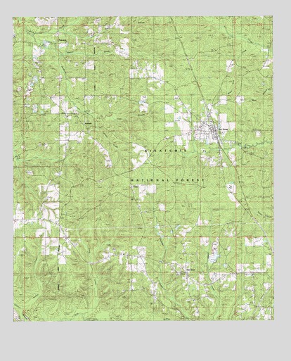
Dry Prong, LA USGS Topographic Map
Click on map above to begin viewing in our Map Viewer.

This topographic map contains these locations and features:
Feature Name Type Latitude Longitude GNIS ID View Map
Beaver CreekStreamN31.6179°W92.6160°547044View Map
Bethel ChurchChurchN31.5343°W92.5996°547061View Map
Black Creek School (historical)SchoolN31.6180°W92.6035°545746View Map
Black Lick CreekStreamN31.6130°W92.5065°547095View Map
Buehler Church (historical)ChurchN31.5346°W92.6196°545751View Map
Clear BranchStreamN31.5852°W92.5882°547220View Map
Colfax Lookout TowerTowerN31.5502°W92.5679°558754View Map
Cress CreekStreamN31.5013°W92.5915°547264View Map
Cypress CreekStreamN31.5846°W92.5888°547280View Map
Dry ProngPopulated PlaceN31.5813°W92.5329°554276View Map
Dry Prong Junior High SchoolSchoolN31.5790°W92.5304°545761View Map
Dry Prong Post OfficePost OfficeN31.5791°W92.5290°1630317View Map
FairclothPopulated PlaceN31.6143°W92.6049°547348View Map
FairfieldPopulated PlaceN31.5807°W92.5907°541538View Map
Fairfield ChurchChurchN31.5774°W92.5921°547349View Map
Fairfield School (historical)SchoolN31.5782°W92.5910°545764View Map
Glady HollowValleyN31.6189°W92.5999°547398View Map
Grant Academy SchoolSchoolN31.5558°W92.5212°2462817View Map
Grant High SchoolSchoolN31.5548°W92.5212°545772View Map
Grant ParishCivilN31.5997°W92.5595°558567View Map
Grant Parish Fire District 3BuildingN31.5775°W92.5292°2673089View Map
Hebron ChurchChurchN31.6171°W92.6249°547454View Map
KLAX-TV (Alexandria)TowerN31.5652°W92.5501°1632494View Map
KLPA-TV (Alexandria)TowerN31.5657°W92.5474°1632495View Map
KLSA-FM (Alexandria)TowerN31.5657°W92.5474°1632423View Map
KVDP-FM (Dry Prong)TowerN31.5891°W92.5165°1632439View Map
Lone Pine ChurchChurchN31.5185°W92.5104°547620View Map
Midway CemeteryCemeteryN31.6177°W92.5871°547691View Map
Midway Church (historical)ChurchN31.6185°W92.5840°545783View Map
O K School (historical)SchoolN31.5421°W92.6168°545789View Map
Oak GrovePopulated PlaceN31.5202°W92.5424°541539View Map
Oak Grove ChurchChurchN31.5196°W92.5438°547783View Map
Oak Grove School (historical)SchoolN31.5199°W92.5474°545790View Map
Parsonage CemeteryCemeteryN31.5010°W92.5437°547818View Map
Swafford CreekStreamN31.6099°W92.6038°548056View Map
Turk CreekStreamN31.5041°W92.6207°548092View Map
Village of Dry ProngCivilN31.5806°W92.5305°2407444View Map
Ward ThreeCivilN31.5741°W92.5282°545037View Map

Note: Coordinates in the location and feature list above are referenced to NAD83 datum.


Copyright (C) 2008-2024 Ryan Niemi / Sunset Dynamics ... All Rights Reserved