TopoQuest Logo
Do you find TopoQuest useful?
Help keep TopoQuest running and adding new maps/features by donating!
Bitcoin:  19c7KJd3qBynnjoSw5npx9KScwjBe4ifkT
Litecoin:  LXs6TkuXGGXo1vDsWCkWVdjQX94eUKd6ui
Home View Maps Find Maps Find Places Resources & Links


Appleton City, Missouri Topographic Map

USGS Map Title: Appleton City, MO
USGS Map MRC: 38094B1
DRG (GeoTIFF) Download: o38094b1.tif


Neighboring USGS Topographic Map Quads:


  Spruce, MO  
38094C2
 

  Johnstown, MO  
38094C1
 

  Montrose, MO  
38093C8
 

  Pleasant Gap, MO  
38094B2
 

  Appleton City, MO  
38094B1
 

  Monegaw Springs NW, MO  
38093B8
 

  Papinville, MO  
38094A2
 

  Rockville, MO  
38094A1
 

  Taberville, MO  
38093A8


Map MRC Location:

N39°
W95°
N39°
W94°
H8 H7 H6 H5 H4 H3 H2 H1
G8 G7 G6 G5 G4 G3 G2 G1
F8 F7 F6 F5 F4 F3 F2 F1
E8 E7 E6 E5 E4 E3 E2 E1
D8 D7 D6 D5 D4 D3 D2 D1
C8 C7 C6 C5 C4 C3 C2 C1
B8 B7 B6 B5 B4 B3 B2 B1
A8 A7 A6 A5 A4 A3 A2 A1
N38°
W95°
N38°
W94°

Appleton City, MO USGS 1:24K Topographic Map Preview:
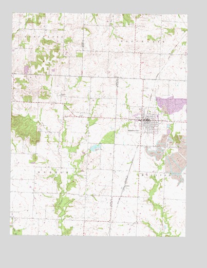
Appleton City, MO USGS Topographic Map
Click on map above to begin viewing in our Map Viewer.

This topographic map contains these locations and features:
Feature Name Type Latitude Longitude GNIS ID View Map
Appleton CityPopulated PlaceN38.1906°W94.0294°755694View Map
Appleton City CemeteryCemeteryN38.1747°W94.0238°755695View Map
Appleton City Elementary SchoolSchoolN38.1903°W94.0338°2743758View Map
Appleton City Fire DepartmentBuildingN38.1899°W94.0268°2621562View Map
Appleton City High SchoolSchoolN38.1902°W94.0329°757134View Map
Appleton City LakeReservoirN38.1747°W94.0652°758244View Map
Appleton City Lake DamDamN38.1734°W94.0686°762895View Map
Appleton City Police DepartmentBuildingN38.1903°W94.0272°2752446View Map
Appleton City Post OfficePost OfficeN38.1907°W94.0288°2783081View Map
Blackwell CemeteryCemeteryN38.1811°W94.1185°714341View Map
Browning School (historical)SchoolN38.2281°W94.0466°745476View Map
Brush College School (historical)SchoolN38.1484°W94.0769°746045View Map
City of Appleton CityCivilN38.1906°W94.0310°2393969View Map
Ellett Memorial HospitalHospitalN38.1932°W94.0214°2655045View Map
Fennewald CemeteryCemeteryN38.2081°W94.0274°756043View Map
Hazel Dell School (historical)SchoolN38.1834°W94.0797°746044View Map
HudsonPopulated PlaceN38.2036°W94.0902°740947View Map
Hudson Elementary SchoolSchoolN38.1922°W94.0766°719955View Map
Hudson Post OfficePost OfficeN38.2028°W94.0905°1891085View Map
LindalePopulated PlaceN38.1534°W94.0438°756303View Map
Marryfield School (historical)SchoolN38.1472°W94.0349°757180View Map
McDavitt School (historical)SchoolN38.1273°W94.1052°746046View Map
Mount Hope Community CenterLocaleN38.2434°W94.0369°722767View Map
Oak Grove School (historical)SchoolN38.2370°W94.1024°746043View Map
Round Prairie CemeteryCemeteryN38.1381°W94.1249°725615View Map
Spring Grove CemeteryCemeteryN38.1250°W94.0069°756755View Map
Township of HudsonCivilN38.1604°W94.1082°766297View Map

Note: Coordinates in the location and feature list above are referenced to NAD83 datum.


Copyright (C) 2008-2024 Ryan Niemi / Sunset Dynamics ... All Rights Reserved