TopoQuest Logo
Do you find TopoQuest useful?
Help keep TopoQuest running and adding new maps/features by donating!
Bitcoin:  19c7KJd3qBynnjoSw5npx9KScwjBe4ifkT
Litecoin:  LXs6TkuXGGXo1vDsWCkWVdjQX94eUKd6ui
Home View Maps Find Maps Find Places Resources & Links


Dixfield, Maine Topographic Map

USGS Map Title: Dixfield, ME
USGS Map MRC: 44070E4
DRG (GeoTIFF) Download: o44070e4.tif


Neighboring USGS Topographic Map Quads:


  Roxbury, ME  
44070F5
 

  Weld, ME  
44070F4
 

  Mount Blue, ME  
44070F3
 

  Rumford, ME  
44070E5
 

  Dixfield, ME  
44070E4
 

  East Dixfield, ME  
44070E3
 

  Mount Zircon, ME  
44070D5
 

  Worthley Pond, ME  
44070D4
 

  Canton, ME  
44070D3


Map MRC Location:

N45°
W71°
N45°
W70°
H8 H7 H6 H5 H4 H3 H2 H1
G8 G7 G6 G5 G4 G3 G2 G1
F8 F7 F6 F5 F4 F3 F2 F1
E8 E7 E6 E5 E4 E3 E2 E1
D8 D7 D6 D5 D4 D3 D2 D1
C8 C7 C6 C5 C4 C3 C2 C1
B8 B7 B6 B5 B4 B3 B2 B1
A8 A7 A6 A5 A4 A3 A2 A1
N44°
W71°
N44°
W70°

Dixfield, ME USGS 1:24K Topographic Map Preview:
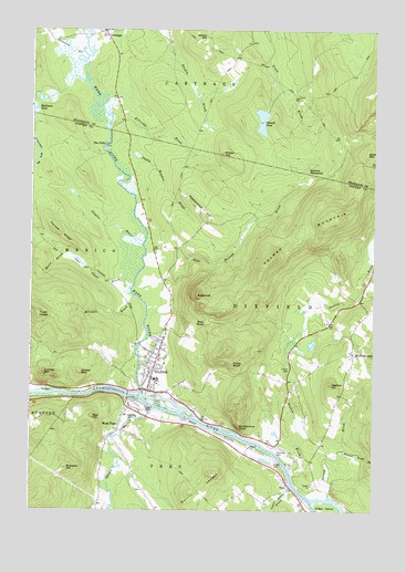
Dixfield, ME USGS Topographic Map
Click on map above to begin viewing in our Map Viewer.

This topographic map contains these locations and features:
Feature Name Type Latitude Longitude GNIS ID View Map
Aunt Hannah BrookStreamN44.5584°W70.4620°561355View Map
Beaver Pond BrookStreamN44.5153°W70.3853°561964View Map
Bull RockPillarN44.5487°W70.4359°563165View Map
Burgess HillSummitN44.5109°W70.4859°563202View Map
Burgess Hill CemeteryCemeteryN44.5206°W70.4917°2736850View Map
Burke IslandIslandN44.5312°W70.4940°563208View Map
CarthagePopulated PlaceN44.6242°W70.4731°563647View Map
Carthage CemeteryCemeteryN44.6077°W70.4029°2736278View Map
Chase BrookStreamN44.5584°W70.4626°563865View Map
Demerritt CemeteryCemeteryN44.5256°W70.4623°565022View Map
Dirigo Elementary SchoolSchoolN44.5221°W70.4555°2738096View Map
Dirigo High SchoolSchoolN44.5404°W70.4527°1907983View Map
DixfieldPopulated PlaceN44.5340°W70.4559°565133View Map
Dixfield Census Designated PlaceCensusN44.5301°W70.4468°2377903View Map
Dixfield CenterPopulated PlaceN44.5409°W70.3823°579241View Map
Dixfield Congregational ChurchChurchN44.5323°W70.4592°1907986View Map
Dixfield Elementary SchoolSchoolN44.5381°W70.4503°1907987View Map
Dixfield Fire CompanyBuildingN44.5312°W70.4559°2552777View Map
Dixfield Historical SocietyBuildingN44.5345°W70.4551°1907988View Map
Dixfield Police DepartmentBuildingN44.5257°W70.4395°2735910View Map
Dixfield Post OfficePost OfficeN44.5312°W70.4554°1907989View Map
Durgin BrookStreamN44.6248°W70.4542°565431View Map
Edmunds Bog BrookStreamN44.5962°W70.4995°565795View Map
Gordon BrookStreamN44.5617°W70.3781°566964View Map
Grays MountainSummitN44.5931°W70.3778°567114View Map
Green IslandIslandN44.5003°W70.3915°567230View Map
Greenwood CemeteryCemeteryN44.5379°W70.4550°2736362View Map
Hanscom BrookStreamN44.6181°W70.4798°567573View Map
Harlow RidgeRidgeN44.5717°W70.4890°567644View Map
Harvey BrookStreamN44.5042°W70.3909°567717View Map
Holman Family CemeteryCemeteryN44.5401°W70.3832°2724645View Map
Holman MountainSummitN44.5767°W70.3867°568199View Map
Kidder MountainSummitN44.5357°W70.4811°569152View Map
Kittredge BrookStreamN44.6031°W70.4712°569233View Map
Knight CemeteryCemeteryN44.5120°W70.4109°569242View Map
Lovejoy MountainSummitN44.5357°W70.4947°570441View Map
Lower Stony BrookStreamN44.5034°W70.3998°570548View Map
Ludden Memorial LibraryBuildingN44.5313°W70.4558°1908074View Map
Masterman HillSummitN44.5793°W70.4400°570885View Map
Mitchell BrookStreamN44.5559°W70.4620°571464View Map
Moore BrookStreamN44.5667°W70.4873°571557View Map
Morrill LedgesSummitN44.5098°W70.4342°571674View Map
Newton BrookStreamN44.5092°W70.4040°572151View Map
Newton HillSummitN44.5330°W70.3900°572152View Map
Paddy Meadow BrookStreamN44.5931°W70.4723°572914View Map
Pauls BluffCliffN44.5378°W70.4259°573079View Map
PeruPopulated PlaceN44.5067°W70.4053°573224View Map
Peru Elementary SchoolSchoolN44.5251°W70.4656°1908146View Map
Peru Fire DepartmentBuildingN44.5265°W70.4643°2552880View Map
Peru Post OfficePost OfficeN44.5212°W70.4682°1908147View Map
Pine Knoll CemeteryCemeteryN44.5201°W70.4656°2736385View Map
Piper CemeteryCemeteryN44.5053°W70.4589°2724759View Map
Podunk PondLakeN44.6013°W70.4162°573552View Map
Potter HillSummitN44.5931°W70.4298°573724View Map
Red HillSummitN44.5242°W70.4769°574087View Map
Riverside CemeteryCemeteryN44.5162°W70.4090°574256View Map
Saint Josephs Roman Catholic ChurchChurchN44.5453°W70.4512°1908177View Map
Seventh Day Adventist ChurchChurchN44.5442°W70.4515°1908184View Map
Siberia MeadowsFlatN44.5884°W70.3995°575443View Map
Spears StreamStreamN44.5265°W70.4545°575993View Map
Staples BrookStreamN44.5701°W70.4587°576253View Map
Storer HillSummitN44.6230°W70.4365°576415View Map
Storer Hill CemeteryCemeteryN44.6217°W70.4201°2736313View Map
SugarloafSummitN44.5558°W70.4392°576505View Map
Swans FieldAirportN44.5137°W70.4047°582140View Map
The FallsFallsN44.5951°W70.4728°576796View Map
Town of CarthageCivilN44.6203°W70.4229°582393View Map
Town of DixfieldCivilN44.5475°W70.3825°582443View Map
Trask LedgeSummitN44.5506°W70.4970°577282View Map
TW Kelly Dirigo Middle SchoolSchoolN44.5502°W70.4534°2737928View Map
Upper Stony BrookStreamN44.5062°W70.4040°577664View Map
Village CemeteryCemeteryN44.5313°W70.4496°2724804View Map
Webb RiverStreamN44.5312°W70.4595°577927View Map
West PeruPopulated PlaceN44.5212°W70.4673°578192View Map
Whittemore BluffCliffN44.5217°W70.4234°578424View Map

Note: Coordinates in the location and feature list above are referenced to NAD83 datum.


Copyright (C) 2008-2024 Ryan Niemi / Sunset Dynamics ... All Rights Reserved