TopoQuest Logo
Do you find TopoQuest useful?
Help keep TopoQuest running and adding new maps/features by donating!
Bitcoin:  19c7KJd3qBynnjoSw5npx9KScwjBe4ifkT
Litecoin:  LXs6TkuXGGXo1vDsWCkWVdjQX94eUKd6ui
Home View Maps Find Maps Find Places Resources & Links


Anza, California Topographic Map

USGS Map Title: Anza, CA
USGS Map MRC: 33116E6
DRG (GeoTIFF) Download: o33116e6.tif


Neighboring USGS Topographic Map Quads:


  Blackburn Canyon, CA  
33116F7
 

  Idyllwild, CA  
33116F6
 

  Palm View Peak, CA  
33116F5
 

  Cahuilla Mountain, CA  
33116E7
 

  Anza, CA  
33116E6
 

  Butterfly Peak, CA  
33116E5
 

  Aguanga, CA  
33116D7
 

  Beauty Mountain, CA  
33116D6
 

  Bucksnort Mountain, CA  
33116D5


Map MRC Location:

N34°
W117°
N34°
W116°
H8 H7 H6 H5 H4 H3 H2 H1
G8 G7 G6 G5 G4 G3 G2 G1
F8 F7 F6 F5 F4 F3 F2 F1
E8 E7 E6 E5 E4 E3 E2 E1
D8 D7 D6 D5 D4 D3 D2 D1
C8 C7 C6 C5 C4 C3 C2 C1
B8 B7 B6 B5 B4 B3 B2 B1
A8 A7 A6 A5 A4 A3 A2 A1
N33°
W117°
N33°
W116°

Anza, CA USGS 1:24K Topographic Map Preview:
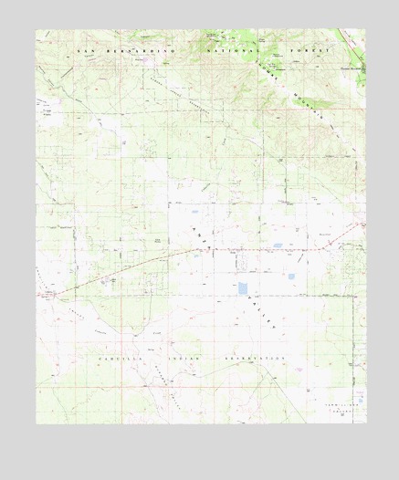
Anza, CA USGS Topographic Map
Click on map above to begin viewing in our Map Viewer.

This topographic map contains these locations and features:
Feature Name Type Latitude Longitude GNIS ID View Map
American Medical Response AnzaBuildingN33.5554°W116.6828°2665552View Map
AnzaPopulated PlaceN33.5550°W116.6736°269555View Map
Anza Census Designated PlaceCensusN33.5678°W116.6966°2582935View Map
Anza Post OfficePost OfficeN33.5587°W116.6750°27833538View Map
Anza ValleyBasinN33.5750°W116.7009°1667899View Map
CahuillaPopulated PlaceN33.5409°W116.7439°270513View Map
Cahuilla ReservationCivilN33.5202°W116.7118°270144View Map
Cave RocksSummitN33.5582°W116.7046°1660449View Map
Cottonwood CanyonValleyN33.6070°W116.7428°270620View Map
Cottonwood Fire BreakDamN33.6153°W116.7245°270625View Map
Durasno ValleyValleyN33.5270°W116.7136°270943View Map
Hamilton CreekStreamN33.5448°W116.6706°243145View Map
Hamilton K-8 SchoolSchoolN33.5708°W116.6567°271483View Map
Hog LakeLakeN33.6153°W116.7091°271597View Map
Larner RanchLocaleN33.5659°W116.6300°1693293View Map
Lucky Deer MineMineN33.6192°W116.6459°272274View Map
Magee SpringSpringN33.6213°W116.6666°272308View Map
Minor ParkParkN33.5542°W116.6753°1868097View Map
Ramona CampgroundLocaleN33.6161°W116.6611°274975View Map
Ramona TrailTrailN33.6059°W116.6661°273182View Map
Ramona VillageCivilN33.6057°W116.6973°273181View Map
Riverside County Fire Department Station 29 AnzaBuildingN33.5555°W116.6743°2664935View Map
Riverside County Fire Department Station 53 - Garner ValleyBuildingN33.6155°W116.6278°2664956View Map
Terwilliger ValleyBasinN33.5000°W116.6384°274075View Map
Thomas MountainPopulated PlaceN33.6125°W116.6270°1661564View Map
Thomas MountainSummitN33.6197°W116.6803°274110View Map
Thomas Mountain CampgroundLocaleN33.6228°W116.6817°274974View Map
Tool Box SpringSpringN33.6130°W116.6599°274158View Map
Tool Box Spring CampgorundLocaleN33.6125°W116.6603°274978View Map
Tool Box Spring CampgroundLocaleN33.6125°W116.6603°274976View Map
Tripp FlatsFlatN33.6003°W116.7481°274190View Map

Note: Coordinates in the location and feature list above are referenced to NAD83 datum.


Copyright (C) 2008-2024 Ryan Niemi / Sunset Dynamics ... All Rights Reserved