TopoQuest Logo
Do you find TopoQuest useful?
Help keep TopoQuest running and adding new maps/features by donating!
Bitcoin:  19c7KJd3qBynnjoSw5npx9KScwjBe4ifkT
Litecoin:  LXs6TkuXGGXo1vDsWCkWVdjQX94eUKd6ui
Home View Maps Find Maps Find Places Resources & Links


Antlers East, Oklahoma Topographic Map

USGS Map Title: Antlers East, OK
USGS Map MRC: 34095B5
DRG (GeoTIFF) Download: o34095b5.tif


Neighboring USGS Topographic Map Quads:


  Moyers, OK  
34095C6
 

  Kosoma, OK  
34095C5
 

  Finley, OK  
34095C4
 

  Antlers West, OK  
34095B6
 

  Antlers East, OK  
34095B5
 

  Rattan, OK  
34095B4
 

  Soper, OK  
34095A6
 

  Hugo, OK  
34095A5
 

  Hugo Dam, OK  
34095A4


Map MRC Location:

N35°
W96°
N35°
W95°
H8 H7 H6 H5 H4 H3 H2 H1
G8 G7 G6 G5 G4 G3 G2 G1
F8 F7 F6 F5 F4 F3 F2 F1
E8 E7 E6 E5 E4 E3 E2 E1
D8 D7 D6 D5 D4 D3 D2 D1
C8 C7 C6 C5 C4 C3 C2 C1
B8 B7 B6 B5 B4 B3 B2 B1
A8 A7 A6 A5 A4 A3 A2 A1
N34°
W96°
N34°
W95°

Antlers East, OK USGS 1:24K Topographic Map Preview:
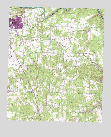
Antlers East, OK USGS Topographic Map
Click on map above to begin viewing in our Map Viewer.

This topographic map contains these locations and features:
Feature Name Type Latitude Longitude GNIS ID View Map
AntlersPopulated PlaceN34.2312°W95.6202°1089664View Map
Antlers Fire Department and Emergency Medical ServicesBuildingN34.2305°W95.6201°2656866View Map
Antlers High SchoolSchoolN34.2390°W95.6197°1790249View Map
Antlers Police DepartmentBuildingN34.2304°W95.6200°2757787View Map
Assembly of God ChurchChurchN34.2315°W95.6141°1778617View Map
Beaver CreekStreamN34.2343°W95.5841°1089935View Map
Big RocksPopulated PlaceN34.2295°W95.5730°1100209View Map
Brantly Elementary SchoolSchoolN34.2335°W95.6191°1803822View Map
Church of ChristChurchN34.2326°W95.6197°1778618View Map
Church of the NazareneChurchN34.2326°W95.6194°1778619View Map
City of AntlersCivilN34.2325°W95.6214°2409716View Map
DelaPopulated PlaceN34.2004°W95.5222°1100348View Map
Dumpling CreekStreamN34.2368°W95.5794°1092281View Map
East Town VillageLocaleN34.2326°W95.6061°1763779View Map
EthelPopulated PlaceN34.2295°W95.5441°1100397View Map
Ethel CemeteryCemeteryN34.2219°W95.5425°2708536View Map
First Baptist ChurchChurchN34.2326°W95.6191°1778620View Map
First Christian ChurchChurchN34.2373°W95.6202°1778621View Map
First Presbyterian ChurchChurchN34.2318°W95.6144°1778622View Map
GreenwoodPopulated PlaceN34.1923°W95.5877°1100464View Map
Haggerman CreekStreamN34.1882°W95.5083°1093476View Map
HamdenPopulated PlaceN34.1423°W95.5666°1100472View Map
Holly BranchStreamN34.1365°W95.5366°1093852View Map
Kingdom Hall-Jehovahs WitnessChurchN34.2318°W95.6244°1778623View Map
Little Cedar CreekStreamN34.2498°W95.5591°1094733View Map
Obuch Middle SchoolSchoolN34.2346°W95.6179°1790250View Map
Odd Fellows CemeteryCemeteryN34.2395°W95.6086°1101891View Map
Oknoname 127006 DamDamN34.2168°W95.5736°1755797View Map
Oknoname 127006 ReservoirReservoirN34.2163°W95.5723°1755798View Map
Pushmataha County JailBuildingN34.2290°W95.6230°2757864View Map
Pushmataha County Sheriff's OfficeBuildingN34.2290°W95.6229°2757534View Map
Pushmataha HospitalHospitalN34.2312°W95.6149°2695704View Map
Saint Agnes Catholic ChurchChurchN34.2320°W95.6158°1778625View Map
Souls Harbor ChurchChurchN34.2362°W95.6197°1778624View Map
White Church CemeteryCemeteryN34.1995°W95.5202°1099696View Map

Note: Coordinates in the location and feature list above are referenced to NAD83 datum.


Copyright (C) 2008-2024 Ryan Niemi / Sunset Dynamics ... All Rights Reserved