TopoQuest Logo
Do you find TopoQuest useful?
Help keep TopoQuest running and adding new maps/features by donating!
Bitcoin:  19c7KJd3qBynnjoSw5npx9KScwjBe4ifkT
Litecoin:  LXs6TkuXGGXo1vDsWCkWVdjQX94eUKd6ui
Home View Maps Find Maps Find Places Resources & Links


Dairy Mountain, Idaho Topographic Map

USGS Map Title: Dairy Mountain, ID
USGS Map MRC: 45116F1
DRG (GeoTIFF) Download: o45116f1.tif


Neighboring USGS Topographic Map Quads:


  White Bird Hill, ID  
45116G2
 

  Goodwin Meadows, ID  
45116G1
 

  Hungry Ridge, ID  
45115G8
 

  McKinzie Creek, ID  
45116F2
 

  Dairy Mountain, ID  
45116F1
 

  Sawyer Ridge, ID  
45115F8
 

  John Day Mountain, ID  
45116E2
 

  Florence, ID  
45116E1
 

  Hanover Mountain, ID  
45115E8


Map MRC Location:

N46°
W117°
N46°
W116°
H8 H7 H6 H5 H4 H3 H2 H1
G8 G7 G6 G5 G4 G3 G2 G1
F8 F7 F6 F5 F4 F3 F2 F1
E8 E7 E6 E5 E4 E3 E2 E1
D8 D7 D6 D5 D4 D3 D2 D1
C8 C7 C6 C5 C4 C3 C2 C1
B8 B7 B6 B5 B4 B3 B2 B1
A8 A7 A6 A5 A4 A3 A2 A1
N45°
W117°
N45°
W116°

Dairy Mountain, ID USGS 1:24K Topographic Map Preview:
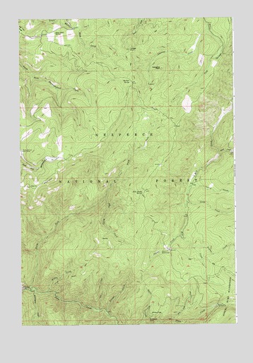
Dairy Mountain, ID USGS Topographic Map
Click on map above to begin viewing in our Map Viewer.

This topographic map contains these locations and features:
Feature Name Type Latitude Longitude GNIS ID View Map
Adams CreekStreamN45.6607°W116.0324°376469View Map
Asbestos CreekStreamN45.7449°W116.0160°376735View Map
Asbestos PeakSummitN45.7291°W116.0424°396054View Map
Basin CreekStreamN45.6252°W116.0549°377002View Map
Black George CreekStreamN45.7166°W116.0007°377746View Map
Buckshot PointCliffN45.6268°W116.0510°378428View Map
Camp CreekStreamN45.6746°W116.0282°378792View Map
Cold Springs SaddleGapN45.7110°W116.0426°393963View Map
Corral CreekStreamN45.6818°W116.0260°379799View Map
Dairy MountainSummitN45.6816°W116.1210°380215View Map
Dry Lake CreekStreamN45.6271°W116.0374°380888View Map
Fenn Cabin SpringSpringN45.7440°W116.1040°381649View Map
Hepner CreekStreamN45.6560°W116.0243°383110View Map
Hunt CreekStreamN45.6943°W116.0087°383556View Map
Jungle PointSummitN45.7371°W116.0610°384075View Map
Lee CreekStreamN45.6313°W116.0832°384513View Map
North Fork CampgroundLocaleN45.6393°W116.1196°387668View Map
North Fork Slate CreekStreamN45.6399°W116.1193°387784View Map
Old Adams Ranger StationLocaleN45.6549°W116.0387°396025View Map
Peter Ready CreekStreamN45.6763°W116.0765°388364View Map
Peter Ready SpringSpringN45.6798°W116.0542°388365View Map
Pig Foot SpringSpringN45.7242°W116.0605°388446View Map
Rocky Bluff CampgroundLocaleN45.6324°W116.0110°389540View Map
Skookumchuck Work CenterLocaleN45.6963°W116.1240°390531View Map
Trough CreekStreamN45.6293°W116.0749°392409View Map
Waterspout CreekStreamN45.6393°W116.1187°392947View Map
Willow CreekStreamN45.6382°W116.1099°393491View Map
Willow FlatFlatN45.6291°W116.0465°393517View Map

Note: Coordinates in the location and feature list above are referenced to NAD83 datum.


Copyright (C) 2008-2024 Ryan Niemi / Sunset Dynamics ... All Rights Reserved