TopoQuest Logo
Do you find TopoQuest useful?
Help keep TopoQuest running and adding new maps/features by donating!
Bitcoin:  19c7KJd3qBynnjoSw5npx9KScwjBe4ifkT
Litecoin:  LXs6TkuXGGXo1vDsWCkWVdjQX94eUKd6ui
Home View Maps Find Maps Find Places Resources & Links


Ansonia, Ohio Topographic Map

USGS Map Title: Ansonia, OH
USGS Map MRC: 40084B6
DRG (GeoTIFF) Download: o40084b6.tif


Neighboring USGS Topographic Map Quads:


  Cosmos, OH  
40084C7
 

  Rossburg, OH  
40084C6
 

  North Star, OH  
40084C5
 

  Union City, IN  
40084B7
 

  Ansonia, OH  
40084B6
 

  Dawn, OH  
40084B5
 

  Spartanburg, IN  
40084A7
 

  Greenville West, OH  
40084A6
 

  Greenville East, OH  
40084A5


Map MRC Location:

N41°
W85°
N41°
W84°
H8 H7 H6 H5 H4 H3 H2 H1
G8 G7 G6 G5 G4 G3 G2 G1
F8 F7 F6 F5 F4 F3 F2 F1
E8 E7 E6 E5 E4 E3 E2 E1
D8 D7 D6 D5 D4 D3 D2 D1
C8 C7 C6 C5 C4 C3 C2 C1
B8 B7 B6 B5 B4 B3 B2 B1
A8 A7 A6 A5 A4 A3 A2 A1
N40°
W85°
N40°
W84°

Ansonia, OH USGS 1:24K Topographic Map Preview:
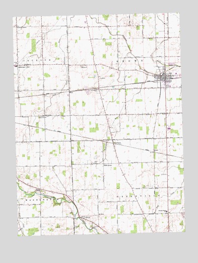
Ansonia, OH USGS Topographic Map
Click on map above to begin viewing in our Map Viewer.

This topographic map contains these locations and features:
Feature Name Type Latitude Longitude GNIS ID View Map
AnsoniaPopulated PlaceN40.2145°W84.6369°1064333View Map
Ansonia Christian ChurchChurchN40.2134°W84.6380°1051875View Map
Ansonia Elementary SchoolSchoolN40.2153°W84.6296°1055491View Map
Ansonia High SchoolSchoolN40.2154°W84.6284°1055494View Map
Ansonia Methodist ChurchChurchN40.2128°W84.6386°1051876View Map
Ansonia Middle SchoolSchoolN40.2153°W84.6289°1055495View Map
Ansonia Police DepartmentBuildingN40.2146°W84.6371°2732791View Map
Ansonia Post OfficePost OfficeN40.2139°W84.6375°1967964View Map
ANSONIA RESCUE SQUADSBuildingN40.2071°W84.6389°2550955View Map
Ansonia Volunteer Fire DepartmentBuildingN40.2136°W84.6376°2550482View Map
Beeler CemeteryCemeteryN40.2209°W84.6366°1806153View Map
Bethel CemeteryCemeteryN40.1657°W84.6916°1037910View Map
Bethel CornersLocaleN40.1648°W84.6850°1037954View Map
Billenstein FarmsLocaleN40.2306°W84.6764°2710805View Map
Byrds Mobile Home ParkPopulated PlaceN40.2153°W84.6350°2634659View Map
Campbell FarmsLocaleN40.2494°W84.6442°2710803View Map
ColetownPopulated PlaceN40.1345°W84.7027°1056824View Map
Coletown Congregational Christian ChurchChurchN40.1342°W84.7002°1051877View Map
Coppess Nature SanctuaryParkN40.2164°W84.7261°1806157View Map
Creekbaum CemeteryCemeteryN40.1286°W84.6936°1083979View Map
Dan Lo FarmsLocaleN40.2353°W84.7486°2710848View Map
Dismal CreekStreamN40.1550°W84.7494°433568View Map
Duvall CemeteryCemeteryN40.2192°W84.6783°1806159View Map
Earhart CemeteryCemeteryN40.1581°W84.6375°1039929View Map
Eastwood Mobile Home EstatesPopulated PlaceN40.2139°W84.6278°2634656View Map
ElroyPopulated PlaceN40.2064°W84.7094°1064619View Map
Elroy Post Office (historical)Post OfficeN40.2070°W84.7097°1968027View Map
Hetslerville Post Office (historical)Post OfficeN40.2056°W84.7277°1968033View Map
Hetzlerville (historical)Populated PlaceN40.2053°W84.7280°1067522View Map
Hiestand Turkey FarmLocaleN40.2231°W84.7425°2710845View Map
Hopper School (historical)SchoolN40.2428°W84.6933°1055521View Map
Hunchberger CornersPopulated PlaceN40.2223°W84.7466°1066274View Map
J and K Swine FarmLocaleN40.2375°W84.6539°2710808View Map
Kramer FarmLocaleN40.2419°W84.7033°2710807View Map
Kraut CreekStreamN40.1487°W84.7425°1066062View Map
Leis AirportAirportN40.2066°W84.6642°1082461View Map
Manuel CemeteryCemeteryN40.1295°W84.7069°1042930View Map
Maplegrove School (historical)SchoolN40.2364°W84.6386°1055526View Map
MeekerLocaleN40.1709°W84.6466°1066290View Map
Mississinawa Valley High SchoolSchoolN40.2217°W84.7488°1055531View Map
Mississinawa Valley Middle SchoolSchoolN40.2217°W84.7477°1055530View Map
Mount HeronPopulated PlaceN40.1359°W84.6894°1080110View Map
Mount HeronLocaleN40.1359°W84.6897°1065849View Map
Mount Heron Post Office (historical)Post OfficeN40.1362°W84.6902°1968188View Map
New Teagarden CemeteryCemeteryN40.2212°W84.6980°1806181View Map
North Fork Kraut CreekStreamN40.1295°W84.7466°1043904View Map
North Fork Stillwater RiverStreamN40.2203°W84.6288°1066114View Map
Old Teegarden CemeteryCemeteryN40.2070°W84.6880°1044139View Map
Phoenix FarmsLocaleN40.1794°W84.6381°2710763View Map
Raffel FarmsLocaleN40.1372°W84.6556°2710765View Map
Roe CornersPopulated PlaceN40.1931°W84.7277°1063404View Map
S and S Swine FarmLocaleN40.1489°W84.6386°2646638View Map
Shady Grove ChurchChurchN40.1923°W84.7322°1046110View Map
Sharps CrossingPopulated PlaceN40.1512°W84.7325°1049171View Map
Southfork FarmsLocaleN40.1939°W84.7203°2710840View Map
Stoney Creek FarmsLocaleN40.1286°W84.7089°2710775View Map
Sunset Memory GardensCemeteryN40.1709°W84.6358°1806198View Map
Suregreen FarmsLocaleN40.1839°W84.6350°2710806View Map
Teegarden Congregational Christian ChurchChurchN40.2212°W84.7000°1058067View Map
Township of BrownCivilN40.2217°W84.6620°1086011View Map
Village of AnsoniaCivilN40.2141°W84.6344°2397968View Map
Waterhouse ChurchChurchN40.2228°W84.7422°1047611View Map
WoodingtonPopulated PlaceN40.1784°W84.6777°1049342View Map
Woodington Congregational Christian ChurchChurchN40.1781°W84.6777°1051897View Map
Woodington Park Post Office (historical)Post OfficeN40.1778°W84.6777°1968210View Map
Woodington RunStreamN40.2162°W84.6494°1066267View Map
Woodland Heights Elementary SchoolSchoolN40.1373°W84.6386°1082086View Map
Zumbrum CornersLocaleN40.2445°W84.7472°1071005View Map

Note: Coordinates in the location and feature list above are referenced to NAD83 datum.


Copyright (C) 2008-2024 Ryan Niemi / Sunset Dynamics ... All Rights Reserved