TopoQuest Logo
Do you find TopoQuest useful?
Help keep TopoQuest running and adding new maps/features by donating!
Bitcoin:  19c7KJd3qBynnjoSw5npx9KScwjBe4ifkT
Litecoin:  LXs6TkuXGGXo1vDsWCkWVdjQX94eUKd6ui
Home View Maps Find Maps Find Places Resources & Links


Crane Islands SW, Texas Topographic Map

USGS Map Title: Crane Islands SW, TX
USGS Map MRC: 27097E2
DRG (GeoTIFF) Download: o27097e2.tif


Neighboring USGS Topographic Map Quads:


  Oso Creek NE, TX  
27097F3
 

  Crane Islands NW, TX  
27097F2


  Pita Island, TX  
27097E3
 

  Crane Islands SW, TX  
27097E2


Map MRC Location:

N28°
W98°
N28°
W97°
H8 H7 H6 H5 H4 H3 H2 H1
G8 G7 G6 G5 G4 G3 G2 G1
F8 F7 F6 F5 F4 F3 F2 F1
E8 E7 E6 E5 E4 E3 E2 E1
D8 D7 D6 D5 D4 D3 D2 D1
C8 C7 C6 C5 C4 C3 C2 C1
B8 B7 B6 B5 B4 B3 B2 B1
A8 A7 A6 A5 A4 A3 A2 A1
N27°
W98°
N27°
W97°

Crane Islands SW, TX USGS 1:24K Topographic Map Preview:
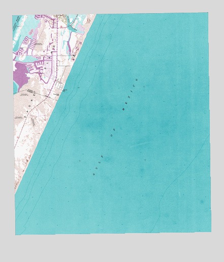
Crane Islands SW, TX USGS Topographic Map
Click on map above to begin viewing in our Map Viewer.

This topographic map contains these locations and features:
Feature Name Type Latitude Longitude GNIS ID View Map
Bob Hall PierLocaleN27.5820°W97.2178°1330971View Map
Corpus Christi Fire Department Station 15BuildingN27.6187°W97.2257°2334309View Map
Fourmile HillSummitN27.5798°W97.2203°1336119View Map
Island Presbyterian ChurchChurchN27.5964°W97.2297°2022905View Map
Light TwentyoneLocaleN27.6186°W97.2475°1339905View Map
Packery ChannelChannelN27.6248°W97.2147°1343405View Map
Padre Bali ParkParkN27.5942°W97.2194°2029659View Map
Range A LightLocaleN27.6064°W97.2450°1344789View Map
Saint Andrew by the Sea Catholic ChurchChurchN27.5906°W97.2283°2022972View Map
Seashore Learning CenterSchoolN27.6188°W97.2209°2434360View Map

Note: Coordinates in the location and feature list above are referenced to NAD83 datum.


Copyright (C) 2008-2024 Ryan Niemi / Sunset Dynamics ... All Rights Reserved