TopoQuest Logo
Do you find TopoQuest useful?
Help keep TopoQuest running and adding new maps/features by donating!
Bitcoin:  19c7KJd3qBynnjoSw5npx9KScwjBe4ifkT
Litecoin:  LXs6TkuXGGXo1vDsWCkWVdjQX94eUKd6ui
Home View Maps Find Maps Find Places Resources & Links


Coup Point, Louisiana Topographic Map

USGS Map Title: Coup Point, LA
USGS Map MRC: 31092H8
DRG (GeoTIFF) Download: o31092h8.tif


Neighboring USGS Topographic Map Quads:


  Chestnut, LA  
32093A1
 

  Goldonna, LA  
32092A8
 

  Iron Branch, LA  
32092A7
 

  Campti, LA  
31093H1
 

  Coup Point, LA  
31092H8
 

  Calvin, LA  
31092H7
 

  Natchitoches North, LA  
31093G1
 

  Saint Maurice, LA  
31092G8
 

  Coochie Brake, LA  
31092G7


Map MRC Location:

N32°
W93°
N32°
W92°
H8 H7 H6 H5 H4 H3 H2 H1
G8 G7 G6 G5 G4 G3 G2 G1
F8 F7 F6 F5 F4 F3 F2 F1
E8 E7 E6 E5 E4 E3 E2 E1
D8 D7 D6 D5 D4 D3 D2 D1
C8 C7 C6 C5 C4 C3 C2 C1
B8 B7 B6 B5 B4 B3 B2 B1
A8 A7 A6 A5 A4 A3 A2 A1
N31°
W93°
N31°
W92°

Coup Point, LA USGS 1:24K Topographic Map Preview:
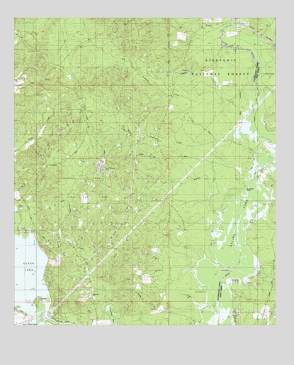
Coup Point, LA USGS Topographic Map
Click on map above to begin viewing in our Map Viewer.

This topographic map contains these locations and features:
Feature Name Type Latitude Longitude GNIS ID View Map
Big Fordoche CreekStreamN31.9621°W92.8868°547082View Map
Black Lake Oil and Gas FieldOilfieldN31.9307°W92.9668°541701View Map
Black Lake Oil and Gas FieldOilfieldN31.9363°W92.9635°548181View Map
Burnt Pine PointCapeN31.9313°W92.8890°541704View Map
Cedar BranchStreamN31.8857°W92.9149°541705View Map
Cedar BranchStreamN31.8838°W92.9074°548244View Map
Cheechee CreekStreamN31.8821°W92.9554°547211View Map
Clear Lake (historical)Populated PlaceN31.8818°W92.9615°1630910View Map
Clear Lake ChurchChurchN31.8877°W92.9627°541703View Map
Clear Lake ChurchChurchN31.8868°W92.9621°548243View Map
Clear Lake ChurchChurchN31.8966°W92.9335°547230View Map
Coup PointCapeN31.9013°W92.9043°547252View Map
Evergreen ChurchChurchN31.9788°W92.9163°547346View Map
Goldonna Lookout TowerTowerN31.9988°W92.9521°558774View Map
Hurricane CreekStreamN31.9668°W92.8815°547497View Map
Lick BranchStreamN31.9213°W92.9027°547580View Map
Little Fordoche CreekStreamN31.9388°W92.8927°547605View Map
Mill CreekStreamN31.9954°W92.9021°547705View Map
Range CreekStreamN31.9188°W92.8827°547884View Map
Saline LakeReservoirN31.8866°W92.9081°555960View Map
Spring BranchStreamN31.9902°W92.8807°548021View Map
Summerseat School (historical)SchoolN31.9235°W92.9557°548926View Map
Yarmuck HillSummitN31.8860°W92.9893°541702View Map
Yarmuck HillIslandN31.8846°W92.9896°548242View Map

Note: Coordinates in the location and feature list above are referenced to NAD83 datum.


Copyright (C) 2008-2024 Ryan Niemi / Sunset Dynamics ... All Rights Reserved