TopoQuest Logo
Do you find TopoQuest useful?
Help keep TopoQuest running and adding new maps/features by donating!
Bitcoin:  19c7KJd3qBynnjoSw5npx9KScwjBe4ifkT
Litecoin:  LXs6TkuXGGXo1vDsWCkWVdjQX94eUKd6ui
Home View Maps Find Maps Find Places Resources & Links


Corunna, Indiana Topographic Map

USGS Map Title: Corunna, IN
USGS Map MRC: 41085D2
DRG (GeoTIFF) Download: o41085d2.tif


Neighboring USGS Topographic Map Quads:


  Wolcottville, IN  
41085E3
 

  Stroh, IN  
41085E2
 

  Ashley, IN  
41085E1
 

  Kendallville, IN  
41085D3
 

  Corunna, IN  
41085D2
 

  Waterloo, IN  
41085D1
 

  Ege, IN  
41085C3
 

  Garrett, IN  
41085C2
 

  Auburn, IN  
41085C1


Map MRC Location:

N42°
W86°
N42°
W85°
H8 H7 H6 H5 H4 H3 H2 H1
G8 G7 G6 G5 G4 G3 G2 G1
F8 F7 F6 F5 F4 F3 F2 F1
E8 E7 E6 E5 E4 E3 E2 E1
D8 D7 D6 D5 D4 D3 D2 D1
C8 C7 C6 C5 C4 C3 C2 C1
B8 B7 B6 B5 B4 B3 B2 B1
A8 A7 A6 A5 A4 A3 A2 A1
N41°
W86°
N41°
W85°

Corunna, IN USGS 1:24K Topographic Map Preview:
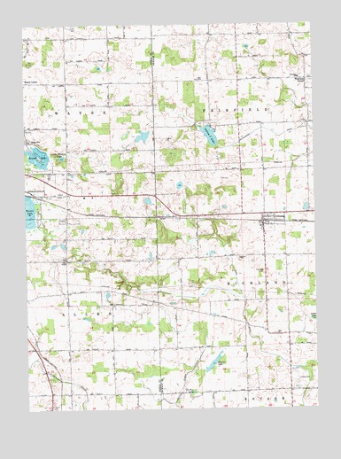
Corunna, IN USGS Topographic Map
Click on map above to begin viewing in our Map Viewer.

This topographic map contains these locations and features:
Feature Name Type Latitude Longitude GNIS ID View Map
Allen ChapelChurchN41.4237°W85.2333°430088View Map
Baby MountainSummitN41.4625°W85.2483°430380View Map
Bixler LakeLakeN41.4393°W85.2487°431113View Map
CorunnaPopulated PlaceN41.4373°W85.1472°432996View Map
Corunna CemeteryCemeteryN41.4195°W85.1472°432997View Map
Corunna Volunteer Fire DepartmentBuildingN41.4388°W85.1412°2625661View Map
Depew LakeLakeN41.3806°W85.1786°433485View Map
Diehl DitchCanalN41.3820°W85.1294°433543View Map
Fairfield CenterPopulated PlaceN41.4826°W85.1280°449653View Map
Haynes LakeLakeN41.3907°W85.1687°435922View Map
Indian LakeLakeN41.4640°W85.1698°436769View Map
Lake MaxlerReservoirN41.4637°W85.1987°447239View Map
Little Whitford LakeLakeN41.4569°W85.2340°438175View Map
McCullough DitchCanalN41.4637°W85.1397°438842View Map
Niezer DamDamN41.4617°W85.2014°447240View Map
Round LakeLakeN41.4571°W85.2457°442354View Map
Saint Marys CemeteryCemeteryN41.3751°W85.2387°442696View Map
Town of CorunnaCivilN41.4359°W85.1442°2396663View Map
Township of FairfieldCivilN41.4825°W85.1370°453284View Map
Township of RichlandCivilN41.4097°W85.1360°453790View Map
Zion ChurchChurchN41.3995°W85.1416°446469View Map
Zion SchoolSchoolN41.4820°W85.1747°446481View Map

Note: Coordinates in the location and feature list above are referenced to NAD83 datum.


Copyright (C) 2008-2024 Ryan Niemi / Sunset Dynamics ... All Rights Reserved