TopoQuest Logo
Do you find TopoQuest useful?
Help keep TopoQuest running and adding new maps/features by donating!
Bitcoin:  19c7KJd3qBynnjoSw5npx9KScwjBe4ifkT
Litecoin:  LXs6TkuXGGXo1vDsWCkWVdjQX94eUKd6ui
Home View Maps Find Maps Find Places Resources & Links


Copper Mountain, Colorado Topographic Map

USGS Map Title: Copper Mountain, CO
USGS Map MRC: 39106D2
DRG (GeoTIFF) Download: o39106d2.tif


Neighboring USGS Topographic Map Quads:


  Red Cliff, CO  
39106E3
 

  Vail Pass, CO  
39106E2
 

  Frisco, CO  
39106E1
 

  Pando, CO  
39106D3
 

  Copper Mountain, CO  
39106D2
 

  Breckenridge, CO  
39106D1
 

  Leadville North, CO  
39106C3
 

  Climax, CO  
39106C2
 

  Alma, CO  
39106C1


Map MRC Location:

N40°
W107°
N40°
W106°
H8 H7 H6 H5 H4 H3 H2 H1
G8 G7 G6 G5 G4 G3 G2 G1
F8 F7 F6 F5 F4 F3 F2 F1
E8 E7 E6 E5 E4 E3 E2 E1
D8 D7 D6 D5 D4 D3 D2 D1
C8 C7 C6 C5 C4 C3 C2 C1
B8 B7 B6 B5 B4 B3 B2 B1
A8 A7 A6 A5 A4 A3 A2 A1
N39°
W107°
N39°
W106°

Copper Mountain, CO USGS 1:24K Topographic Map Preview:
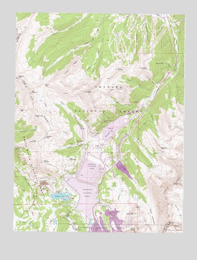
Copper Mountain, CO USGS Topographic Map
Click on map above to begin viewing in our Map Viewer.

This topographic map contains these locations and features:
Feature Name Type Latitude Longitude GNIS ID View Map
American Metals Incline MineMineN39.4483°W106.1953°1684208View Map
American Placer MineMineN39.3989°W106.1672°1684209View Map
Armstrong MineMineN39.4214°W106.1972°1684210View Map
Atlantic PeakSummitN39.4136°W106.1261°1934911View Map
Axtell Tunnel MineMineN39.4222°W106.2000°1684211View Map
Bartlett MountainSummitN39.3769°W106.1592°179621View Map
Boston MineMineN39.4130°W106.1397°179616View Map
Brain MineMineN39.4278°W106.1867°1684212View Map
Buffehr LakeLakeN39.3803°W106.1929°179614View Map
Buffehrs DamDamN39.4433°W106.1939°200798View Map
Buffehrs ReservoirReservoirN39.4433°W106.1939°200799View Map
Carbonate HillSummitN39.4050°W106.1759°179609View Map
Chalk LakeReservoirN39.3807°W106.2185°179605View Map
Chalk Mountain DamDamN39.3936°W106.2139°199782View Map
Chalk Mountain ReservoirReservoirN39.3934°W106.2117°179612View Map
Champion MineMineN39.4278°W106.1872°1684213View Map
Climax-Moly Number 4 DamDamN39.4033°W106.2322°199390View Map
Climax-Moly Number 4 ReservoirReservoirN39.4033°W106.2322°199391View Map
Clinton AmphitheatreBasinN39.3853°W106.1481°179619View Map
Clinton CreekStreamN39.4311°W106.1803°179623View Map
Clinton Creek DitchCanalN39.4036°W106.1750°179610View Map
Clinton Gulch DamDamN39.4133°W106.1722°201408View Map
Clinton Gulch Dam ReservoirReservoirN39.4112°W106.1696°201409View Map
Cole Peterson MineMineN39.4303°W106.1870°1684214View Map
Colonel Sellers MineMineN39.4275°W106.2042°179599View Map
Columbia Group MineMineN39.3855°W106.1617°1684240View Map
Columbine DitchCanalN39.3794°W106.2397°179604View Map
Connors MineMineN39.4253°W106.2075°179625View Map
Copper CreekStreamN39.4572°W106.1450°179582View Map
Copper MountainSummitN39.4690°W106.1571°179579View Map
Copper Mountain Census Designated PlaceCensusN39.4769°W106.2011°2583226View Map
Copper Mountain Ski AreaLocaleN39.4864°W106.1614°169418View Map
Corbett PeakSummitN39.4408°W106.2231°179590View Map
D and G MineMineN39.4278°W106.1872°1684215View Map
Delaware MineMineN39.4214°W106.1972°1684216View Map
Delphos MineMineN39.4214°W106.1972°1684217View Map
East Sheep MountainSummitN39.4167°W106.2089°179593View Map
El Dorado Shaft MineMineN39.4339°W106.1886°1684218View Map
Elk MountainSummitN39.4536°W106.2381°179588View Map
Elk RidgeRidgeN39.4442°W106.2336°202668View Map
Fletcher MountainSummitN39.4033°W106.1289°179617View Map
Fremont DitchCanalN39.3833°W106.1895°179611View Map
Fugitive MineMineN39.3850°W106.2081°1735611View Map
Gold HillSummitN39.4161°W106.1606°179615View Map
Graveline GulchValleyN39.4598°W106.1436°179580View Map
Humbug CreekStreamN39.4475°W106.1564°179583View Map
Iron Mask MineMineN39.4303°W106.1861°1735579View Map
Jacque CreekStreamN39.4889°W106.1900°179574View Map
Jacque PeakSummitN39.4544°W106.1975°179594View Map
Jacque RidgeRidgeN39.4697°W106.2081°179573View Map
Kimberly MineMineN39.4214°W106.1972°1684219View Map
Kokomo (historical)Populated PlaceN39.4242°W106.1897°179601View Map
Kokomo GulchValleyN39.4277°W106.1923°179600View Map
Kokomo PassGapN39.4286°W106.2272°179592View Map
Little Artist Group MineMineN39.4214°W106.1972°1684220View Map
Little Bartlett MountainSummitN39.3858°W106.1614°179618View Map
Lucky Strike MineMineN39.4483°W106.1953°1684221View Map
Mayflower CreekStreamN39.4478°W106.1678°179587View Map
Mayflower HillSummitN39.4230°W106.1422°179584View Map
Mayflower Tailings PondReservoirN39.4342°W106.1778°197626View Map
McKenzie GulchValleyN39.4959°W106.1553°179576View Map
McNulty CreekStreamN39.3928°W106.1870°179624View Map
Michigan MineMineN39.4303°W106.1861°1735581View Map
Nettie B MineMineN39.4303°W106.1861°1684222View Map
New Shaft MineMineN39.4336°W106.1922°1684223View Map
North Sheep MountainSummitN39.4264°W106.2334°179591View Map
Oxide Tailings PondReservoirN39.4028°W106.2284°197648View Map
Pacific CreekStreamN39.4192°W106.1509°179585View Map
Pearl PeakSummitN39.4436°W106.2464°179589View Map
Queen-of-the-West MineMineN39.4383°W106.1847°197649View Map
Queen-of-the-West MineMineN39.4383°W106.1842°179596View Map
Raven Eagle Tunnel MineMineN39.4280°W106.2056°1684224View Map
Robinson DamDamN39.3967°W106.2239°199394View Map
Robinson LakeReservoirN39.3955°W106.2161°179603View Map
Robinson ReservoirReservoirN39.3967°W106.2239°199395View Map
Robinson Tailings PondLakeN39.3964°W106.1988°179608View Map
Rose GulchValleyN39.4381°W106.1788°179613View Map
Searle GulchValleyN39.4278°W106.1890°179597View Map
Searle PassGapN39.4586°W106.2278°179572View Map
Selma MineMineN39.4464°W106.1867°1684225View Map
Sheep MountainSummitN39.4144°W106.2289°179602View Map
Silver Queen MineMineN39.4328°W106.1845°1684226View Map
Snowbank MineMineN39.4303°W106.1861°1735582View Map
Spaulding GulchValleyN39.4689°W106.1339°179578View Map
Sugarloaf PeakSummitN39.4625°W106.2481°179571View Map
Ten Mile Tunnel MineMineN39.4361°W106.1945°1684227View Map
Tenmile Tailings PondReservoirN39.4089°W106.1943°179607View Map
Tucker GulchValleyN39.4465°W106.1623°179586View Map
Tucker MountainSummitN39.4633°W106.1803°179595View Map
Union MountainSummitN39.4683°W106.1750°179575View Map
Uthoff MineMineN39.4303°W106.1861°1684228View Map
Victory Tunnel MineMineN39.4483°W106.1953°1684229View Map
Walsh Incline MineMineN39.4483°W106.1953°1684230View Map
Washington MineMineN39.4239°W106.1945°1684231View Map
Weller MineMineN39.4303°W106.2089°1684232View Map
Wheel of Fortune MineMineN39.4158°W106.2139°1684233View Map
Wheeler Guard StationLocaleN39.4961°W106.1397°179577View Map
Wheeler GulchValleyN39.4996°W106.1549°181803View Map
Wheeler MountainSummitN39.3805°W106.1361°179620View Map
Wheeler TrailTrailN39.4911°W106.1300°179581View Map
Wifley MineMineN39.4339°W106.1984°1684234View Map
Wilfley AditMineN39.4336°W106.1984°179598View Map
Wilson MineMineN39.4653°W106.1881°1684235View Map
Wintergreen MineMineN39.4322°W106.1956°1684236View Map

Note: Coordinates in the location and feature list above are referenced to NAD83 datum.


Copyright (C) 2008-2024 Ryan Niemi / Sunset Dynamics ... All Rights Reserved