TopoQuest Logo
Do you find TopoQuest useful?
Help keep TopoQuest running and adding new maps/features by donating!
Bitcoin:  19c7KJd3qBynnjoSw5npx9KScwjBe4ifkT
Litecoin:  LXs6TkuXGGXo1vDsWCkWVdjQX94eUKd6ui
Home View Maps Find Maps Find Places Resources & Links


Clayton North, Alabama Topographic Map

USGS Map Title: Clayton North, AL
USGS Map MRC: 31085H4
DRG (GeoTIFF) Download: o31085h4.tif


Neighboring USGS Topographic Map Quads:


  Midway, AL  
32085A5
 

  Comer, AL  
32085A4
 

  Batesville, AL  
32085A3
 

  Mount Andrew, AL  
31085H5
 

  Clayton North, AL  
31085H4
 

  White Oak, AL  
31085H3
 

  Louisville, AL  
31085G5
 

  Clayton South, AL  
31085G4
 

  Baker Hill, AL  
31085G3


Map MRC Location:

N32°
W86°
N32°
W85°
H8 H7 H6 H5 H4 H3 H2 H1
G8 G7 G6 G5 G4 G3 G2 G1
F8 F7 F6 F5 F4 F3 F2 F1
E8 E7 E6 E5 E4 E3 E2 E1
D8 D7 D6 D5 D4 D3 D2 D1
C8 C7 C6 C5 C4 C3 C2 C1
B8 B7 B6 B5 B4 B3 B2 B1
A8 A7 A6 A5 A4 A3 A2 A1
N31°
W86°
N31°
W85°

Clayton North, AL USGS 1:24K Topographic Map Preview:
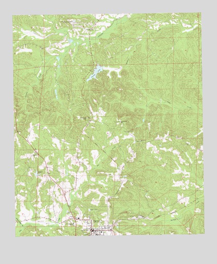
Clayton North, AL USGS Topographic Map
Click on map above to begin viewing in our Map Viewer.

This topographic map contains these locations and features:
Feature Name Type Latitude Longitude GNIS ID View Map
Barbour County CourthouseBuildingN31.8785°W85.4502°134753View Map
Barbour County Farm (historical)LocaleN31.8968°W85.4352°1805309View Map
Barbour County Public Lake DamDamN31.9685°W85.4399°130039View Map
Barbour County Sheriff's OfficeBuildingN31.8852°W85.4851°2751980View Map
Barbour County Training SchoolSchoolN31.8818°W85.4622°134754View Map
Blair CemeteryCemeteryN31.9263°W85.3858°114467View Map
ClaytonPopulated PlaceN31.8782°W85.4497°116206View Map
Clayton Baptist ChurchChurchN31.8802°W85.4502°134766View Map
Clayton CemeteryCemeteryN31.8807°W85.4513°1805631View Map
Clayton DivisionCivilN31.9204°W85.4538°165655View Map
Clayton Fire and RescueBuildingN31.8774°W85.4493°2691226View Map
Clayton Municipal AirportAirportN31.8842°W85.4846°164156View Map
Clayton Police DepartmentBuildingN31.8774°W85.4493°2751789View Map
Clayton Post OfficePost OfficeN31.8769°W85.4500°168063View Map
Clayton Presbyterian ChurchChurchN31.8785°W85.4463°134767View Map
Clayton United Methodist ChurchChurchN31.8810°W85.4499°155952View Map
County LakeReservoirN31.9670°W85.4454°116709View Map
Eufaula District Academy (historical)SchoolN31.8788°W85.4524°134777View Map
Graveyard HillSummitN31.9393°W85.4313°119281View Map
Jacksonville CemeteryCemeteryN31.9335°W85.4252°163349View Map
Jacksonville ChurchChurchN31.9335°W85.4255°120790View Map
Kennedy HillSummitN31.9418°W85.4516°121153View Map
Kennedy Lookout TowerTowerN31.9418°W85.4516°163350View Map
Lavinia Church (historical)ChurchN31.9296°W85.4916°134799View Map
Marianna ChurchChurchN31.9210°W85.4880°122282View Map
Mount Nebo Church (historical)ChurchN31.9363°W85.4369°134806View Map
Mount Olive (historical)Populated PlaceN31.9324°W85.4222°134807View Map
Mount Olive CemeteryCemeteryN31.9096°W85.4374°163354View Map
Mount Olive ChurchChurchN31.9279°W85.4163°152458View Map
Mount Scilla ChurchChurchN31.9918°W85.4488°164085View Map
Mount Scilla SchoolSchoolN31.9896°W85.4486°134808View Map
Nebo School (historical)SchoolN31.9363°W85.4513°134809View Map
Nix Mill (historical)LocaleN31.8835°W85.4719°1805344View Map
Town of ClaytonCivilN31.8824°W85.4605°2406274View Map
Ventress Correctional FacilityBuildingN31.8883°W85.4927°2739755View Map
Ventress Mill (historical)LocaleN31.9085°W85.4605°134833View Map
Ventress PondReservoirN31.9104°W85.4854°128431View Map
Williams Mill BranchStreamN31.8802°W85.4947°129027View Map

Note: Coordinates in the location and feature list above are referenced to NAD83 datum.


Copyright (C) 2008-2024 Ryan Niemi / Sunset Dynamics ... All Rights Reserved