TopoQuest Logo
Do you find TopoQuest useful?
Help keep TopoQuest running and adding new maps/features by donating!
Bitcoin:  19c7KJd3qBynnjoSw5npx9KScwjBe4ifkT
Litecoin:  LXs6TkuXGGXo1vDsWCkWVdjQX94eUKd6ui
Home View Maps Find Maps Find Places Resources & Links


Clancy, Montana Topographic Map

USGS Map Title: Clancy, MT
USGS Map MRC: 46111D8
DRG (GeoTIFF) Download: o46111d8.tif


Neighboring USGS Topographic Map Quads:


  Helena, MT  
46112E1
 

  East Helena, MT  
46111E8
 

  Louisville, MT  
46111E7
 

  Jefferson City, MT  
46112D1
 

  Clancy, MT  
46111D8
 

  Casey Peak, MT  
46111D7
 

  Wickes, MT  
46112C1
 

  Elkhorn, MT  
46111C8
 

  Crow Creek Falls, MT  
46111C7


Map MRC Location:

N47°
W112°
N47°
W111°
H8 H7 H6 H5 H4 H3 H2 H1
G8 G7 G6 G5 G4 G3 G2 G1
F8 F7 F6 F5 F4 F3 F2 F1
E8 E7 E6 E5 E4 E3 E2 E1
D8 D7 D6 D5 D4 D3 D2 D1
C8 C7 C6 C5 C4 C3 C2 C1
B8 B7 B6 B5 B4 B3 B2 B1
A8 A7 A6 A5 A4 A3 A2 A1
N46°
W112°
N46°
W111°

Clancy, MT USGS 1:24K Topographic Map Preview:
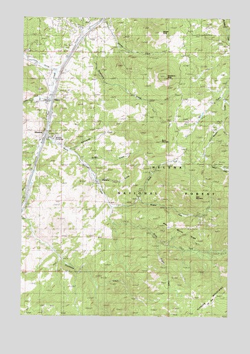
Clancy, MT USGS Topographic Map
Click on map above to begin viewing in our Map Viewer.

This topographic map contains these locations and features:
Feature Name Type Latitude Longitude GNIS ID View Map
08N03W16AAB_01 WellWellN46.4502°W111.9814°816330View Map
08N03W16AAC_01 WellWellN46.4502°W111.9814°816329View Map
08N03W16ABB_01 WellWellN46.4477°W111.9775°816311View Map
08N03W16ACA_01 SpringSpringN46.4480°W111.9817°816315View Map
08N03W16ACAA01 SpringSpringN46.4497°W111.9814°816327View Map
08N03W16ACBC01 WellWellN46.4469°W111.9878°816309View Map
08N03W16ACD_01 SpringSpringN46.4463°W111.9836°816306View Map
08N03W16ADB_01 WellWellN46.4480°W111.9814°816314View Map
08N03W16ADD_01 WellWellN46.4466°W111.9789°816308View Map
08N03W16BDA_01 WellWellN46.4477°W111.9880°816312View Map
08N03W22ACA_01 WellWellN46.4316°W111.9550°816235View Map
AlhambraPopulated PlaceN46.4513°W111.9883°778941View Map
Alhambra (historical)LocaleN46.4513°W111.9883°1762525View Map
Alhambra Hot Springs MineMineN46.4513°W111.9847°803264View Map
Alhambra Post Office (historical)Post OfficeN46.4513°W111.9883°1762494View Map
Alhambra RV ParkLocaleN46.4513°W111.9883°1762593View Map
Argonaut MineMineN46.4527°W111.9572°803479View Map
B and G MineMineN46.4130°W111.9003°803477View Map
Badger CreekStreamN46.4399°W111.9653°779236View Map
Browns GulchValleyN46.4319°W111.9550°780458View Map
Burnt MountainSummitN46.4483°W111.9194°806902View Map
Champion MineMineN46.4916°W111.9869°803525View Map
ClancyPopulated PlaceN46.4652°W111.9864°800597View Map
Clancy (historical)LocaleN46.4652°W111.9864°1762487View Map
Clancy CreekStreamN46.4669°W111.9839°781306View Map
Clancy Elementary SchoolSchoolN46.4819°W111.9905°1762531View Map
Clancy Post OfficePost OfficeN46.4651°W111.9861°800329View Map
Clancy United Methodist ChurchChurchN46.4658°W111.9858°1762584View Map
Clancy Volunteer Fire Company Station 1BuildingN46.4641°W111.9844°2546600View Map
Dutchman CreekStreamN46.4380°W111.9930°782735View Map
Eagles Nest MineMineN46.4130°W111.8947°803475View Map
Elk ParkFlatN46.3797°W111.8914°783107View Map
Elkhorn MountainsRangeN46.4805°W111.8761°783135View Map
Elkhorn Search and RescueBuildingN46.4636°W111.9844°2637826View Map
Forest Park MineMineN46.4991°W111.9808°803360View Map
Hartford (historical)LocaleN46.4777°W111.9786°1762682View Map
Haystack CreekStreamN46.4952°W111.8783°794781View Map
Hillbrook Nursing HomeHospitalN46.4652°W111.9864°1762589View Map
Hogan CreekStreamN46.4058°W111.9186°784920View Map
Interchange 182CrossingN46.4683°W111.9814°1762610View Map
Kains (historical)LocaleN46.4994°W111.9550°1762674View Map
Lava MountainSummitN46.4252°W111.8978°785984View Map
Lewiston (historical)Populated PlaceN46.4638°W111.9864°1762670View Map
Lump (historical)LocaleN46.4819°W111.9981°1762665View Map
Lump GulchValleyN46.4783°W111.9828°786714View Map
Lump Post Office (historical)Post OfficeN46.4819°W111.9981°1762555View Map
McClellan Ranger StationLocaleN46.4952°W111.9019°773970View Map
Mid Fork Warm Springs MineMineN46.4166°W111.8925°803261View Map
Middle Fork Warm Springs CreekStreamN46.4238°W111.9314°787313View Map
Mike Murray RidgeRidgeN46.4122°W111.9080°794685View Map
Mill CreekStreamN46.4727°W111.8775°794684View Map
NE NE Section 18 MineMineN46.4549°W111.8925°803483View Map
New Haven (historical)Populated PlaceN46.4624°W111.9864°1762671View Map
North Fork Warm Springs CreekStreamN46.4210°W111.9478°788276View Map
NW SW Section 24 MineMineN46.4274°W111.9300°803463View Map
Rattlesnake CreekStreamN46.4447°W111.9733°789405View Map
Saint John MissionChurchN46.4638°W111.9864°1762585View Map
Scott ReservoirReservoirN46.4216°W111.9153°795976View Map
Shingle ButteSummitN46.4935°W111.9189°806975View Map
Shingle CreekStreamN46.4985°W111.9544°790421View Map
South Fork Warm Springs CreekStreamN46.4213°W111.9480°791080View Map
Strawberry ButteSummitN46.4758°W111.9161°791588View Map
Strawberry CreekStreamN46.4919°W111.9669°791590View Map
Sunnyside (historical)LocaleN46.4499°W111.9814°1762644View Map
Wall 2 MineMineN46.4555°W111.9842°803462View Map
Warm Springs CreekStreamN46.4510°W111.9864°794683View Map

Note: Coordinates in the location and feature list above are referenced to NAD83 datum.


Copyright (C) 2008-2024 Ryan Niemi / Sunset Dynamics ... All Rights Reserved