TopoQuest Logo
Do you find TopoQuest useful?
Help keep TopoQuest running and adding new maps/features by donating!
Bitcoin:  19c7KJd3qBynnjoSw5npx9KScwjBe4ifkT
Litecoin:  LXs6TkuXGGXo1vDsWCkWVdjQX94eUKd6ui
Home View Maps Find Maps Find Places Resources & Links


Chrome Ridge, Oregon Topographic Map

USGS Map Title: Chrome Ridge, OR
USGS Map MRC: 42123D6
DRG (GeoTIFF) Download: o42123d6.tif


Neighboring USGS Topographic Map Quads:


  Hobson Horn, OR  
42123E7
 

  Mount Peavine, OR  
42123E6
 

  Galice, OR  
42123E5
 

  York Butte, OR  
42123D7
 

  Chrome Ridge, OR  
42123D6
 

  Onion Mountain, OR  
42123D5
 

  Pearsoll Peak, OR  
42123C7
 

  Eight Dollar Mountain, OR  
42123C6
 

  Selma, OR  
42123C5


Map MRC Location:

N43°
W124°
N43°
W123°
H8 H7 H6 H5 H4 H3 H2 H1
G8 G7 G6 G5 G4 G3 G2 G1
F8 F7 F6 F5 F4 F3 F2 F1
E8 E7 E6 E5 E4 E3 E2 E1
D8 D7 D6 D5 D4 D3 D2 D1
C8 C7 C6 C5 C4 C3 C2 C1
B8 B7 B6 B5 B4 B3 B2 B1
A8 A7 A6 A5 A4 A3 A2 A1
N42°
W124°
N42°
W123°

Chrome Ridge, OR USGS 1:24K Topographic Map Preview:
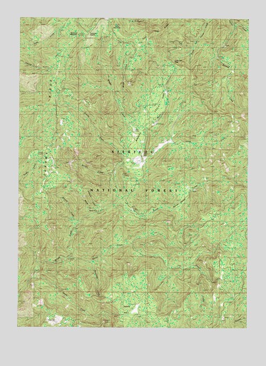
Chrome Ridge, OR USGS Topographic Map
Click on map above to begin viewing in our Map Viewer.

This topographic map contains these locations and features:
Feature Name Type Latitude Longitude GNIS ID View Map
Barr MineMineN42.4546°W123.6878°1137540View Map
Big Pine Recreation SiteLocaleN42.4579°W123.6759°1926241View Map
Briggs ValleyValleyN42.4415°W123.6928°1167037View Map
Brushy CreekStreamN42.4371°W123.6995°1138707View Map
Chrome CampLocaleN42.4451°W123.7373°1139717View Map
Chrome RidgeRidgeN42.4554°W123.7317°1139720View Map
Courier MineMineN42.4032°W123.7234°1140255View Map
Dutchy CreekStreamN42.4404°W123.6948°1141444View Map
Elkhorn CreekStreamN42.4215°W123.7056°1141811View Map
Elkhorn MineMineN42.4223°W123.7084°1141818View Map
Freeland MountainSummitN42.4924°W123.7198°1142438View Map
Freeland SaddleGapN42.4943°W123.7137°1155739View Map
Granite CreekStreamN42.4176°W123.7192°1142916View Map
Horse CreekStreamN42.4248°W123.6984°1143751View Map
Horse MountainSummitN42.3765°W123.7350°1143772View Map
Lone Tree CreekStreamN42.4884°W123.6603°1145368View Map
Lone Tree PassGapN42.4773°W123.6665°1155740View Map
Lone Tree RidgeRidgeN42.4937°W123.6778°1145370View Map
Maple CreekStreamN42.4207°W123.7109°1154349View Map
Minnow CreekStreamN42.4984°W123.6378°1146342View Map
Myers CreekStreamN42.4540°W123.6837°1146705View Map
Myers Creek Recreation SiteLocaleN42.4726°W123.6728°1155915View Map
Onion CreekStreamN42.4023°W123.7256°1147230View Map
Sam Brown Horse CampLocaleN42.4421°W123.6876°1926255View Map
Sam Brown Recreation SiteLocaleN42.4415°W123.6876°1155913View Map
Secret CreekStreamN42.4248°W123.6987°1149211View Map
Secret Creek Recreation SiteLocaleN42.4218°W123.6892°1155914View Map
Secret ValleyValleyN42.4226°W123.6678°1159170View Map
South Fork Taylor CreekStreamN42.4998°W123.6520°1150028View Map
Swede BasinBasinN42.3832°W123.6912°1150770View Map
Swede CreekStreamN42.3946°W123.7442°1150775View Map
Taylor MountainSummitN42.4966°W123.6988°1150922View Map
Valley CreekStreamN42.4498°W123.6651°1154348View Map
Waterdog CreekStreamN42.4012°W123.7120°1151945View Map
Whiskey GulchValleyN42.4401°W123.6845°1154350View Map
Wilderville DivisionCivilN42.3794°W123.6725°1938153View Map
Windy CreekStreamN42.4651°W123.6956°1154351View Map

Note: Coordinates in the location and feature list above are referenced to NAD83 datum.


Copyright (C) 2008-2024 Ryan Niemi / Sunset Dynamics ... All Rights Reserved