TopoQuest Logo
Do you find TopoQuest useful?
Help keep TopoQuest running and adding new maps/features by donating!
Bitcoin:  19c7KJd3qBynnjoSw5npx9KScwjBe4ifkT
Litecoin:  LXs6TkuXGGXo1vDsWCkWVdjQX94eUKd6ui
Home View Maps Find Maps Find Places Resources & Links


Cerro Castellan, Texas Topographic Map

USGS Map Title: Cerro Castellan, TX
USGS Map MRC: 29103B4
DRG (GeoTIFF) Download: o29103b4.tif


Neighboring USGS Topographic Map Quads:


  Terlingua, TX  
29103C5
 

  Tule Mountain, TX  
29103C4
 

  The Basin, TX  
29103C3
 

  Castolon, TX  
29103B5
 

  Cerro Castellan, TX  
29103B4
 

  Emory Peak, TX  
29103B3


  Smoky Creek, TX  
29103A4
 

  Reed Camp, TX  
29103A3


Map MRC Location:

N30°
W104°
N30°
W103°
H8 H7 H6 H5 H4 H3 H2 H1
G8 G7 G6 G5 G4 G3 G2 G1
F8 F7 F6 F5 F4 F3 F2 F1
E8 E7 E6 E5 E4 E3 E2 E1
D8 D7 D6 D5 D4 D3 D2 D1
C8 C7 C6 C5 C4 C3 C2 C1
B8 B7 B6 B5 B4 B3 B2 B1
A8 A7 A6 A5 A4 A3 A2 A1
N29°
W104°
N29°
W103°

Cerro Castellan, TX USGS 1:24K Topographic Map Preview:
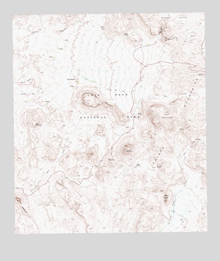
Cerro Castellan, TX USGS Topographic Map
Click on map above to begin viewing in our Map Viewer.

This topographic map contains these locations and features:
Feature Name Type Latitude Longitude GNIS ID View Map
Bee MountainSummitN29.1878°W103.4863°1351773View Map
Black MesaSummitN29.2116°W103.4896°1352339View Map
Burro MesaSummitN29.2472°W103.4126°1377838View Map
Burro Mesa PouroffValleyN29.2369°W103.4044°1353385View Map
Burro Mesa Pouroff TrailTrailN29.2391°W103.4038°2032972View Map
Burro Mesa Pouroff WindowArchN29.2355°W103.3977°1679042View Map
Burro Mesa Spring TrailTrailN29.2380°W103.4255°2032973View Map
Burro SpringSpringN29.2383°W103.4241°1353386View Map
Cerro CastellanSummitN29.1446°W103.4974°1377823View Map
Chimneys TrailTrailN29.2085°W103.4730°1354417View Map
Chimneys TrailTrailN29.2060°W103.4241°2032872View Map
Goat MountainSummitN29.1877°W103.4057°1373862View Map
Kit MountainSummitN29.2037°W103.4506°1360704View Map
Mule Ear OverlookLocaleN29.1669°W103.4352°1363453View Map
Mule Ear PeaksSummitN29.1435°W103.4023°1363454View Map
Mule Ear SpringSpringN29.1624°W103.4074°1363455View Map
Mule Ears - Smoky Creek TrailTrailN29.1663°W103.4346°2033360View Map
Sotol Vista OverlookLocaleN29.2146°W103.3768°1368615View Map
The ChimneysPillarN29.2130°W103.4588°1369773View Map
Trap MountainSummitN29.1720°W103.4277°1370074View Map
Trap SpringSpringN29.1636°W103.4211°1370075View Map
Tuff CanyonValleyN29.1485°W103.4926°1370191View Map
Tuff Canyon TrailTrailN29.1494°W103.4880°2033055View Map
Tule SpringSpringN29.2425°W103.4431°1370196View Map

Note: Coordinates in the location and feature list above are referenced to NAD83 datum.


Copyright (C) 2008-2024 Ryan Niemi / Sunset Dynamics ... All Rights Reserved