TopoQuest Logo
Do you find TopoQuest useful?
Help keep TopoQuest running and adding new maps/features by donating!
Bitcoin:  19c7KJd3qBynnjoSw5npx9KScwjBe4ifkT
Litecoin:  LXs6TkuXGGXo1vDsWCkWVdjQX94eUKd6ui
Home View Maps Find Maps Find Places Resources & Links


Cascade, Wisconsin Topographic Map

USGS Map Title: Cascade, WI
USGS Map MRC: 43088F1
DRG (GeoTIFF) Download: o43088f1.tif


Neighboring USGS Topographic Map Quads:


  Saint Cloud, WI  
43088G2
 

  Elkhart Lake, WI  
43088G1
 

  Franklin, WI  
43087G8
 

  Dundee, WI  
43088F2
 

  Cascade, WI  
43088F1
 

  Plymouth South, WI  
43087F8
 

  Kewaskum, WI  
43088E2
 

  Batavia, WI  
43088E1
 

  Random Lake, WI  
43087E8


Map MRC Location:

N44°
W89°
N44°
W88°
H8 H7 H6 H5 H4 H3 H2 H1
G8 G7 G6 G5 G4 G3 G2 G1
F8 F7 F6 F5 F4 F3 F2 F1
E8 E7 E6 E5 E4 E3 E2 E1
D8 D7 D6 D5 D4 D3 D2 D1
C8 C7 C6 C5 C4 C3 C2 C1
B8 B7 B6 B5 B4 B3 B2 B1
A8 A7 A6 A5 A4 A3 A2 A1
N43°
W89°
N43°
W88°

Cascade, WI USGS 1:24K Topographic Map Preview:
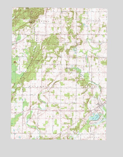
Cascade, WI USGS Topographic Map
Click on map above to begin viewing in our Map Viewer.

This topographic map contains these locations and features:
Feature Name Type Latitude Longitude GNIS ID View Map
Ben Nutt CreekStreamN43.7067°W88.0148°1561552View Map
CascadePopulated PlaceN43.6583°W88.0070°1562757View Map
Cascade Elementary SchoolSchoolN43.6598°W88.0113°1834523View Map
Cascade Fire DepartmentBuildingN43.6574°W88.0058°2697871View Map
Cascade Police DepartmentBuildingN43.6559°W88.0109°2759872View Map
Chambers CreekStreamN43.6267°W88.0412°1562934View Map
German CornersLocaleN43.7464°W88.0601°1565478View Map
Greenbush CampgroundLocaleN43.7497°W88.1054°1565834View Map
Greenbush KettleBasinN43.7358°W88.0973°1565836View Map
Johnson HillSummitN43.6980°W88.1209°1567226View Map
Johnson Hill Kame State Natural AreaParkN43.6980°W88.1209°2055599View Map
Lake EllenLakeN43.6464°W88.0150°1564535View Map
Lyndon Mitchell School (historical)SchoolN43.6889°W88.0026°1834616View Map
Melius CreekStreamN43.6261°W88.0418°1569325View Map
Mill CreekStreamN43.7067°W88.0145°1569470View Map
Mount Pleasant CemeteryCemeteryN43.6601°W88.0405°1569839View Map
Nichols Creek State Wildlife AreaParkN43.6844°W88.0304°1570279View Map
ParnellPopulated PlaceN43.6667°W88.1001°1571063View Map
Parnell Elementary SchoolSchoolN43.6672°W88.1048°1834643View Map
Parnell Observation TowerTowerN43.6997°W88.0895°1581308View Map
Saint Michael ChurchChurchN43.6706°W88.1104°1573368View Map
Saint Michael's CemeteryCemeteryN43.6710°W88.1104°1833478View Map
Saint Paul's CemeteryCemeteryN43.6648°W88.0141°1573465View Map
Sheboygan County Waterfowl Production AreaParkN43.6381°W88.1198°2765500View Map
South Prairie School (historical)SchoolN43.7314°W88.0809°1834716View Map
Spring Farm School (historical)SchoolN43.7033°W88.0407°1834719View Map
Town of MitchellCivilN43.6739°W88.1003°1583732View Map
Union CemeteryCemeteryN43.6304°W88.0204°1575881View Map
Victor School (historical)SchoolN43.7247°W88.0115°1834735View Map
Village of CascadeCivilN43.6596°W88.0072°1582920View Map

Note: Coordinates in the location and feature list above are referenced to NAD83 datum.


Copyright (C) 2008-2024 Ryan Niemi / Sunset Dynamics ... All Rights Reserved