TopoQuest Logo
Do you find TopoQuest useful?
Help keep TopoQuest running and adding new maps/features by donating!
Bitcoin:  19c7KJd3qBynnjoSw5npx9KScwjBe4ifkT
Litecoin:  LXs6TkuXGGXo1vDsWCkWVdjQX94eUKd6ui
Home View Maps Find Maps Find Places Resources & Links


Carroll, Ohio Topographic Map

USGS Map Title: Carroll, OH
USGS Map MRC: 39082G6
DRG (GeoTIFF) Download: o39082g6.tif


Neighboring USGS Topographic Map Quads:


  Reynoldsburg, OH  
39082H7
 

  Pataskala, OH  
39082H6
 

  Millersport, OH  
39082H5
 

  Canal Winchester, OH  
39082G7
 

  Carroll, OH  
39082G6
 

  Baltimore, OH  
39082G5
 

  East Ringgold, OH  
39082F7
 

  Amanda, OH  
39082F6
 

  Lancaster, OH  
39082F5


Map MRC Location:

N40°
W83°
N40°
W82°
H8 H7 H6 H5 H4 H3 H2 H1
G8 G7 G6 G5 G4 G3 G2 G1
F8 F7 F6 F5 F4 F3 F2 F1
E8 E7 E6 E5 E4 E3 E2 E1
D8 D7 D6 D5 D4 D3 D2 D1
C8 C7 C6 C5 C4 C3 C2 C1
B8 B7 B6 B5 B4 B3 B2 B1
A8 A7 A6 A5 A4 A3 A2 A1
N39°
W83°
N39°
W82°

Carroll, OH USGS 1:24K Topographic Map Preview:
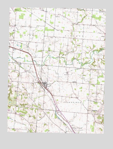
Carroll, OH USGS Topographic Map
Click on map above to begin viewing in our Map Viewer.

This topographic map contains these locations and features:
Feature Name Type Latitude Longitude GNIS ID View Map
Alspach Boving CemeteryCemeteryN39.8099°W82.7352°2765642View Map
Anderson Airport (historical)AirportN39.8334°W82.7332°1082539View Map
Baugher CemeteryCemeteryN39.7839°W82.6360°1037684View Map
Betzer CemeteryCemeteryN39.7912°W82.7396°1037974View Map
Bickel CemeteryCemeteryN39.8731°W82.6327°1806797View Map
Bismark ParkLocaleN39.7690°W82.6879°1071023View Map
Bloom - Carroll High SchoolSchoolN39.7947°W82.6975°1056134View Map
Brandt Middletown CemeteryCemeteryN39.7953°W82.6419°2765646View Map
Bright CemeteryCemeteryN39.8322°W82.6731°1806799View Map
CarrollPopulated PlaceN39.7990°W82.7010°1056768View Map
Carroll CemeteryCemeteryN39.7955°W82.7070°1038835View Map
Carroll Elementary SchoolSchoolN39.7962°W82.6997°1084111View Map
Carroll Municipal BuildingBuildingN39.7986°W82.7019°2126010View Map
Carroll Police DepartmentBuildingN39.7988°W82.7023°2733001View Map
Carroll Post OfficePost OfficeN39.8005°W82.7035°1985007View Map
Claypools RunStreamN39.7573°W82.6724°2045810View Map
Coffman CemeteryCemeteryN39.7902°W82.7274°2765650View Map
Cook PondReservoirN39.7686°W82.7331°1078806View Map
Cook Pond DamDamN39.7684°W82.7316°1078805View Map
Fairchild CemeteryCemeteryN39.8163°W82.6778°1806810View Map
Fairfield CountyCivilN39.7516°W82.6306°1074035View Map
Fairfield County AirportAirportN39.7541°W82.6614°1082778View Map
Fairview ChurchChurchN39.8720°W82.7054°1040355View Map
Fairview-Ritter CemeteryCemeteryN39.8712°W82.7021°1806811View Map
Greenfield Dam Wildlife AreaParkN39.7717°W82.6307°1070122View Map
Greenfield LakeReservoirN39.7727°W82.6312°1078866View Map
Greenfield Lake DamDamN39.7717°W82.6332°1078865View Map
Greenfield Township CemeteryCemeteryN39.7578°W82.6671°1806818View Map
Greenfield Township Fire Department Station 560BuildingN39.7734°W82.6474°2549416View Map
HarleyPopulated PlaceN39.8531°W82.6879°1064795View Map
HavensportPopulated PlaceN39.8101°W82.6729°1048826View Map
Honey Hill OrchardLocaleN39.7803°W82.7197°2515704View Map
Hunters Run Conservation District Structure Five DamDamN39.7917°W82.6349°1078875View Map
Hunters Run Conservation District Structure ReservoirReservoirN39.7906°W82.6338°1078876View Map
Hunters Run Conservation District Structure ReservoirReservoirN39.7701°W82.6682°1078878View Map
Hunters Run Conservation District Structure Six DamDamN39.7701°W82.6682°1078877View Map
Jefferson WoodsPopulated PlaceN39.8453°W82.7476°2771444View Map
John Bright BridgeBridgeN39.8295°W82.6741°1056155View Map
LockvillePopulated PlaceN39.8187°W82.7335°1065017View Map
Lockville ParkParkN39.8190°W82.7385°1806828View Map
Lockville Post Office (historical)Post OfficeN39.8181°W82.7332°1985033View Map
Lockville StationPopulated PlaceN39.8337°W82.7441°1048928View Map
McGill PondReservoirN39.8691°W82.7490°1078808View Map
McGill Pond DamDamN39.8684°W82.7466°1078807View Map
Morse PondReservoirN39.7720°W82.7482°1078804View Map
Morse Pond DamDamN39.7717°W82.7482°1078803View Map
Mount Carmel CemeteryCemeteryN39.8459°W82.6932°1043526View Map
Mount Carmel Church (historical)ChurchN39.8459°W82.6924°1056167View Map
Ohio Power Company Pond Mur-32ReservoirN39.8551°W82.7332°1079485View Map
Ohio Power Company Pond Mur-32 DamDamN39.8551°W82.7332°1079484View Map
Old Betzer CemeteryCemeteryN39.7905°W82.7375°1806845View Map
Pine Hill Golf CourseLocaleN39.7920°W82.7141°1056170View Map
Poplar CreekStreamN39.8265°W82.6824°1044687View Map
Poplar Creek CemeteryCemeteryN39.8590°W82.6623°1806860View Map
Ritter School (historical)SchoolN39.8706°W82.7021°1056174View Map
River of Life ChurchChurchN39.8041°W82.6989°2513400View Map
Saint Michaels ChurchChurchN39.8726°W82.6327°1045714View Map
StoudertownPopulated PlaceN39.8676°W82.6913°1049214View Map
Sunny Hill Fruit FarmLocaleN39.7883°W82.7389°2515695View Map
Township of GreenfieldCivilN39.7762°W82.6570°1086076View Map
Township of LibertyCivilN39.8736°W82.6439°1086079View Map
Village of CarrollCivilN39.7991°W82.7039°2397562View Map
Wildermuth Memorial ChurchChurchN39.8006°W82.6618°1047909View Map

Note: Coordinates in the location and feature list above are referenced to NAD83 datum.


Copyright (C) 2008-2024 Ryan Niemi / Sunset Dynamics ... All Rights Reserved