TopoQuest Logo
Do you find TopoQuest useful?
Help keep TopoQuest running and adding new maps/features by donating!
Bitcoin:  19c7KJd3qBynnjoSw5npx9KScwjBe4ifkT
Litecoin:  LXs6TkuXGGXo1vDsWCkWVdjQX94eUKd6ui
Home View Maps Find Maps Find Places Resources & Links


Jellico, California Topographic Map

USGS Map Title: Jellico, CA
USGS Map MRC: 40121G3
DRG (GeoTIFF) Download: o40121g3.tif


Neighboring USGS Topographic Map Quads:


  Hogback Ridge, CA  
40121H4
 

  Coble Mountain, CA  
40121H3
 

  Little Valley, CA  
40121H2
 

  Murken Bench, CA  
40121G4
 

  Jellico, CA  
40121G3
 

  Corders Reservoir, CA  
40121G2
 

  Old Station, CA  
40121F4
 

  Swains Hole, CA  
40121F3
 

  Poison Lake, CA  
40121F2


Map MRC Location:

N41°
W122°
N41°
W121°
H8 H7 H6 H5 H4 H3 H2 H1
G8 G7 G6 G5 G4 G3 G2 G1
F8 F7 F6 F5 F4 F3 F2 F1
E8 E7 E6 E5 E4 E3 E2 E1
D8 D7 D6 D5 D4 D3 D2 D1
C8 C7 C6 C5 C4 C3 C2 C1
B8 B7 B6 B5 B4 B3 B2 B1
A8 A7 A6 A5 A4 A3 A2 A1
N40°
W122°
N40°
W121°

Jellico, CA USGS 1:24K Topographic Map Preview:
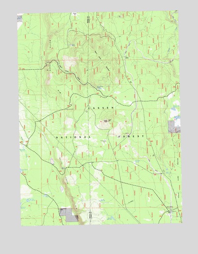
Jellico, CA USGS Topographic Map
Click on map above to begin viewing in our Map Viewer.

This topographic map contains these locations and features:
Feature Name Type Latitude Longitude GNIS ID View Map
Bainbridge ReservoirReservoirN40.7965°W121.3730°256435View Map
Beaver Creek ReservoirReservoirN40.8169°W121.2562°1665831View Map
Beaver Creek WetlandsFlatN40.8113°W121.2539°1744596View Map
Bootleg ReservoirReservoirN40.7536°W121.3048°257354View Map
Butte CampLocaleN40.7991°W121.3094°257761View Map
Butte Creek RimCliffN40.8516°W121.3544°257768View Map
Butte Creek RimCliffN40.7538°W121.3286°257769View Map
Coble SpringSpringN40.8557°W121.3339°258500View Map
Cone and Ward RanchLocaleN40.7591°W121.3439°258634View Map
Cone ReservoirReservoirN40.7645°W121.3697°274679View Map
Ericksons SpringSpringN40.7867°W121.2867°259952View Map
Freebe ReservoirReservoirN40.7636°W121.3152°274675View Map
Halls FlatPopulated PlaceN40.7560°W121.2591°1658700View Map
JellicoPopulated PlaceN40.8449°W121.2928°1658854View Map
Jelly CampLocaleN40.7807°W121.2647°261919View Map
Jelly SpringSpringN40.7791°W121.2625°261920View Map
Ladder ButteSummitN40.8107°W121.3058°262257View Map
Moon SpringsSpringN40.8721°W121.3730°1661832View Map
Negro CampLocaleN40.8179°W121.3386°264027View Map
Negro Camp GulchValleyN40.8466°W121.3511°264028View Map
Negro Camp MountainSummitN40.8516°W121.3141°1659207View Map
Negro Camp SpringSpringN40.8301°W121.3153°264029View Map
Twin PondsReservoirN40.7675°W121.3574°274677View Map
Ward SpringSpringN40.7834°W121.3410°274678View Map

Note: Coordinates in the location and feature list above are referenced to NAD83 datum.


Copyright (C) 2008-2024 Ryan Niemi / Sunset Dynamics ... All Rights Reserved