TopoQuest Logo
Do you find TopoQuest useful?
Help keep TopoQuest running and adding new maps/features by donating!
Bitcoin:  19c7KJd3qBynnjoSw5npx9KScwjBe4ifkT
Litecoin:  LXs6TkuXGGXo1vDsWCkWVdjQX94eUKd6ui
Home View Maps Find Maps Find Places Resources & Links


Humboldt Peak, California Topographic Map

USGS Map Title: Humboldt Peak, CA
USGS Map MRC: 40121B4
DRG (GeoTIFF) Download: o40121b4.tif


Neighboring USGS Topographic Map Quads:


  Mineral, CA  
40121C5
 

  Childs Meadows, CA  
40121C4
 

  Stover Mountain, CA  
40121C3
 

  Onion Butte, CA  
40121B5
 

  Humboldt Peak, CA  
40121B4
 

  Humbug Valley, CA  
40121B3
 

  Butte Meadows, CA  
40121A5
 

  Jonesville, CA  
40121A4
 

  Belden, CA  
40121A3


Map MRC Location:

N41°
W122°
N41°
W121°
H8 H7 H6 H5 H4 H3 H2 H1
G8 G7 G6 G5 G4 G3 G2 G1
F8 F7 F6 F5 F4 F3 F2 F1
E8 E7 E6 E5 E4 E3 E2 E1
D8 D7 D6 D5 D4 D3 D2 D1
C8 C7 C6 C5 C4 C3 C2 C1
B8 B7 B6 B5 B4 B3 B2 B1
A8 A7 A6 A5 A4 A3 A2 A1
N40°
W122°
N40°
W121°

Humboldt Peak, CA USGS 1:24K Topographic Map Preview:
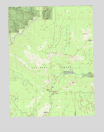
Humboldt Peak, CA USGS Topographic Map
Click on map above to begin viewing in our Map Viewer.

This topographic map contains these locations and features:
Feature Name Type Latitude Longitude GNIS ID View Map
Alder Creek CampgroundLocaleN40.2102°W121.4961°256154View Map
Butt MountainSummitN40.2177°W121.3864°257756View Map
Carter Creek TrailTrailN40.2104°W121.4133°1655190View Map
Carter MeadowFlatN40.2232°W121.4094°258017View Map
Carter Meadow Trail (historical)TrailN40.2024°W121.4186°258019View Map
Eagle RocksSummitN40.1627°W121.4102°259680View Map
Elam CampgroundLocaleN40.2452°W121.4486°259815View Map
Elam CreekStreamN40.2482°W121.4486°259816View Map
Humboldt PeakSummitN40.1507°W121.4302°261609View Map
Humboldt SummitSummitN40.1540°W121.4528°261610View Map
Lost LakeLakeN40.1361°W121.3975°262952View Map
Robbers RoostLocaleN40.1574°W121.4380°265448View Map
Round ValleyValleyN40.2140°W121.4928°1666423View Map
Round Valley CreekStreamN40.2138°W121.4916°265627View Map
Ruffa RanchLocaleN40.1746°W121.4119°265663View Map
Ruffa Ranch (historical)LocaleN40.1732°W121.3811°265662View Map
Slate CreekStreamN40.2360°W121.4591°266272View Map
Swamp CreekStreamN40.2402°W121.4653°268000View Map

Note: Coordinates in the location and feature list above are referenced to NAD83 datum.


Copyright (C) 2008-2024 Ryan Niemi / Sunset Dynamics ... All Rights Reserved