TopoQuest Logo
Do you find TopoQuest useful?
Help keep TopoQuest running and adding new maps/features by donating!
Bitcoin:  19c7KJd3qBynnjoSw5npx9KScwjBe4ifkT
Litecoin:  LXs6TkuXGGXo1vDsWCkWVdjQX94eUKd6ui
Home View Maps Find Maps Find Places Resources & Links


Westfield, Maine Topographic Map

USGS Map Title: Westfield, ME
USGS Map MRC: 46067E8
DRG (GeoTIFF) Download: o46067e8.tif


Neighboring USGS Topographic Map Quads:


  Presque Isle, ME  
46068F1
 

  Easton, ME  
46067F8
 

  Easton Center, ME  
46067F7
 

  Echo Lake, ME  
46068E1
 

  Westfield, ME  
46067E8
 

  Mars Hill, ME  
46067E7
 

  Number Nine Lake, ME  
46068D1
 

  Packard Lake, ME  
46067D8
 

  Bridgewater, ME  
46067D7


Map MRC Location:

N47°
W68°
N47°
W67°
H8 H7 H6 H5 H4 H3 H2 H1
G8 G7 G6 G5 G4 G3 G2 G1
F8 F7 F6 F5 F4 F3 F2 F1
E8 E7 E6 E5 E4 E3 E2 E1
D8 D7 D6 D5 D4 D3 D2 D1
C8 C7 C6 C5 C4 C3 C2 C1
B8 B7 B6 B5 B4 B3 B2 B1
A8 A7 A6 A5 A4 A3 A2 A1
N46°
W68°
N46°
W67°

Westfield, ME USGS 1:24K Topographic Map Preview:
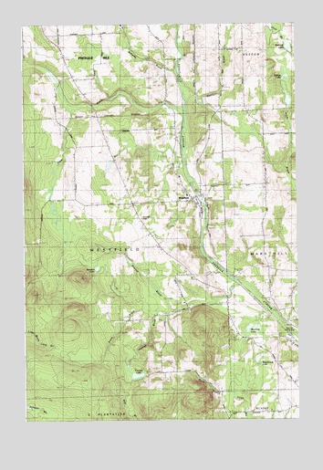
Westfield, ME USGS Topographic Map
Click on map above to begin viewing in our Map Viewer.

This topographic map contains these locations and features:
Feature Name Type Latitude Longitude GNIS ID View Map
Bennett LakeLakeN46.6177°W67.8782°562059View Map
Clark BrookStreamN46.5970°W67.9259°564025View Map
Dilling LakeLakeN46.6086°W67.8797°565101View Map
Eastabrook LakeLakeN46.5186°W67.8914°565705View Map
Getchell BrookStreamN46.6014°W67.9245°566767View Map
Getchell Farnham CemeteryCemeteryN46.6181°W67.8985°2678616View Map
Marshall CemeteryCemeteryN46.5636°W67.9459°570821View Map
Pretty BrookStreamN46.5353°W67.9392°573802View Map
Rideout BrookStreamN46.5348°W67.9331°574193View Map
School Number 1SchoolN46.5731°W67.9517°575010View Map
School Number 2SchoolN46.5464°W67.9242°575016View Map
Smith Farm DamDamN46.5820°W67.9595°1774388View Map
Smith Farm PondReservoirN46.5804°W67.9609°1774389View Map
Snow CemeteryCemeteryN46.5173°W67.8843°2678641View Map
Town of WestfieldCivilN46.5517°W67.9768°582804View Map
Water District ReservoirReservoirN46.5169°W67.9528°1774439View Map
Water District Reservoir DamDamN46.5176°W67.9528°1774438View Map
WestfieldPopulated PlaceN46.5703°W67.9225°578271View Map
Westfield Elementary SchoolSchoolN46.5712°W67.9250°1910704View Map
Westfield LakeLakeN46.5480°W67.9664°578272View Map
Westfield Post OfficePost OfficeN46.5703°W67.9220°1910705View Map
Williams BrookStreamN46.6103°W67.9295°1910711View Map
Winslow LakeLakeN46.5289°W67.8964°578597View Map
Youngs BrookStreamN46.5437°W67.9031°578799View Map
Youngs LakeReservoirN46.5142°W67.9487°578803View Map
Youngs Lake DamDamN46.5150°W67.9513°1774436View Map

Note: Coordinates in the location and feature list above are referenced to NAD83 datum.


Copyright (C) 2008-2024 Ryan Niemi / Sunset Dynamics ... All Rights Reserved