TopoQuest Logo
Do you find TopoQuest useful?
Help keep TopoQuest running and adding new maps/features by donating!
Bitcoin:  19c7KJd3qBynnjoSw5npx9KScwjBe4ifkT
Litecoin:  LXs6TkuXGGXo1vDsWCkWVdjQX94eUKd6ui
Home View Maps Find Maps Find Places Resources & Links


Scobey, Mississippi Topographic Map

USGS Map Title: Scobey, MS
USGS Map MRC: 33089H7
DRG (GeoTIFF) Download: o33089h7.tif


Neighboring USGS Topographic Map Quads:


  Oakland, MS  
34089A8
 

  Coker Lake, MS  
34089A7
 

  Velma, MS  
34089A6
 

  Tillatoba, MS  
33089H8
 

  Scobey, MS  
33089H7
 

  Coffeeville, MS  
33089H6
 

  Holcomb, MS  
33089G8
 

  Grenada, MS  
33089G7
 

  Kincaid, MS  
33089G6


Map MRC Location:

N34°
W90°
N34°
W89°
H8 H7 H6 H5 H4 H3 H2 H1
G8 G7 G6 G5 G4 G3 G2 G1
F8 F7 F6 F5 F4 F3 F2 F1
E8 E7 E6 E5 E4 E3 E2 E1
D8 D7 D6 D5 D4 D3 D2 D1
C8 C7 C6 C5 C4 C3 C2 C1
B8 B7 B6 B5 B4 B3 B2 B1
A8 A7 A6 A5 A4 A3 A2 A1
N33°
W90°
N33°
W89°

Scobey, MS USGS 1:24K Topographic Map Preview:
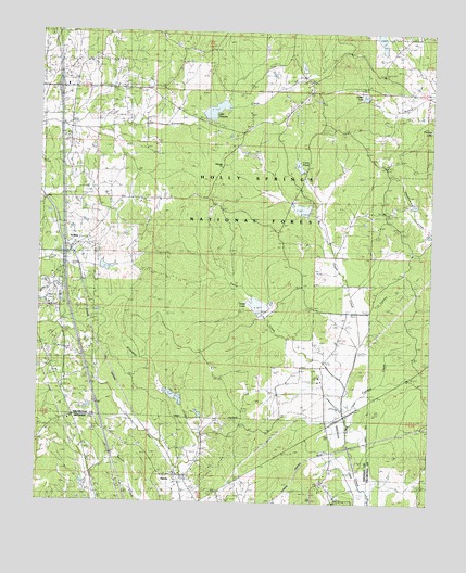
Scobey, MS USGS Topographic Map
Click on map above to begin viewing in our Map Viewer.

This topographic map contains these locations and features:
Feature Name Type Latitude Longitude GNIS ID View Map
Brattons ChapelChurchN33.9559°W89.8379°711478View Map
Curry PondReservoirN33.9647°W89.7926°704576View Map
Cypress CreekStreamN33.8982°W89.7751°693032View Map
Daily SchoolSchoolN33.9412°W89.7537°693043View Map
GatewoodPopulated PlaceN33.9748°W89.7645°693286View Map
Grenada Work CenterLocaleN33.9926°W89.7951°705603View Map
HardyPopulated PlaceN33.8821°W89.8295°693415View Map
Hardy Baptist ChurchChurchN33.8826°W89.8306°704481View Map
Horseshoe LakeReservoirN33.9887°W89.8009°1964975View Map
Interchange 220CrossingN33.9848°W89.8690°691451View Map
Irrigation LakeReservoirN33.9910°W89.7917°1964978View Map
Jehovah CemeteryCemeteryN33.9643°W89.8162°693609View Map
Jehovah ChurchChurchN33.9646°W89.8162°693610View Map
Jehovah SchoolSchoolN33.9640°W89.8162°693611View Map
Jordan LakeReservoirN33.9836°W89.7721°704580View Map
Jordan PondReservoirN33.9821°W89.7865°1964977View Map
Lake Tilatoba Picnic AreaLocaleN33.9757°W89.8209°705602View Map
Lake TillatobaReservoirN33.9793°W89.8195°704588View Map
Leighton (historical)LocaleN33.9212°W89.8473°704581View Map
Mount Zion ChurchChurchN33.8757°W89.8240°694117View Map
New Garner ChurchChurchN33.9334°W89.8598°694163View Map
Oak Hill ChurchChurchN33.9268°W89.7854°694235View Map
Organ CreekStreamN33.9076°W89.7756°694277View Map
Organ LakeReservoirN33.9532°W89.7915°1964976View Map
Organ SchoolSchoolN33.9268°W89.7865°694278View Map
Penman SchoolSchoolN33.9851°W89.7576°694341View Map
ScobeyPopulated PlaceN33.9415°W89.8659°694727View Map
Scobey CemeteryCemeteryN33.9418°W89.8679°705934View Map
Springhill ChurchChurchN33.9415°W89.7554°694880View Map
Texas LakeReservoirN33.9282°W89.8053°704587View Map
Walthall High School (historical)SchoolN33.9612°W89.7643°705938View Map
Williams Lake DamDamN33.8801°W89.8634°695494View Map
Williams Lake DamDamN33.8951°W89.8501°695497View Map
Y-19a-1 DamDamN33.9818°W89.7701°695519View Map
Y-19a-1 LakeReservoirN33.9818°W89.7701°695517View Map
Y-19a-2 DamDamN33.9818°W89.7701°695520View Map
Y-19a-2 LakeReservoirN33.9818°W89.7701°695518View Map
Y-19c-1 DamDamN33.9518°W89.7884°695507View Map
Y-19c-1 LakeReservoirN33.9518°W89.7884°695508View Map
Y-19c-2 DamDamN33.9518°W89.7884°695506View Map
Y-19c-2 LakeReservoirN33.9518°W89.7884°695509View Map
Y-19c-3 DamDamN33.9251°W89.8051°695501View Map
Y-19c-3 LakeDamN33.9251°W89.8051°695502View Map
Yalobusha Work CenterLocaleN33.9859°W89.7901°705604View Map
YO-29-10 DamDamN33.9784°W89.8234°695516View Map

Note: Coordinates in the location and feature list above are referenced to NAD83 datum.


Copyright (C) 2008-2024 Ryan Niemi / Sunset Dynamics ... All Rights Reserved