TopoQuest Logo
Do you find TopoQuest useful?
Help keep TopoQuest running and adding new maps/features by donating!
Bitcoin:  19c7KJd3qBynnjoSw5npx9KScwjBe4ifkT
Litecoin:  LXs6TkuXGGXo1vDsWCkWVdjQX94eUKd6ui
Home View Maps Find Maps Find Places Resources & Links


Peshastin, Washington Topographic Map

USGS Map Title: Peshastin, WA
USGS Map MRC: 47120E5
DRG (GeoTIFF) Download: o47120e5.tif


Neighboring USGS Topographic Map Quads:


  Winton, WA  
47120F6
 

  Van Creek, WA  
47120F5
 

  Chumstick Mountain, WA  
47120F4
 

  Leavenworth, WA  
47120E6
 

  Peshastin, WA  
47120E5
 

  Cashmere, WA  
47120E4
 

  Blewett, WA  
47120D6
 

  Tiptop, WA  
47120D5
 

  Monitor, WA  
47120D4


Map MRC Location:

N48°
W121°
N48°
W120°
H8 H7 H6 H5 H4 H3 H2 H1
G8 G7 G6 G5 G4 G3 G2 G1
F8 F7 F6 F5 F4 F3 F2 F1
E8 E7 E6 E5 E4 E3 E2 E1
D8 D7 D6 D5 D4 D3 D2 D1
C8 C7 C6 C5 C4 C3 C2 C1
B8 B7 B6 B5 B4 B3 B2 B1
A8 A7 A6 A5 A4 A3 A2 A1
N47°
W121°
N47°
W120°

Peshastin, WA USGS 1:24K Topographic Map Preview:
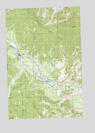
Peshastin, WA USGS Topographic Map
Click on map above to begin viewing in our Map Viewer.

This topographic map contains these locations and features:
Feature Name Type Latitude Longitude GNIS ID View Map
Anderson CanyonValleyN47.5823°W120.6045°1515862View Map
Blag MountainSummitN47.6021°W120.5095°1516640View Map
Brender CanyonValleyN47.5212°W120.5195°1516931View Map
Brisky CanyonValleyN47.5068°W120.5484°1516961View Map
C and D OrchardsLocaleN47.5447°W120.5825°2707420View Map
Dawn Lee Mobile Home CourtPopulated PlaceN47.5196°W120.5009°2607150View Map
Derby CanyonValleyN47.5696°W120.5879°1518680View Map
DrydenPopulated PlaceN47.5412°W120.5609°1518980View Map
Dryden Community ChurchChurchN47.5402°W120.5607°2609433View Map
Dryden Diversion DamDamN47.5545°W120.5728°1532971View Map
Dryden Post OfficePost OfficeN47.5414°W120.5612°2781665View Map
High Line CanalCanalN47.5535°W120.5498°1531205View Map
Judge CanyonValleyN47.5523°W120.5534°1521485View Map
KZPH-FM (Cashmere)TowerN47.5096°W120.5245°1534332View Map
Larsen CreekStreamN47.5235°W120.6245°1521911View Map
Leavenworth Christian Fellowship ChurchChurchN47.5541°W120.6008°2609758View Map
Ollala CanyonValleyN47.5387°W120.5417°1524029View Map
PeshastinPopulated PlaceN47.5707°W120.6040°1524346View Map
Peshastin Assembly of God ChurchChurchN47.5691°W120.6023°2609759View Map
Peshastin CemeteryCemeteryN47.5832°W120.6071°1524347View Map
Peshastin CreekStreamN47.5573°W120.5737°1524348View Map
Peshastin DitchCanalN47.5248°W120.5587°1530440View Map
Peshastin Dryden Elementary SchoolSchoolN47.5680°W120.6028°1531204View Map
Peshastin PinnaclesPillarN47.5415°W120.5206°1528410View Map
Peshastin Post OfficePost OfficeN47.5734°W120.6054°2781640View Map
Peshastin United Church of ChristChurchN47.5702°W120.6034°2609760View Map
Posey CanyonValleyN47.6018°W120.6212°1524596View Map
Riverbend Mobile Home ParkPopulated PlaceN47.5319°W120.5465°2607152View Map
Williams CanyonValleyN47.5523°W120.5531°1528168View Map

Note: Coordinates in the location and feature list above are referenced to NAD83 datum.


Copyright (C) 2008-2024 Ryan Niemi / Sunset Dynamics ... All Rights Reserved