TopoQuest Logo
Do you find TopoQuest useful?
Help keep TopoQuest running and adding new maps/features by donating!
Bitcoin:  19c7KJd3qBynnjoSw5npx9KScwjBe4ifkT
Litecoin:  LXs6TkuXGGXo1vDsWCkWVdjQX94eUKd6ui
Home View Maps Find Maps Find Places Resources & Links


Norfork SE, Arkansas Topographic Map

USGS Map Title: Norfork SE, AR
USGS Map MRC: 36092A3
DRG (GeoTIFF) Download: o36092a3.tif


Neighboring USGS Topographic Map Quads:


  Buffalo City, AR  
36092B4
 

  Norfork, AR  
36092B3
 

  Norfork Dam South, AR  
36092B2
 

  Big Flat, AR  
36092A4
 

  Norfork SE, AR  
36092A3
 

  Calico Rock, AR  
36092A2
 

  Landis, AR  
35092H4
 

  Onia, AR  
35092H3
 

  Fiftysix, AR  
35092H2


Map MRC Location:

N37°
W93°
N37°
W92°
H8 H7 H6 H5 H4 H3 H2 H1
G8 G7 G6 G5 G4 G3 G2 G1
F8 F7 F6 F5 F4 F3 F2 F1
E8 E7 E6 E5 E4 E3 E2 E1
D8 D7 D6 D5 D4 D3 D2 D1
C8 C7 C6 C5 C4 C3 C2 C1
B8 B7 B6 B5 B4 B3 B2 B1
A8 A7 A6 A5 A4 A3 A2 A1
N36°
W93°
N36°
W92°

Norfork SE, AR USGS 1:24K Topographic Map Preview:
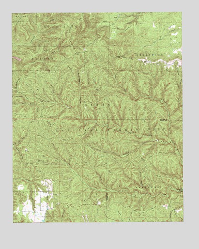
Norfork SE, AR USGS Topographic Map
Click on map above to begin viewing in our Map Viewer.

This topographic map contains these locations and features:
Feature Name Type Latitude Longitude GNIS ID View Map
Acklin CemeteryCemeteryN36.1156°W92.3013°70408View Map
Barkshed CreekStreamN36.0490°W92.2727°70509View Map
Barkshed Picnic AreaLocaleN36.0187°W92.2502°76232View Map
Bee BranchStreamN36.0190°W92.3027°70600View Map
Birmingham HollowValleyN36.0626°W92.3260°70689View Map
Cap ForkStreamN36.0187°W92.2510°71006View Map
Caroline GapGapN36.0987°W92.2952°71014View Map
Clifty CanyonValleyN36.0637°W92.2604°71169View Map
Clifty Canyon Special Interest AreaParkN36.0531°W92.2646°74413View Map
Cole ForkStreamN36.0487°W92.2585°71195View Map
Grassy HollowValleyN36.0845°W92.2502°71814View Map
Hooper CreekStreamN36.0170°W92.2763°72060View Map
Jonesdale (historical)Populated PlaceN36.0570°W92.3468°69390View Map
Push MountainSummitN36.0845°W92.3702°58448View Map
Push Mountain Lookout TowerTowerN36.0803°W92.3710°74558View Map
Sandy RidgeRidgeN36.0870°W92.2518°73480View Map
Spring Beech CreekStreamN36.0409°W92.2529°78427View Map
Stewart ForkStreamN36.0484°W92.2585°73706View Map
Sycamore HollowValleyN36.0462°W92.3743°73809View Map
Tassel SpringSpringN36.0753°W92.3675°73825View Map
Township of Big FlatCivilN36.0328°W92.3591°69556View Map
Township of GreenwoodCivilN36.1072°W92.2526°69559View Map

Note: Coordinates in the location and feature list above are referenced to NAD83 datum.


Copyright (C) 2008-2024 Ryan Niemi / Sunset Dynamics ... All Rights Reserved