TopoQuest Logo
Do you find TopoQuest useful?
Help keep TopoQuest running and adding new maps/features by donating!
Bitcoin:  19c7KJd3qBynnjoSw5npx9KScwjBe4ifkT
Litecoin:  LXs6TkuXGGXo1vDsWCkWVdjQX94eUKd6ui
Home View Maps Find Maps Find Places Resources & Links


Las Tablas, New Mexico Topographic Map

USGS Map Title: Las Tablas, NM
USGS Map MRC: 36106E1
DRG (GeoTIFF) Download: o36106e1.tif


Neighboring USGS Topographic Map Quads:


  Burned Mountain, NM  
36106F2
 

  Mule Canyon, NM  
36106F1
 

  Tres Piedras, NM  
36105F8
 

  Canon Plaza, NM  
36106E2
 

  Las Tablas, NM  
36106E1
 

  Petaca Peak, NM  
36105E8
 

  Valle Grande Peak, NM  
36106D2
 

  La Madera, NM  
36106D1
 

  Servilleta Plaza, NM  
36105D8


Map MRC Location:

N37°
W107°
N37°
W106°
H8 H7 H6 H5 H4 H3 H2 H1
G8 G7 G6 G5 G4 G3 G2 G1
F8 F7 F6 F5 F4 F3 F2 F1
E8 E7 E6 E5 E4 E3 E2 E1
D8 D7 D6 D5 D4 D3 D2 D1
C8 C7 C6 C5 C4 C3 C2 C1
B8 B7 B6 B5 B4 B3 B2 B1
A8 A7 A6 A5 A4 A3 A2 A1
N36°
W107°
N36°
W106°

Las Tablas, NM USGS 1:24K Topographic Map Preview:
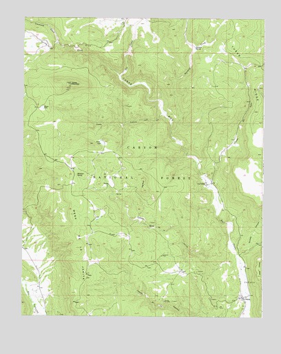
Las Tablas, NM USGS Topographic Map
Click on map above to begin viewing in our Map Viewer.

This topographic map contains these locations and features:
Feature Name Type Latitude Longitude GNIS ID View Map
Abeyta LakeLakeN36.6196°W106.1016°913024View Map
Agua TankReservoirN36.5983°W106.0134°913028View Map
Alire SpringSpringN36.5555°W106.0805°913040View Map
AlmaMineN36.5447°W106.0653°916751View Map
Apaches Number Two MineMineN36.5064°W106.0511°903245View Map
Benjamin TankReservoirN36.5405°W106.0865°913036View Map
Big RockSummitN36.5575°W106.0620°903808View Map
Burma Trick TankReservoirN36.5059°W106.0806°913038View Map
Caņada de los ApachesStreamN36.5072°W106.0061°904362View Map
Caņada del AguaStreamN36.5545°W106.0270°904389View Map
Caņada Spring de la JaritaStreamN36.5228°W106.0111°904484View Map
Carson National ForestForestN36.5104°W106.0751°1851851View Map
Cleveland GulchValleyN36.6139°W106.1075°905207View Map
Dorado CanyonValleyN36.5267°W106.0109°905817View Map
Dry LakesLakeN36.6097°W106.0253°913020View Map
Hondito CanyonValleyN36.5689°W106.0397°913032View Map
Hondito TankReservoirN36.5847°W106.0321°913031View Map
Hondo CanyonValleyN36.5770°W106.0481°913030View Map
Hondo Number One TankReservoirN36.6004°W106.0298°913025View Map
Hondo Number Two TankReservoirN36.6008°W106.0325°2678105View Map
Jersey CreamMineN36.6103°W106.1009°917345View Map
Johnny Williams ProspectMineN36.6120°W106.0997°916705View Map
JunipurMineN36.6217°W106.1211°916708View Map
Keystone ProspectMineN36.6206°W106.1109°917340View Map
Keystone-WesternMineN36.5092°W106.0459°917341View Map
Kiawa MineMineN36.5886°W106.0720°917342View Map
Kiawa Mountain Molybdenite ProspectMineN36.5997°W106.0972°916709View Map
KingMineN36.5089°W106.0261°916710View Map
Kiowa CanyonValleyN36.5850°W106.0514°907561View Map
Kiowa LakeLakeN36.5871°W106.1149°907562View Map
Kiowa MountainSummitN36.5972°W106.1003°907563View Map
Kiowa Mountain LookoutLocaleN36.5970°W106.1006°913033View Map
Kiowa View 1MineN36.5614°W106.0728°916712View Map
Kiowa View 3MineN36.5497°W106.0772°916713View Map
Kiowa View IVMineN36.5370°W106.0817°917333View Map
Kiowa View VMineN36.5450°W106.0936°917334View Map
La JaritaMineN36.5384°W106.0517°917335View Map
Lagunita TankReservoirN36.5785°W106.1077°913034View Map
Las TablasPopulated PlaceN36.5556°W106.0292°907880View Map
Las Tablas Post Office (historical)Post OfficeN36.5556°W106.0292°938305View Map
Lonesome MineMineN36.5256°W106.0522°908147View Map
MaryMineN36.5234°W106.0375°916761View Map
MaulsbyMineN36.5103°W106.0414°916745View Map
McIntyre SpringSpringN36.5590°W106.0970°908526View Map
Miller TankReservoirN36.5567°W106.0047°913039View Map
Noria TankReservoirN36.5427°W106.1092°913037View Map
North Malpais TankReservoirN36.6187°W106.0039°913021View Map
Parish TankReservoirN36.5955°W106.0031°913029View Map
Peņa TankReservoirN36.5080°W106.0763°913045View Map
PetacaPopulated PlaceN36.5084°W106.0106°909584View Map
Petaca Post OfficePost OfficeN36.5095°W106.0111°2780905View Map
Petaca Post Office (historical)Post OfficeN36.5084°W106.0106°937794View Map
Poso SpringSpringN36.5512°W106.0767°913041View Map
Posos LakeLakeN36.5728°W106.0842°909803View Map
Posos TankReservoirN36.5735°W106.0636°913035View Map
Red MesaSummitN36.5639°W106.0003°913089View Map
Saint Christopher Columbite PlateMineN36.5239°W106.0375°917265View Map
Saint JosephMineN36.5231°W106.0472°917266View Map
SandovalMineN36.5064°W106.0514°917286View Map
Sandoval TankReservoirN36.5185°W106.0417°913046View Map
Sawmill CreekStreamN36.5775°W106.0481°910845View Map
Sawmill SpringSpringN36.6126°W106.0359°910852View Map
Silver PlateMineN36.5059°W106.0622°917274View Map
Silver SpurMineN36.5520°W106.0411°917013View Map
South KiawaMineN36.5856°W106.0689°917015View Map
South Malpais TankReservoirN36.6127°W106.0023°913027View Map
Spring CreekStreamN36.6009°W106.0750°911329View Map
Sty TankReservoirN36.6093°W106.0497°913019View Map
SumnerMineN36.6164°W106.1100°917285View Map
Teddy Number Two MineMineN36.5061°W106.0103°939922View Map
Trail Prospect PitsMineN36.5392°W106.0589°916731View Map
Tusas BoxValleyN36.5114°W106.0103°911919View Map
Tusas River Canyon ProspectsMineN36.5884°W106.0697°917019View Map
Vallecitos Deposit Number TwoMineN36.5003°W106.1111°917278View Map
VeseleyMineN36.5261°W106.0467°917280View Map
Vestegard MineMineN36.5317°W106.0503°939907View Map
Wagon Road DepositsMineN36.5434°W106.0792°917281View Map
Wagon Road ProspectsMineN36.5434°W106.0792°916771View Map
Werner MineMineN36.5200°W106.0345°939918View Map
Werner MineMineN36.5200°W106.0442°939963View Map
White MineMineN36.5200°W106.0345°939964View Map
WyomingMineN36.5134°W106.0461°917290View Map
Wyoming ProspectMineN36.5061°W106.0103°916758View Map

Note: Coordinates in the location and feature list above are referenced to NAD83 datum.


Copyright (C) 2008-2024 Ryan Niemi / Sunset Dynamics ... All Rights Reserved