TopoQuest Logo
Do you find TopoQuest useful?
Help keep TopoQuest running and adding new maps/features by donating!
Bitcoin:  19c7KJd3qBynnjoSw5npx9KScwjBe4ifkT
Litecoin:  LXs6TkuXGGXo1vDsWCkWVdjQX94eUKd6ui
Home View Maps Find Maps Find Places Resources & Links


Jessen Butte, Utah Topographic Map

USGS Map Title: Jessen Butte, UT
USGS Map MRC: 40109H7
DRG (GeoTIFF) Download: o40109h7.tif


Neighboring USGS Topographic Map Quads:


  McKinnon, WY  
41109A8
 

  Antelope Wash, WY  
41109A7
 

  Linwood Canyon, WY  
41109A6
 

  Phil Pico Mountain, UT  
40109H8
 

  Jessen Butte, UT  
40109H7
 

  Manila, UT  
40109H6
 

  Whiterocks Lake, UT  
40109G8
 

  Leidy Peak, UT  
40109G7
 

  Elk Park, UT  
40109G6


Map MRC Location:

N41°
W110°
N41°
W109°
H8 H7 H6 H5 H4 H3 H2 H1
G8 G7 G6 G5 G4 G3 G2 G1
F8 F7 F6 F5 F4 F3 F2 F1
E8 E7 E6 E5 E4 E3 E2 E1
D8 D7 D6 D5 D4 D3 D2 D1
C8 C7 C6 C5 C4 C3 C2 C1
B8 B7 B6 B5 B4 B3 B2 B1
A8 A7 A6 A5 A4 A3 A2 A1
N40°
W110°
N40°
W109°

Jessen Butte, UT USGS 1:24K Topographic Map Preview:
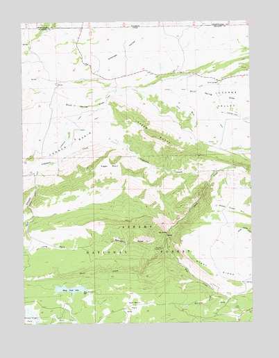
Jessen Butte, UT USGS Topographic Map
Click on map above to begin viewing in our Map Viewer.

This topographic map contains these locations and features:
Feature Name Type Latitude Longitude GNIS ID View Map
Antelope HollowValleyN40.9986°W109.8035°1438241View Map
Big SpringSpringN40.9121°W109.7970°1438736View Map
Birch SpringSpringN40.9745°W109.7685°1438810View Map
Daggett County JailBuildingN40.9785°W109.7773°2769013View Map
Daggett County Sheriff's OfficeBuildingN40.9783°W109.7773°2730362View Map
Digger BasinBasinN40.9402°W109.8268°1440459View Map
Dowds GraveCemeteryN40.9400°W109.7593°1454719View Map
Half Moon ParkFlatN40.8777°W109.8179°1441545View Map
Hope CreekStreamN40.9075°W109.7999°1441846View Map
Jessen ButteSummitN40.9527°W109.8035°1442134View Map
Lodgepole CanalCanalN40.9569°W109.8515°1442833View Map
Lodgepole CreekStreamN40.9375°W109.7693°1442835View Map
Long ParkFlatN40.9069°W109.8582°1442927View Map
Long Park DamDamN40.9083°W109.8690°1447999View Map
Long Park ReservoirReservoirN40.9069°W109.8633°1447998View Map
Mahogany DrawValleyN40.9094°W109.7996°1443084View Map
Palisade CampgroundLocaleN40.9061°W109.7993°1444165View Map
Palisades Memorial ParkParkN40.9072°W109.7993°1450089View Map
Sheep Creek CanalCanalN40.9313°W109.8671°1445495View Map
Sheep Creek Canyon Geological AreaAreaN40.9055°W109.8174°1448994View Map
Sheep Creek DamDamN40.8877°W109.8435°1447993View Map
Sheep Creek HillSummitN40.9202°W109.7524°1445498View Map
Sheep Creek LakeReservoirN40.8892°W109.8506°1445499View Map
Sheep Creek ParkFlatN40.8800°W109.8740°1445500View Map
Sols CanyonValleyN40.9105°W109.8707°1445781View Map
South Valley CanalCanalN40.9530°W109.7660°1445931View Map
Whiskey CreekStreamN40.8888°W109.7735°1447227View Map
Windy RidgeRidgeN40.8938°W109.7560°1447476View Map

Note: Coordinates in the location and feature list above are referenced to NAD83 datum.


Copyright (C) 2008-2024 Ryan Niemi / Sunset Dynamics ... All Rights Reserved