TopoQuest Logo
Do you find TopoQuest useful?
Help keep TopoQuest running and adding new maps/features by donating!
Bitcoin:  19c7KJd3qBynnjoSw5npx9KScwjBe4ifkT
Litecoin:  LXs6TkuXGGXo1vDsWCkWVdjQX94eUKd6ui
Home View Maps Find Maps Find Places Resources & Links


Glennville, California Topographic Map

USGS Map Title: Glennville, CA
USGS Map MRC: 35118F6
DRG (GeoTIFF) Download: o35118f6.tif


Neighboring USGS Topographic Map Quads:


  White River, CA  
35118G7
 

  Posey, CA  
35118G6
 

  Tobias Peak, CA  
35118G5
 

  Woody, CA  
35118F7
 

  Glennville, CA  
35118F6
 

  Alta Sierra, CA  
35118F5
 

  Pine Mountain, CA  
35118E7
 

  Democrat Hot Springs, CA  
35118E6
 

  Miracle Hot Springs, CA  
35118E5


Map MRC Location:

N36°
W119°
N36°
W118°
H8 H7 H6 H5 H4 H3 H2 H1
G8 G7 G6 G5 G4 G3 G2 G1
F8 F7 F6 F5 F4 F3 F2 F1
E8 E7 E6 E5 E4 E3 E2 E1
D8 D7 D6 D5 D4 D3 D2 D1
C8 C7 C6 C5 C4 C3 C2 C1
B8 B7 B6 B5 B4 B3 B2 B1
A8 A7 A6 A5 A4 A3 A2 A1
N35°
W119°
N35°
W118°

Glennville, CA USGS 1:24K Topographic Map Preview:
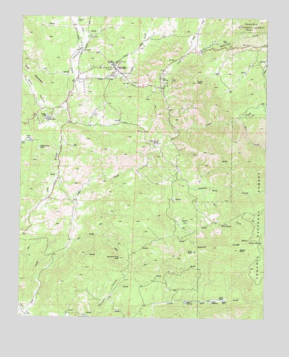
Glennville, CA USGS Topographic Map
Click on map above to begin viewing in our Map Viewer.

This topographic map contains these locations and features:
Feature Name Type Latitude Longitude GNIS ID View Map
Angel CreekStreamN35.7166°W118.7220°269534View Map
Basket FlatFlatN35.6644°W118.6668°269700View Map
Basket PassGapN35.6566°W118.6287°269701View Map
Basket PeakSummitN35.6533°W118.6393°269702View Map
Basket RidgeRidgeN35.6536°W118.6393°269703View Map
Bear CreekStreamN35.7080°W118.6395°269733View Map
Bear Hollow CreekStreamN35.7038°W118.7343°1662279View Map
Bohna CreekStreamN35.7136°W118.6276°269405View Map
Burnt SpringSpringN35.6641°W118.6484°270100View Map
Cedar CreekStreamN35.6416°W118.7415°270365View Map
Ercil LakeReservoirN35.6984°W118.7460°271068View Map
Fulton CreekStreamN35.7008°W118.6720°271249View Map
Fulton PeakSummitN35.7227°W118.6623°242545View Map
Fulton StationLocaleN35.7244°W118.6801°271250View Map
GlennvillePopulated PlaceN35.7288°W118.7037°271314View Map
Glennville AdobeLocaleN35.7266°W118.7006°271315View Map
Glennville Post OfficePost OfficeN35.7292°W118.7033°2769543View Map
Goat PeakSummitN35.6525°W118.6623°271319View Map
Johhnycakes LakeReservoirN35.6949°W118.7414°271794View Map
Kern County Fire Department Station 36 GlennvilleBuildingN35.7264°W118.7006°2665392View Map
Kern County Sheriff's Office - Glennville SubstationBuildingN35.7292°W118.7033°2756525View Map
Lackey PlacePopulated PlaceN35.6322°W118.6468°1660871View Map
Lake EngleReservoirN35.6327°W118.6465°271065View Map
Lake MarionReservoirN35.6319°W118.6658°272355View Map
Lake StocktonReservoirN35.6319°W118.6532°273906View Map
Lavers CrossingCrossingN35.7366°W118.7212°1835886View Map
Linns ValleyValleyN35.7091°W118.7168°272048View Map
Linns Valley - Poso Flat Elementary SchoolSchoolN35.7301°W118.7044°272049View Map
Lumreau CreekStreamN35.6891°W118.6876°272280View Map
McFarland CreekStreamN35.7352°W118.6670°272390View Map
Mill CreekStreamN35.6786°W118.6581°272462View Map
Oak Grove CemeteryCemeteryN35.7413°W118.7167°272745View Map
Peyton CreekStreamN35.7352°W118.6670°272935View Map
Poso Flat School (historical)SchoolN35.6283°W118.7493°275098View Map
Raljon LakeReservoirN35.7079°W118.7373°273177View Map
Raljon RanchLocaleN35.7069°W118.7373°273178View Map
Rock Corral SpringSpringN35.6972°W118.6806°273308View Map
White MillLocaleN35.6691°W118.6356°275099View Map
Windmill Tree PeakSummitN35.6497°W118.6995°274549View Map

Note: Coordinates in the location and feature list above are referenced to NAD83 datum.


Copyright (C) 2008-2024 Ryan Niemi / Sunset Dynamics ... All Rights Reserved