TopoQuest Logo
Do you find TopoQuest useful?
Help keep TopoQuest running and adding new maps/features by donating!
Bitcoin:  19c7KJd3qBynnjoSw5npx9KScwjBe4ifkT
Litecoin:  LXs6TkuXGGXo1vDsWCkWVdjQX94eUKd6ui
Home View Maps Find Maps Find Places Resources & Links


Essex, Montana Topographic Map

USGS Map Title: Essex, MT
USGS Map MRC: 48113C5
DRG (GeoTIFF) Download: o48113c5.tif


Neighboring USGS Topographic Map Quads:


  Stanton Lake, MT  
48113D6
 

  Mount Saint Nicholas, MT  
48113D5
 

  Mount Rockwell, MT  
48113D4
 

  Pinnacle, MT  
48113C6
 

  Essex, MT  
48113C5
 

  Blacktail, MT  
48113C4
 

  Felix Peak, MT  
48113B6
 

  Nimrod, MT  
48113B5
 

  Mount Bradley, MT  
48113B4


Map MRC Location:

N49°
W114°
N49°
W113°
H8 H7 H6 H5 H4 H3 H2 H1
G8 G7 G6 G5 G4 G3 G2 G1
F8 F7 F6 F5 F4 F3 F2 F1
E8 E7 E6 E5 E4 E3 E2 E1
D8 D7 D6 D5 D4 D3 D2 D1
C8 C7 C6 C5 C4 C3 C2 C1
B8 B7 B6 B5 B4 B3 B2 B1
A8 A7 A6 A5 A4 A3 A2 A1
N48°
W114°
N48°
W113°

Essex, MT USGS 1:24K Topographic Map Preview:
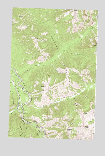
Essex, MT USGS Topographic Map
Click on map above to begin viewing in our Map Viewer.

This topographic map contains these locations and features:
Feature Name Type Latitude Longitude GNIS ID View Map
Briggs (historical)LocaleN48.2875°W113.6107°1796063View Map
Dickey CreekStreamN48.3039°W113.6112°782370View Map
EssexLocaleN48.2800°W113.6120°1796035View Map
EssexPopulated PlaceN48.2780°W113.6126°783229View Map
Essex CreekStreamN48.2786°W113.6065°783230View Map
Essex Cross Country Ski AreaLocaleN48.2739°W113.6248°1796091View Map
Essex Post Office (historical)Post OfficeN48.2973°W113.6153°806298View Map
Essex School (historical)SchoolN48.2791°W113.6109°1796036View Map
Fielding Coal Creek TrailTrailN48.3372°W113.5515°783372View Map
Half-Way Motel CampgroundLocaleN48.2958°W113.6120°1795920View Map
McDonald CreekStreamN48.2644°W113.5965°787030View Map
Middlefork Quick Response UnitBuildingN48.2852°W113.6069°2637879View Map
Mount ShieldsSummitN48.2756°W113.5160°790416View Map
Ole CreekStreamN48.2822°W113.5990°788430View Map
Park CreekStreamN48.3097°W113.6143°788637View Map
PinnacleLocaleN48.3166°W113.6204°1795970View Map
Rampage MountainSummitN48.3459°W113.5886°789364View Map
Riverview MountainSummitN48.3667°W113.6161°789614View Map
Running Rabbit MountainSummitN48.2590°W113.5408°789859View Map
Salvage MountainSummitN48.3749°W113.5359°789981View Map
Scalplock MountainSummitN48.3001°W113.5745°790101View Map
Sheep CreekStreamN48.2589°W113.5779°790332View Map
Snowslide GulchValleyN48.2597°W113.5769°794226View Map
Snowslip MountainSummitN48.2625°W113.5151°790808View Map
Soldier MountainSummitN48.3412°W113.5004°790840View Map
Tank CreekStreamN48.2655°W113.6009°791888View Map
Theodore Roosevelt PassGapN48.2652°W113.5901°792057View Map
Walton Ranger StationLocaleN48.2736°W113.6037°792791View Map
Walton Sportsmans AccessLocaleN48.2750°W113.6045°798862View Map

Note: Coordinates in the location and feature list above are referenced to NAD83 datum.


Copyright (C) 2008-2024 Ryan Niemi / Sunset Dynamics ... All Rights Reserved