TopoQuest Logo
Do you find TopoQuest useful?
Help keep TopoQuest running and adding new maps/features by donating!
Bitcoin:  19c7KJd3qBynnjoSw5npx9KScwjBe4ifkT
Litecoin:  LXs6TkuXGGXo1vDsWCkWVdjQX94eUKd6ui
Home View Maps Find Maps Find Places Resources & Links


Chestnut Mountain, North Carolina Topographic Map

USGS Map Title: Chestnut Mountain, NC
USGS Map MRC: 35081H7
DRG (GeoTIFF) Download: o35081h7.tif


Neighboring USGS Topographic Map Quads:


  Newland, NC  
36081A8
 

  Grandfather Mountain, NC  
36081A7
 

  Globe, NC  
36081A6
 

  Linville Falls, NC  
35081H8
 

  Chestnut Mountain, NC  
35081H7
 

  Collettsville, NC  
35081H6
 

  Ashford, NC  
35081G8
 

  Oak Hill, NC  
35081G7
 

  Morganton North, NC  
35081G6


Map MRC Location:

N36°
W82°
N36°
W81°
H8 H7 H6 H5 H4 H3 H2 H1
G8 G7 G6 G5 G4 G3 G2 G1
F8 F7 F6 F5 F4 F3 F2 F1
E8 E7 E6 E5 E4 E3 E2 E1
D8 D7 D6 D5 D4 D3 D2 D1
C8 C7 C6 C5 C4 C3 C2 C1
B8 B7 B6 B5 B4 B3 B2 B1
A8 A7 A6 A5 A4 A3 A2 A1
N35°
W82°
N35°
W81°

Chestnut Mountain, NC USGS 1:24K Topographic Map Preview:
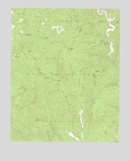
Chestnut Mountain, NC USGS Topographic Map
Click on map above to begin viewing in our Map Viewer.

This topographic map contains these locations and features:
Feature Name Type Latitude Longitude GNIS ID View Map
Bandy Cove MountainSummitN35.8946°W81.8457°1008911View Map
Barkhouse Picnic AreaLocaleN35.9546°W81.8532°1023742View Map
Brown MountainSummitN35.9293°W81.7582°1009663View Map
Brown Mountain Overlook Scenic ViewLocaleN35.9407°W81.8398°1017992View Map
Buck CreekStreamN35.9143°W81.8418°1009734View Map
Burnthouse BranchStreamN35.9504°W81.8234°1009852View Map
Chestnut MountainSummitN35.9618°W81.8071°1019649View Map
Cold MountainSummitN35.9754°W81.8643°1010377View Map
Cold SpringsPopulated PlaceN35.9546°W81.8712°1010388View Map
Craig CreekStreamN35.9479°W81.7568°1010557View Map
Daniel Boone Wildlife Management AreaParkN35.9429°W81.8737°1017363View Map
Daniel Boone Wildlife Management AreaParkN35.9662°W81.7937°1017885View Map
Estes Mill CreekStreamN35.9901°W81.7604°1011107View Map
Gingercake CreekStreamN35.9296°W81.8476°1027399View Map
Griffith BranchStreamN35.9310°W81.8057°1011748View Map
Harper CreekStreamN35.9724°W81.7654°1011866View Map
Headquarters MountainSummitN35.9929°W81.8673°1011950View Map
Horsepen CreekStreamN35.9510°W81.7637°1012213View Map
Hull BranchStreamN35.9829°W81.8268°1012273View Map
Jackson KnobSummitN35.9882°W81.7518°1012411View Map
KawanaPopulated PlaceN35.9807°W81.8232°1021016View Map
Lettered Rock RidgeRidgeN35.9210°W81.8626°1012828View Map
Licklog GapGapN35.9321°W81.8221°1012862View Map
Little Chestnut MountainSummitN35.9410°W81.7768°1012929View Map
Little ForkStreamN35.8996°W81.8162°1012962View Map
MortimerPopulated PlaceN35.9854°W81.7612°1021538View Map
Mortimer Recreation AreaLocaleN35.9987°W81.7696°1023745View Map
Mortimer Work CenterLocaleN35.9918°W81.7696°1023746View Map
Old Way RidgeRidgeN35.9371°W81.7957°1014110View Map
Parks CemeteryCemeteryN35.8848°W81.7509°1014231View Map
Persimmon RidgeRidgeN35.9896°W81.8029°1014347View Map
Phillips BranchStreamN35.9712°W81.7654°1014363View Map
Pine RidgeRidgeN35.9618°W81.7843°1014437View Map
Raider Camp CreekStreamN35.9776°W81.7807°1014713View Map
Rich Cove BranchStreamN35.8807°W81.8526°1014855View Map
Ripshin BranchStreamN35.9387°W81.8159°1014915View Map
Ripshin RidgeRidgeN35.9368°W81.8379°1014917View Map
Rose MountainRidgeN35.8815°W81.8312°1015088View Map
Simmons RidgeRidgeN35.9918°W81.8376°1015541View Map
Sugar KnobSummitN35.9718°W81.8368°1015925View Map
Thorps CreekStreamN35.9879°W81.7612°1016128View Map
Timbered BranchStreamN35.9204°W81.7923°1016155View Map
Township of Wilson CreekCivilN35.9770°W81.7652°1026493View Map
Windling Stair KnobSummitN35.9593°W81.8559°1023277View Map
Woodcock KnobSummitN35.9674°W81.7684°1023309View Map
Yellow Buck MountainSummitN35.9879°W81.7729°1016858View Map

Note: Coordinates in the location and feature list above are referenced to NAD83 datum.


Copyright (C) 2008-2024 Ryan Niemi / Sunset Dynamics ... All Rights Reserved