TopoQuest Logo
Do you find TopoQuest useful?
Help keep TopoQuest running and adding new maps/features by donating!
Bitcoin:  19c7KJd3qBynnjoSw5npx9KScwjBe4ifkT
Litecoin:  LXs6TkuXGGXo1vDsWCkWVdjQX94eUKd6ui
Home View Maps Find Maps Find Places Resources & Links


Charleston North, Illinois Topographic Map

USGS Map Title: Charleston North, IL
USGS Map MRC: 39088E2
DRG (GeoTIFF) Download: o39088e2.tif


Neighboring USGS Topographic Map Quads:


  Arcola, IL  
39088F3
 

  Hindsboro, IL  
39088F2
 

  Oakland, IL  
39088F1
 

  Humboldt, IL  
39088E3
 

  Charleston North, IL  
39088E2
 

  Ashmore, IL  
39088E1
 

  Mattoon East, IL  
39088D3
 

  Charleston South, IL  
39088D2
 

  Westfield West, IL  
39088D1


Map MRC Location:

N40°
W89°
N40°
W88°
H8 H7 H6 H5 H4 H3 H2 H1
G8 G7 G6 G5 G4 G3 G2 G1
F8 F7 F6 F5 F4 F3 F2 F1
E8 E7 E6 E5 E4 E3 E2 E1
D8 D7 D6 D5 D4 D3 D2 D1
C8 C7 C6 C5 C4 C3 C2 C1
B8 B7 B6 B5 B4 B3 B2 B1
A8 A7 A6 A5 A4 A3 A2 A1
N39°
W89°
N39°
W88°

Charleston North, IL USGS 1:24K Topographic Map Preview:
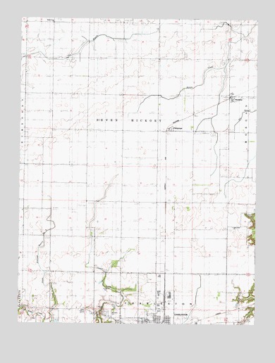
Charleston North, IL USGS Topographic Map
Click on map above to begin viewing in our Map Viewer.

This topographic map contains these locations and features:
Feature Name Type Latitude Longitude GNIS ID View Map
Bunker Hill School (historical)SchoolN39.6236°W88.1956°405201View Map
BushtonPopulated PlaceN39.5923°W88.1387°405287View Map
Bushton Post Office (historical)Post OfficeN39.5928°W88.1384°1807876View Map
Center School (historical)SchoolN39.5823°W88.1950°405808View Map
Charleston Post OfficePost OfficeN39.5015°W88.1907°1807881View Map
Coles CountyCivilN39.5203°W88.2218°424216View Map
Contrary School (historical)SchoolN39.6228°W88.1264°406489View Map
Cossel CemeteryCemeteryN39.5142°W88.2025°1721035View Map
Craig CemeteryCemeteryN39.5400°W88.1373°406720View Map
Dice School (historical)SchoolN39.5392°W88.2142°407190View Map
FairgrangePopulated PlaceN39.5786°W88.1717°408153View Map
First Apostolic ChurchChurchN39.5017°W88.1812°1962496View Map
Glassco School (historical)SchoolN39.5425°W88.2342°409052View Map
Grant School (historical)SchoolN39.5950°W88.2325°409300View Map
Marshall School (historical)SchoolN39.5500°W88.1900°413054View Map
Martin Box School (historical)SchoolN39.6236°W88.2331°413061View Map
Mound CemeteryCemeteryN39.5075°W88.2031°405983View Map
Mullen School (historical)SchoolN39.5384°W88.1678°414228View Map
North Union ChurchChurchN39.5400°W88.1373°1721052View Map
O'Hara School (historical)SchoolN39.6225°W88.1587°414748View Map
Old Salem Church (historical)ChurchN39.5056°W88.2428°415055View Map
Roselawn CemeteryCemeteryN39.5048°W88.2023°1721059View Map
Salem CemeteryCemeteryN39.5059°W88.2470°1721060View Map
Seven Hickory - Morgan Township Fire Protection DistrictBuildingN39.5788°W88.1498°2682581View Map
Seven Hickory School (historical)SchoolN39.5648°W88.2331°418227View Map
Township of Seven HickoryCivilN39.5866°W88.1935°427931View Map
Union Drainage District Number 3CanalN39.5489°W88.2331°425586View Map
Walnut Grove ChurchChurchN39.6231°W88.2331°1721063View Map
Walnut Grove School (historical)SchoolN39.5073°W88.2245°420464View Map
WEIC-AM (Charleston)TowerN39.5050°W88.2150°427956View Map
WEIC-FM (Charleston)TowerN39.5050°W88.2150°428141View Map
Winkleblack CemeteryCemeteryN39.5450°W88.1270°1721064View Map
Winkleblack School (historical)SchoolN39.5450°W88.1292°421329View Map

Note: Coordinates in the location and feature list above are referenced to NAD83 datum.


Copyright (C) 2008-2024 Ryan Niemi / Sunset Dynamics ... All Rights Reserved