TopoQuest Logo
Do you find TopoQuest useful?
Help keep TopoQuest running and adding new maps/features by donating!
Bitcoin:  19c7KJd3qBynnjoSw5npx9KScwjBe4ifkT
Litecoin:  LXs6TkuXGGXo1vDsWCkWVdjQX94eUKd6ui
Home View Maps Find Maps Find Places Resources & Links


Bryant Mountain, Oregon Topographic Map

USGS Map Title: Bryant Mountain, OR
USGS Map MRC: 42121A3
DRG (GeoTIFF) Download: o42121a3.tif


Neighboring USGS Topographic Map Quads:


  Bonanza, OR  
42121B4
 

  Lorella, OR  
42121B3
 

  Goodlow Mountain, OR  
42121B2
 

  Malin, OR  
42121A4
 

  Bryant Mountain, OR  
42121A3
 

  Langell Valley, OR  
42121A2
 

  Tulelake, CA  
41121H4
 

  Newell, CA  
41121H3
 

  Carr Butte, CA  
41121H2


Map MRC Location:

N43°
W122°
N43°
W121°
H8 H7 H6 H5 H4 H3 H2 H1
G8 G7 G6 G5 G4 G3 G2 G1
F8 F7 F6 F5 F4 F3 F2 F1
E8 E7 E6 E5 E4 E3 E2 E1
D8 D7 D6 D5 D4 D3 D2 D1
C8 C7 C6 C5 C4 C3 C2 C1
B8 B7 B6 B5 B4 B3 B2 B1
A8 A7 A6 A5 A4 A3 A2 A1
N42°
W122°
N42°
W121°

Bryant Mountain, OR USGS 1:24K Topographic Map Preview:
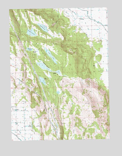
Bryant Mountain, OR USGS Topographic Map
Click on map above to begin viewing in our Map Viewer.

This topographic map contains these locations and features:
Feature Name Type Latitude Longitude GNIS ID View Map
Bryant MountainSummitN42.0338°W121.2753°1118171View Map
Capek ReservoirReservoirN42.0291°W121.3701°1133084View Map
Captain Jack LakeLakeN42.0864°W121.3512°1118598View Map
Dearborn ReservoirReservoirN42.1104°W121.2978°1160672View Map
Fivemile ReservoirReservoirN42.0499°W121.3261°1120811View Map
Grohs ReservoirReservoirN42.0136°W121.3498°1161637View Map
Gulch DamDamN42.0124°W121.3511°1161636View Map
Hamaker CanyonValleyN42.1235°W121.3144°1121531View Map
Harpold ReservoirReservoirN42.1023°W121.3483°1158280View Map
Hot SpringsPopulated PlaceN42.1152°W121.2861°1122063View Map
Lone Pine ReservoirReservoirN42.0841°W121.3416°1133284View Map
Long LakeReservoirN42.0806°W121.3248°1123436View Map
McCoy DamDamN42.0719°W121.3417°1131386View Map
McCoy ReservoirReservoirN42.0706°W121.3357°1131387View Map
McCoy SpringSpringN42.0760°W121.3395°1123925View Map
Miller CreekStreamN42.1077°W121.2567°1124194View Map
Mills CreekStreamN42.0171°W121.3497°1124219View Map
Pope ReservoirReservoirN42.0565°W121.3355°1125558View Map
Ralston SpringSpringN42.0705°W121.2696°1133073View Map
Smith DamDamN42.1065°W121.3290°1155655View Map
Smith ReservoirReservoirN42.1068°W121.3334°1133283View Map
Tule Lake (historical)Populated PlaceN42.1110°W121.2817°1159054View Map
Tule Lake Post Office (historical)Post OfficeN42.1110°W121.2817°1166070View Map
West CanalCanalN42.0799°W121.2564°1128815View Map
Wooden CreekStreamN42.0138°W121.3178°1133072View Map
Worlow DamDamN42.0652°W121.3189°1131385View Map
Worlow MeadowSwampN42.0715°W121.3323°1129327View Map
Worlow ReservoirReservoirN42.0641°W121.3150°1161602View Map

Note: Coordinates in the location and feature list above are referenced to NAD83 datum.


Copyright (C) 2008-2024 Ryan Niemi / Sunset Dynamics ... All Rights Reserved