TopoQuest Logo
Do you find TopoQuest useful?
Help keep TopoQuest running and adding new maps/features by donating!
Bitcoin:  19c7KJd3qBynnjoSw5npx9KScwjBe4ifkT
Litecoin:  LXs6TkuXGGXo1vDsWCkWVdjQX94eUKd6ui
Home View Maps Find Maps Find Places Resources & Links


Alloway, New Jersey Topographic Map

USGS Map Title: Alloway, NJ
USGS Map MRC: 39075E3
DRG (GeoTIFF) Download: o39075e3.tif


Neighboring USGS Topographic Map Quads:


  Penns Grove, NJ  
39075F4
 

  Woodstown, NJ  
39075F3
 

  Pitman West, NJ  
39075F2
 

  Salem, NJ  
39075E4
 

  Alloway, NJ  
39075E3
 

  Elmer, NJ  
39075E2
 

  Canton, NJ  
39075D4
 

  Shiloh, NJ  
39075D3
 

  Bridgeton, NJ  
39075D2


Map MRC Location:

N40°
W76°
N40°
W75°
H8 H7 H6 H5 H4 H3 H2 H1
G8 G7 G6 G5 G4 G3 G2 G1
F8 F7 F6 F5 F4 F3 F2 F1
E8 E7 E6 E5 E4 E3 E2 E1
D8 D7 D6 D5 D4 D3 D2 D1
C8 C7 C6 C5 C4 C3 C2 C1
B8 B7 B6 B5 B4 B3 B2 B1
A8 A7 A6 A5 A4 A3 A2 A1
N39°
W76°
N39°
W75°

Alloway, NJ USGS 1:24K Topographic Map Preview:
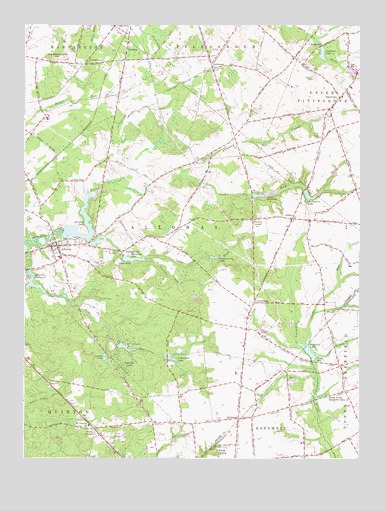
Alloway, NJ USGS Topographic Map
Click on map above to begin viewing in our Map Viewer.

This topographic map contains these locations and features:
Feature Name Type Latitude Longitude GNIS ID View Map
AldinePopulated PlaceN39.5690°W75.2749°874278View Map
AllowayPopulated PlaceN39.5609°W75.3624°874308View Map
Alloway AirfieldAirportN39.5431°W75.3051°884639View Map
Alloway Census Designated PlaceCensusN39.5621°W75.3509°2389125View Map
Alloway JunctionPopulated PlaceN39.5815°W75.3630°884525View Map
Alloway LakeReservoirN39.5658°W75.3564°874311View Map
Alloway Lake DamDamN39.5651°W75.3613°883796View Map
Alloway Post OfficePost OfficeN39.5592°W75.3631°2767810View Map
Alloway Township Ambulance CorporationBuildingN39.5611°W75.3607°2660202View Map
Alloway Township Fire CompanyBuildingN39.5610°W75.3609°2401734View Map
Alloway Township SchoolSchoolN39.5583°W75.3640°2372101View Map
Ballingers LakeReservoirN39.5759°W75.2685°874477View Map
Ballingers MillPopulated PlaceN39.5765°W75.2691°883119View Map
Ballingers Mill Pond DamDamN39.5773°W75.2705°883797View Map
Beals MillPopulated PlaceN39.5287°W75.2657°874582View Map
Big Mannington HillSummitN39.6157°W75.3616°874756View Map
Bostwick LakeReservoirN39.5298°W75.2679°874860View Map
Bostwicks Pond DamDamN39.5284°W75.2677°883799View Map
Camp EdgeLocaleN39.5565°W75.3377°875122View Map
Camp RooseveltLocaleN39.5748°W75.2857°875155View Map
Carlisle RunStreamN39.5567°W75.3298°875202View Map
Cedar BrookStreamN39.5623°W75.3505°875261View Map
CedarvillePopulated PlaceN39.6246°W75.3413°875321View Map
Clark BranchStreamN39.5296°W75.2638°875453View Map
Clarks RunStreamN39.5354°W75.2690°875466View Map
Cobbs MillPopulated PlaceN39.5293°W75.3210°883204View Map
Cobbs Mill DamDamN39.5287°W75.3213°883801View Map
Cobbs Mill LakeReservoirN39.5286°W75.3194°875531View Map
CohanseyPopulated PlaceN39.5115°W75.2949°875535View Map
Cohansey Seventh Day Adventist SchoolSchoolN39.5112°W75.2983°2372178View Map
Cool RunStreamN39.5815°W75.3171°875622View Map
Coxhat PondReservoirN39.5291°W75.3447°875681View Map
Coxhat Pond DamDamN39.5304°W75.3444°883795View Map
DaretownPopulated PlaceN39.6043°W75.2574°875799View Map
Daretown Fire CompanyBuildingN39.6060°W75.2594°2401740View Map
Daretown LakeReservoirN39.6110°W75.2512°882412View Map
Daretown Lake DamDamN39.6118°W75.2546°883798View Map
Daretown SchoolSchoolN39.6071°W75.2533°2373751View Map
Elkinton MillpondLakeN39.5501°W75.3718°876154View Map
FenwickPopulated PlaceN39.6176°W75.3369°876319View Map
Finley RunStreamN39.5238°W75.2657°876340View Map
Foxs MillPopulated PlaceN39.6134°W75.2538°876454View Map
FriesburgPopulated PlaceN39.5448°W75.2891°876535View Map
Houses PondLakeN39.5465°W75.3594°883203View Map
Mount Vernon ChurchChurchN39.5093°W75.3505°878597View Map
Mount Zion CemeteryCemeteryN39.6129°W75.3555°878598View Map
MowerPopulated PlaceN39.5868°W75.3627°882971View Map
OaklandPopulated PlaceN39.5987°W75.3413°882282View Map
Paradise LakesPopulated PlaceN39.5265°W75.3388°879114View Map
PauldingPopulated PlaceN39.6093°W75.2835°882969View Map
Pecks CornerPopulated PlaceN39.5068°W75.3485°879190View Map
Ponchantoula LakeReservoirN39.5580°W75.3042°879419View Map
PortertownPopulated PlaceN39.6137°W75.3530°879450View Map
RemstervillePopulated PlaceN39.5598°W75.3374°879659View Map
RiddletonPopulated PlaceN39.5946°W75.3527°882970View Map
Salem CountyCivilN39.5768°W75.3580°882233View Map
SlabtownPopulated PlaceN39.6184°W75.2663°880637View Map
Slabtown LakeReservoirN39.6166°W75.2636°880638View Map
South Jersey Nazarene CampLocaleN39.5171°W75.2621°880731View Map
StockingtonPopulated PlaceN39.5651°W75.3191°883117View Map
Strang School Ranch Hope for BoysSchoolN39.5479°W75.3626°2373785View Map
Sycamore LakeReservoirN39.5575°W75.3350°881064View Map
Thundergut PondReservoirN39.5320°W75.3376°881178View Map
Thundergut Pond DamDamN39.5329°W75.3385°882411View Map
Township of AllowayCivilN39.5612°W75.3194°882131View Map
Watson CornerPopulated PlaceN39.5687°W75.2896°881623View Map
Watsons CornerPopulated PlaceN39.5268°W75.2571°883118View Map
Watsons Mill PondReservoirN39.5762°W75.2856°882399View Map
Wentzell-Wilson DamDamN39.5818°W75.2605°883800View Map
Wentzell-Wilson PondReservoirN39.5829°W75.2592°882413View Map
Woods MillsPopulated PlaceN39.6215°W75.2585°883120View Map
YorktownPopulated PlaceN39.6126°W75.3049°881987View Map

Note: Coordinates in the location and feature list above are referenced to NAD83 datum.


Copyright (C) 2008-2024 Ryan Niemi / Sunset Dynamics ... All Rights Reserved