TopoQuest Logo
Do you find TopoQuest useful?
Help keep TopoQuest running and adding new maps/features by donating!
Bitcoin:  19c7KJd3qBynnjoSw5npx9KScwjBe4ifkT
Litecoin:  LXs6TkuXGGXo1vDsWCkWVdjQX94eUKd6ui
Home View Maps Find Maps Find Places Resources & Links


Camden, Michigan Topographic Map

USGS Map Title: Camden, MI
USGS Map MRC: 41084G7
DRG (GeoTIFF) Download: o41084g7.tif


Neighboring USGS Topographic Map Quads:


  Coldwater East, MI  
41084H8
 

  Allen, MI  
41084H7
 

  Hillsdale, MI  
41084H6
 

  California, MI  
41084G8
 

  Camden, MI  
41084G7
 

  Reading, MI  
41084G6
 

  Angola East, IN  
41084F8
 

  Clear Lake, IN  
41084F7
 

  Nettle Lake, OH  
41084F6


Map MRC Location:

N42°
W85°
N42°
W84°
H8 H7 H6 H5 H4 H3 H2 H1
G8 G7 G6 G5 G4 G3 G2 G1
F8 F7 F6 F5 F4 F3 F2 F1
E8 E7 E6 E5 E4 E3 E2 E1
D8 D7 D6 D5 D4 D3 D2 D1
C8 C7 C6 C5 C4 C3 C2 C1
B8 B7 B6 B5 B4 B3 B2 B1
A8 A7 A6 A5 A4 A3 A2 A1
N41°
W85°
N41°
W84°

Camden, MI USGS 1:24K Topographic Map Preview:
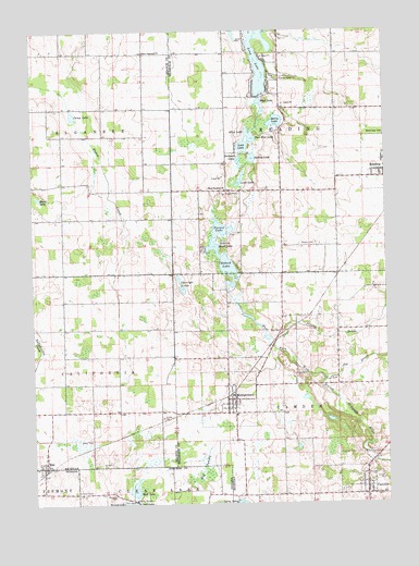
Camden, MI USGS Topographic Map
Click on map above to begin viewing in our Map Viewer.

This topographic map contains these locations and features:
Feature Name Type Latitude Longitude GNIS ID View Map
Allen LakeLakeN41.8481°W84.7986°619975View Map
Barre FieldParkN41.8397°W84.7542°2418394View Map
Beckwith LakeLakeN41.8409°W84.8017°620976View Map
Berg CemeteryCemeteryN41.7956°W84.7869°621153View Map
Berry LakeLakeN41.8511°W84.7883°621172View Map
Big SwampSwampN41.7589°W84.8144°431069View Map
Bovee LakeLakeN41.8311°W84.8727°621784View Map
CamdenPopulated PlaceN41.7523°W84.7577°622509View Map
Camden CemeteryCemeteryN41.7533°W84.7647°2419746View Map
Camden Community FieldParkN41.7519°W84.7667°2418474View Map
Camden Fire DepartmentBuildingN41.7555°W84.7579°2636049View Map
Camden Missionary ChurchChurchN41.7561°W84.7553°2419712View Map
Camden Post OfficePost OfficeN41.7522°W84.7578°2419713View Map
Camden Township LibraryBuildingN41.7550°W84.7572°2419711View Map
Camden United Methodist ChurchChurchN41.7583°W84.7581°2419710View Map
Camp LakeLakeN41.8528°W84.8602°622593View Map
Cartwright LakesLakeN41.8096°W84.8233°622815View Map
Covenant CemeteryCemeteryN41.7537°W84.8605°433048View Map
East Alganssee ChurchChurchN41.8692°W84.8352°625109View Map
Gleason CemeteryCemeteryN41.8189°W84.7747°626868View Map
Hillsdale Medical ClinicHospitalN41.7550°W84.7581°2419709View Map
Joe DrainStreamN41.7825°W84.7719°629291View Map
Kimball CampLocaleN41.8623°W84.7863°629672View Map
Lime LakeLakeN41.8349°W84.8016°630420View Map
Lime Lake CampgroundLocaleN41.8336°W84.8019°2418426View Map
Long LakeLakeN41.8629°W84.7937°630970View Map
Loon LakeLakeN41.8443°W84.7986°631038View Map
Mead LakeLakeN41.8228°W84.8086°632038View Map
MontgomeryPopulated PlaceN41.7773°W84.8041°632603View Map
Montgomery Fire Department Station 7BuildingN41.7737°W84.8043°2636152View Map
Montgomery Post OfficePost OfficeN41.7772°W84.8042°2418478View Map
Montgomery StationLocaleN41.7783°W84.8061°2418479View Map
Montgomery United Brethren ChurchChurchN41.7750°W84.8064°2418476View Map
Montgomery United Methodist ChurchChurchN41.7756°W84.8053°2418477View Map
Mud LakeLakeN41.8563°W84.7940°632890View Map
Mud LakeLakeN41.7542°W84.8400°439825View Map
Paw Paw LakeLakeN41.8464°W84.7969°634491View Map
Prouty DrainStreamN41.7909°W84.7897°635496View Map
RayPopulated PlaceN41.7598°W84.8719°635676View Map
Rebeck LakeLakeN41.8131°W84.8060°635699View Map
Suckey LakeLakeN41.8414°W84.7968°639012View Map
Township of CamdenCivilN41.7568°W84.7624°1626027View Map
Township of ReadingCivilN41.8547°W84.7677°1626957View Map
Turner LakeLakeN41.8229°W84.8089°1615185View Map
Village of CamdenCivilN41.7551°W84.7562°2397541View Map
Village of MontgomeryCivilN41.7775°W84.8064°2399388View Map
West Reading CemeteryCemeteryN41.8319°W84.8081°2418459View Map
West Reading ChurchChurchN41.8328°W84.8066°1616164View Map

Note: Coordinates in the location and feature list above are referenced to NAD83 datum.


Copyright (C) 2008-2024 Ryan Niemi / Sunset Dynamics ... All Rights Reserved