TopoQuest Logo
Do you find TopoQuest useful?
Help keep TopoQuest running and adding new maps/features by donating!
Bitcoin:  19c7KJd3qBynnjoSw5npx9KScwjBe4ifkT
Litecoin:  LXs6TkuXGGXo1vDsWCkWVdjQX94eUKd6ui
Home View Maps Find Maps Find Places Resources & Links


Calderwood, Tennessee Topographic Map

USGS Map Title: Calderwood, TN
USGS Map MRC: 35083E8
DRG (GeoTIFF) Download: o35083e8.tif


Neighboring USGS Topographic Map Quads:


  Binfield, TN  
35084F1
 

  Blockhouse, TN  
35083F8
 

  Kinzel Springs, TN  
35083F7
 

  Tallassee, TN  
35084E1
 

  Calderwood, TN  
35083E8
 

  Cades Cove, TN  
35083E7
 

  Whiteoak Flats, TN  
35084D1
 

  Tapoco, NC  
35083D8
 

  Fontana Dam, NC  
35083D7


Map MRC Location:

N36°
W84°
N36°
W83°
H8 H7 H6 H5 H4 H3 H2 H1
G8 G7 G6 G5 G4 G3 G2 G1
F8 F7 F6 F5 F4 F3 F2 F1
E8 E7 E6 E5 E4 E3 E2 E1
D8 D7 D6 D5 D4 D3 D2 D1
C8 C7 C6 C5 C4 C3 C2 C1
B8 B7 B6 B5 B4 B3 B2 B1
A8 A7 A6 A5 A4 A3 A2 A1
N35°
W84°
N35°
W83°

Calderwood, TN USGS 1:24K Topographic Map Preview:
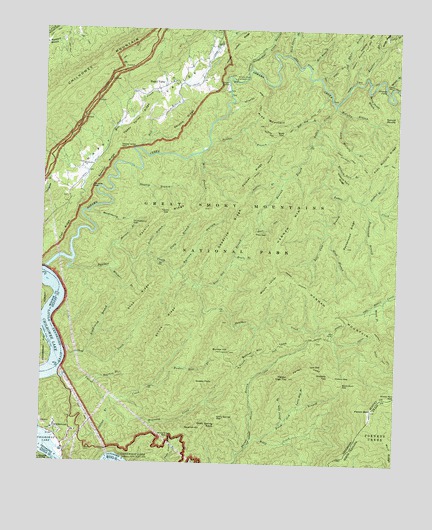
Calderwood, TN USGS Topographic Map
Click on map above to begin viewing in our Map Viewer.

This topographic map contains these locations and features:
Feature Name Type Latitude Longitude GNIS ID View Map
Abrams CreekStreamN35.5556°W83.9988°1304758View Map
Abrams Creek CampgroundLocaleN35.6107°W83.9332°1275430View Map
Abrams Creek ShoalsBarN35.5543°W83.9991°1642632View Map
Abrams FallsFallsN35.6084°W83.8796°1275431View Map
Abrams GapGapN35.5798°W83.9827°1275433View Map
Abrams RidgeRidgeN35.5987°W83.9499°1275434View Map
Andy McCully BranchStreamN35.6015°W83.8938°1275755View Map
Andy McCully RidgeRidgeN35.5907°W83.8772°1275756View Map
Bas Shaw CemeteryCemeteryN35.5075°W83.9546°2775224View Map
Bear Den BranchStreamN35.5515°W83.9449°1276607View Map
Bell BranchStreamN35.5904°W83.9660°1276907View Map
Bell Cove BranchStreamN35.5768°W83.8960°1276923View Map
Bible CreekStreamN35.5045°W83.9268°1277211View Map
Black Gum BranchStreamN35.5073°W83.9221°1277571View Map
Black Gum GapGapN35.5234°W83.8927°1277573View Map
Blacksmith BranchStreamN35.5312°W83.9843°1305275View Map
Boarhog BranchStreamN35.5245°W83.9788°1277851View Map
Boone CemeteryCemeteryN35.6073°W83.9668°1642634View Map
Boring CemeteryCemeteryN35.6117°W83.9315°2775223View Map
Bruin BranchStreamN35.5598°W83.9327°1278663View Map
Buck Shank BranchStreamN35.6176°W83.9143°1307412View Map
Buckshank BranchStreamN35.6181°W83.9143°1269271View Map
Bunker HillSummitN35.5322°W83.9362°1279005View Map
Bunker Hill BranchStreamN35.5223°W83.9605°1279009View Map
Bunker Hill LeadRidgeN35.5343°W83.9155°1279010View Map
Burchfield CemeteryCemeteryN35.5351°W83.9024°2775230View Map
CalderwoodPopulated PlaceN35.5093°W83.9941°1305593View Map
Carsons Iron Works (historical)LocaleN35.6143°W83.9271°1642636View Map
Cattail BranchStreamN35.5181°W83.9771°1279907View Map
Chilhowee CemeteryCemeteryN35.5859°W83.9857°1642633View Map
Chilhowee Primitive Baptist ChurchChurchN35.5859°W83.9857°1305900View Map
Chilly Spring GapGapN35.5131°W83.9371°1280467View Map
Chilly Spring KnobSummitN35.5109°W83.9378°1280468View Map
Chilogatee BranchStreamN35.5773°W83.9999°1327914View Map
Cooper Road CampsiteLocaleN35.6204°W83.9216°1323596View Map
Deadrick RidgeRidgeN35.5716°W83.9309°1282259View Map
Flat RidgeRidgeN35.5697°W83.9890°1328190View Map
Flint GapGapN35.5659°W83.9249°1284483View Map
Flint Gap CampsiteLocaleN35.5662°W83.9260°1652178View Map
Garland School (historical)SchoolN35.5762°W83.9891°1308140View Map
Gourley FordCrossingN35.6059°W83.9343°1642635View Map
Grassy FlatsFlatN35.5243°W83.9418°1285890View Map
Hannah BranchStreamN35.5926°W83.9057°1286741View Map
Hannah MountainRidgeN35.5543°W83.9167°1286746View Map
Hannah Mountain TrailTrailN35.5568°W83.9168°1286747View Map
Happy ValleyPopulated PlaceN35.6090°W83.9574°1286777View Map
Happy ValleyValleyN35.5788°W83.9935°1286778View Map
Happy Valley CemeteryCemeteryN35.6098°W83.9549°1642638View Map
Happy Valley GapGapN35.5909°W83.9738°1286784View Map
Happy Valley Missionary Baptist ChurchChurchN35.6101°W83.9555°1642637View Map
Happy Valley RidgeRidgeN35.5933°W83.9728°1286786View Map
Happy Valley School (historical)SchoolN35.6098°W83.9541°1323597View Map
Hickory GapGapN35.5248°W83.8957°1287581View Map
Hickory TopSummitN35.5257°W83.8979°1287622View Map
Hickory Turn BranchStreamN35.5873°W83.8985°1287625View Map
Hickory Turn RidgeRidgeN35.5821°W83.8927°1287626View Map
Huckleberry BranchStreamN35.5720°W83.9830°1288588View Map
Huckleberry GapGapN35.5693°W83.9682°1288591View Map
Kingfisher CreekStreamN35.6140°W83.9271°1290239View Map
Kreider BranchStreamN35.6104°W83.8907°1269709View Map
Little Bottom CampsiteLocaleN35.6151°W83.9066°1323598View Map
Little Bottoms TrailTrailN35.6115°W83.9055°1291395View Map
Lynn GapGapN35.5284°W83.9049°1292352View Map
Lynn Gap BranchStreamN35.5156°W83.9102°1292353View Map
Maynard CreekStreamN35.5181°W83.9752°1293019View Map
Maynard Hughes CemeteryCemeteryN35.5111°W83.9682°2775273View Map
McCully BranchStreamN35.6034°W83.8971°1293231View Map
Mill BranchStreamN35.5893°W83.9455°1293792View Map
Mill BranchStreamN35.6151°W83.9071°1293794View Map
Mill CreekStreamN35.5723°W83.9857°1293839View Map
Mink BranchStreamN35.5670°W83.9002°1294052View Map
Mitchell BranchStreamN35.5554°W83.9755°1294096View Map
Mount LanierSummitN35.5543°W83.9166°1307386View Map
Murray BranchStreamN35.5631°W83.9743°1295132View Map
Oak Flats BranchStreamN35.6090°W83.8924°1296051View Map
Panther CreekStreamN35.5579°W83.9891°1296741View Map
Panther Creek CemeteryCemeteryN35.5545°W83.9541°2775295View Map
Pardon BranchStreamN35.5931°W83.9416°1296763View Map
Parson BaldSummitN35.5158°W83.8829°1296886View Map
Parson High TopSummitN35.5249°W83.9121°1296889View Map
Parson LeadRidgeN35.5256°W83.8978°1296890View Map
Parsons - Ghormley CemeteryCemeteryN35.5553°W83.9969°2775296View Map
Peckerwood BranchStreamN35.5762°W83.8880°1297098View Map
Peckerwood RidgeRidgeN35.5525°W83.8883°1297100View Map
Pine MountainSummitN35.5972°W83.9211°1297563View Map
Polecat BranchStreamN35.5806°W83.9160°1298037View Map
Polecat RidgeRidgeN35.5784°W83.9305°1298050View Map
Rabbit CreekStreamN35.6040°W83.8971°1298772View Map
Rabbit Creek CampsiteLocaleN35.5926°W83.9049°1323599View Map
Revenue HillSummitN35.5113°W83.9418°1299240View Map
Rollins HollowValleyN35.5554°W83.9522°1300037View Map
Sawmill RidgeRidgeN35.5845°W83.9781°1300845View Map
Scott GapGapN35.5951°W83.9160°1300948View Map
Scott Gap BranchStreamN35.5984°W83.9027°1300949View Map
Shaw Grave GapGapN35.5076°W83.9546°1269937View Map
Shootly BranchStreamN35.5856°W83.9691°1270160View Map
Shop CreekStreamN35.5323°W83.9918°1270161View Map
Shop RidgeRidgeN35.5445°W83.9683°1270169View Map
Silver Creek ShoalsBarN35.5293°W83.9924°1642641View Map
Skunk RidgeRidgeN35.5412°W83.9548°1270453View Map
Slaty BranchStreamN35.5579°W83.9588°1270484View Map
Spruce Double BranchStreamN35.6076°W83.8857°1271158View Map
Stickbait BranchStreamN35.5765°W83.8849°1271379View Map
Sweet Gum BranchStreamN35.5112°W83.9149°1271967View Map
Tabcat CreekStreamN35.5245°W83.9935°1303983View Map
Tarkiln BranchStreamN35.5604°W83.9632°1272124View Map
Tarkiln GapGapN35.5715°W83.9568°1272127View Map
Tarkiln RidgeRidgeN35.5757°W83.9488°1272130View Map
W H Pryor CemeteryCemeteryN35.5232°W83.9909°2775311View Map
Weasel BranchStreamN35.5465°W83.8818°1273974View Map
Wedge RidgeRidgeN35.6248°W83.8790°1274056View Map
Whitehead CemeteryCemeteryN35.6229°W83.9373°2775317View Map
Wilham (historical)Populated PlaceN35.5329°W83.9916°1308139View Map
Wilson BranchStreamN35.6098°W83.8796°1274795View Map
Wolf RidgeRidgeN35.5115°W83.8820°1016789View Map

Note: Coordinates in the location and feature list above are referenced to NAD83 datum.


Copyright (C) 2008-2024 Ryan Niemi / Sunset Dynamics ... All Rights Reserved