TopoQuest Logo
Do you find TopoQuest useful?
Help keep TopoQuest running and adding new maps/features by donating!
Bitcoin:  19c7KJd3qBynnjoSw5npx9KScwjBe4ifkT
Litecoin:  LXs6TkuXGGXo1vDsWCkWVdjQX94eUKd6ui
Home View Maps Find Maps Find Places Resources & Links


Cahuilla Mountain, California Topographic Map

USGS Map Title: Cahuilla Mountain, CA
USGS Map MRC: 33116E7
DRG (GeoTIFF) Download: o33116e7.tif


Neighboring USGS Topographic Map Quads:


  Hemet, CA  
33116F8
 

  Blackburn Canyon, CA  
33116F7
 

  Idyllwild, CA  
33116F6
 

  Sage, CA  
33116E8
 

  Cahuilla Mountain, CA  
33116E7
 

  Anza, CA  
33116E6
 

  Vail Lake, CA  
33116D8
 

  Aguanga, CA  
33116D7
 

  Beauty Mountain, CA  
33116D6


Map MRC Location:

N34°
W117°
N34°
W116°
H8 H7 H6 H5 H4 H3 H2 H1
G8 G7 G6 G5 G4 G3 G2 G1
F8 F7 F6 F5 F4 F3 F2 F1
E8 E7 E6 E5 E4 E3 E2 E1
D8 D7 D6 D5 D4 D3 D2 D1
C8 C7 C6 C5 C4 C3 C2 C1
B8 B7 B6 B5 B4 B3 B2 B1
A8 A7 A6 A5 A4 A3 A2 A1
N33°
W117°
N33°
W116°

Cahuilla Mountain, CA USGS 1:24K Topographic Map Preview:
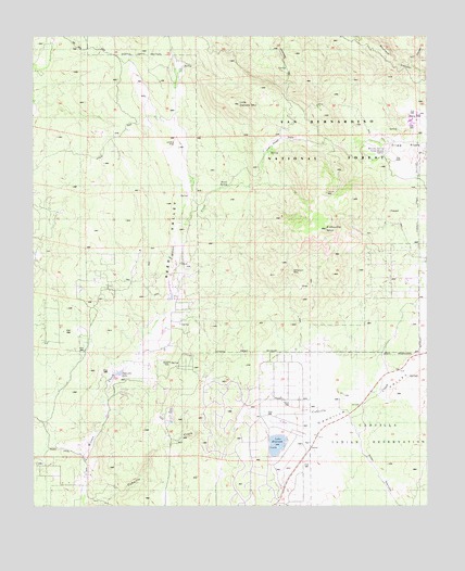
Cahuilla Mountain, CA USGS Topographic Map
Click on map above to begin viewing in our Map Viewer.

This topographic map contains these locations and features:
Feature Name Type Latitude Longitude GNIS ID View Map
Cahuilla LakeReservoirN33.5353°W116.8490°1701422View Map
Cahuilla MountainSummitN33.5767°W116.7831°270145View Map
Cahuilla Mountain WildernessReserveN33.5711°W116.7934°2767364View Map
Cal Fire Station 77BuildingN33.5099°W116.7894°2665367View Map
Duval SpringSpringN33.5856°W116.8139°270958View Map
Elder CanyonValleyN33.5209°W116.7750°1667750View Map
Elder CreekStreamN33.5270°W116.7800°271044View Map
Juan Diego FlatFlatN33.5964°W116.8011°271831View Map
Lake RiversideReservoirN33.5164°W116.7986°1701424View Map
Lake Riverside Census Designated PlaceCensusN33.5173°W116.8108°2583052View Map
Lake Riverside Estates AirportAirportN33.5209°W116.7959°1653221View Map
Lion CanyonValleyN33.6172°W116.7567°1667775View Map
Little Cahuilla MountainSummitN33.6067°W116.8103°272074View Map
Rancho SpringSpringN33.5947°W116.7641°1667793View Map
Reed ValleyValleyN33.5750°W116.8295°273260View Map
Tripp Flats Forest Service FaciltiyLocaleN33.5939°W116.7642°274965View Map
Williamson MineMineN33.5581°W116.7911°274509View Map

Note: Coordinates in the location and feature list above are referenced to NAD83 datum.


Copyright (C) 2008-2024 Ryan Niemi / Sunset Dynamics ... All Rights Reserved