TopoQuest Logo
Do you find TopoQuest useful?
Help keep TopoQuest running and adding new maps/features by donating!
Bitcoin:  19c7KJd3qBynnjoSw5npx9KScwjBe4ifkT
Litecoin:  LXs6TkuXGGXo1vDsWCkWVdjQX94eUKd6ui
Home View Maps Find Maps Find Places Resources & Links


Cable, Wisconsin Topographic Map

USGS Map Title: Cable, WI
USGS Map MRC: 46091B3
DRG (GeoTIFF) Download: o46091b3.tif


Neighboring USGS Topographic Map Quads:


  Upper Eau Claire Lake, WI  
46091C4
 

  Drummond, WI  
46091C3
 

  Diamond Lake, WI  
46091C2
 

  Totagatic Lake, WI  
46091B4
 

  Cable, WI  
46091B3
 

  Lake Tahkodah, WI  
46091B2
 

  Hayward, WI  
46091A4
 

  Seeley, WI  
46091A3
 

  Spider Lake, WI  
46091A2


Map MRC Location:

N47°
W92°
N47°
W91°
H8 H7 H6 H5 H4 H3 H2 H1
G8 G7 G6 G5 G4 G3 G2 G1
F8 F7 F6 F5 F4 F3 F2 F1
E8 E7 E6 E5 E4 E3 E2 E1
D8 D7 D6 D5 D4 D3 D2 D1
C8 C7 C6 C5 C4 C3 C2 C1
B8 B7 B6 B5 B4 B3 B2 B1
A8 A7 A6 A5 A4 A3 A2 A1
N46°
W92°
N46°
W91°

Cable, WI USGS 1:24K Topographic Map Preview:
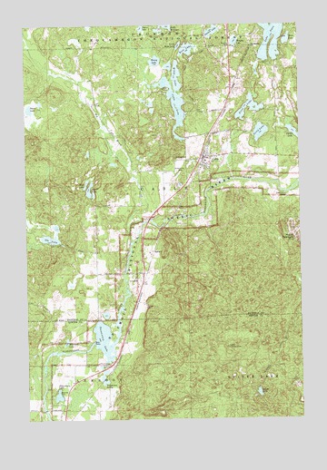
Cable, WI USGS Topographic Map
Click on map above to begin viewing in our Map Viewer.

This topographic map contains these locations and features:
Feature Name Type Latitude Longitude GNIS ID View Map
Bass LakeLakeN46.2451°W91.2554°1561273View Map
Big BrookStreamN46.1805°W91.3271°1578763View Map
CablePopulated PlaceN46.2080°W91.2921°1578909View Map
Cable Census Designated PlaceCensusN46.2013°W91.2933°2586463View Map
Cable LakeLakeN46.2250°W91.3038°1578910View Map
Cable Volunteer Fire DepartmentBuildingN46.2063°W91.2920°2696740View Map
Dawn LakeLakeN46.2234°W91.3732°1579086View Map
Great Divide Ambulance ServiceBuildingN46.2063°W91.2921°2698348View Map
Greenwood CemeteryCemeteryN46.2039°W91.3062°1579363View Map
Henry LakeLakeN46.2385°W91.3153°1579435View Map
LeonardsPopulated PlaceN46.1697°W91.3213°1579645View Map
Lerche LakeLakeN46.1978°W91.3461°1579646View Map
Little Rosa LakeLakeN46.2433°W91.3046°1579708View Map
Mossback LakeLakeN46.1496°W91.3574°1579928View Map
Motyka LakeLakeN46.2445°W91.2791°1579929View Map
Mount TelemarkSummitN46.1819°W91.2527°1580593View Map
Mount Telemark Winter Sports AreaLocaleN46.1847°W91.2505°1580974View Map
Ole LakeLakeN46.1823°W91.3643°1580054View Map
Pacwawong LakeLakeN46.1511°W91.3405°1580081View Map
Pacwawong SpringSpringN46.1369°W91.3396°1580082View Map
Perry LakeLakeN46.2159°W91.2678°1580122View Map
Philadelphia Biblical University - Wisconsin WildernessSchoolN46.2496°W91.2549°2713287View Map
Picture LakeLakeN46.2478°W91.2892°1580139View Map
Porter LakesLakeN46.2157°W91.2527°1580202View Map
Price LakeLakeN46.2258°W91.2725°1580211View Map
RadspurPopulated PlaceN46.1786°W91.3169°1580218View Map
Rosa LakeLakeN46.2425°W91.2999°1580286View Map
Saint Anne CemeteryCemeteryN46.2074°W91.3034°1580313View Map
Seeley Lookout TowerTowerN46.1477°W91.2838°1584509View Map
Silverthorn LakeLakeN46.1326°W91.3613°1580415View Map
Smear LakeLakeN46.2495°W91.3216°1580432View Map
Smith LakeLakeN46.1333°W91.2698°1580434View Map
Telemark Ski AreaLocaleN46.1847°W91.2505°1834269View Map
Town of CableCivilN46.2001°W91.3018°1582898View Map
West LakeLakeN46.1998°W91.3475°1580757View Map
Wiley LakeLakeN46.2271°W91.3064°1580790View Map

Note: Coordinates in the location and feature list above are referenced to NAD83 datum.


Copyright (C) 2008-2024 Ryan Niemi / Sunset Dynamics ... All Rights Reserved