TopoQuest Logo
Do you find TopoQuest useful?
Help keep TopoQuest running and adding new maps/features by donating!
Bitcoin:  19c7KJd3qBynnjoSw5npx9KScwjBe4ifkT
Litecoin:  LXs6TkuXGGXo1vDsWCkWVdjQX94eUKd6ui
Home View Maps Find Maps Find Places Resources & Links


Bybee Knoll, Utah Topographic Map

USGS Map Title: Bybee Knoll, UT
USGS Map MRC: 41111B5
DRG (GeoTIFF) Download: o41111b5.tif


Neighboring USGS Topographic Map Quads:


  Browns Hole, UT  
41111C6
 

  Causey Dam, UT  
41111C5
 

  Horse Ridge, UT  
41111C4
 

  Durst Mountain, UT  
41111B6
 

  Bybee Knoll, UT  
41111B5
 

  Lost Creek Dam, UT  
41111B4
 

  Morgan, UT  
41111A6
 

  Devils Slide, UT  
41111A5
 

  Henefer, UT  
41111A4


Map MRC Location:

N42°
W112°
N42°
W111°
H8 H7 H6 H5 H4 H3 H2 H1
G8 G7 G6 G5 G4 G3 G2 G1
F8 F7 F6 F5 F4 F3 F2 F1
E8 E7 E6 E5 E4 E3 E2 E1
D8 D7 D6 D5 D4 D3 D2 D1
C8 C7 C6 C5 C4 C3 C2 C1
B8 B7 B6 B5 B4 B3 B2 B1
A8 A7 A6 A5 A4 A3 A2 A1
N41°
W112°
N41°
W111°

Bybee Knoll, UT USGS 1:24K Topographic Map Preview:
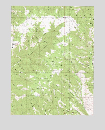
Bybee Knoll, UT USGS Topographic Map
Click on map above to begin viewing in our Map Viewer.

This topographic map contains these locations and features:
Feature Name Type Latitude Longitude GNIS ID View Map
Berry GulchValleyN41.1794°W111.6213°1438611View Map
Big Buck CanyonValleyN41.2069°W111.5844°1438642View Map
Black GulchValleyN41.1711°W111.5299°1438845View Map
Box CanyonValleyN41.1816°W111.5044°1439061View Map
Box SpringSpringN41.2488°W111.5373°1439083View Map
Bybee CreekStreamN41.1919°W111.6030°1439400View Map
Bybee GulchValleyN41.1827°W111.6155°1439401View Map
Bybee KnollSummitN41.1861°W111.5638°1439402View Map
Cold SpringSpringN41.1634°W111.5680°1439873View Map
Cordwood CreekStreamN41.1380°W111.5644°1439950View Map
Devils HollowValleyN41.1922°W111.5058°1440436View Map
Dry CanyonValleyN41.1722°W111.5308°1440575View Map
Dry HollowValleyN41.1430°W111.5199°1440648View Map
Goat KnollSummitN41.1449°W111.5569°1441341View Map
Herd MountainSummitN41.2227°W111.5991°1441720View Map
Hoodoo KnollSummitN41.1680°W111.5772°1441834View Map
Left Fork Guilder Sleeve CanyonValleyN41.1983°W111.5071°1442499View Map
Little Buck CanyonValleyN41.1988°W111.5935°1442674View Map
Long HollowValleyN41.1405°W111.5258°1442914View Map
Maggie Hopkins Cottonwood CreekStreamN41.1277°W111.5235°1443079View Map
Middle Fork Guilder Sleeve CanyonValleyN41.2005°W111.5102°1443345View Map
Morgan North DivisionCivilN41.1695°W111.5153°1939393View Map
Petes CanyonValleyN41.1833°W111.5052°1444315View Map
Raymonds HollowValleyN41.1894°W111.5063°1444750View Map
Right Fork Guilder Sleeve CanyonValleyN41.1983°W111.5074°1444922View Map
Right Fork Pete Nelson HollowValleyN41.2477°W111.5191°1444946View Map
Right Hand Fork Bybee CreekStreamN41.1849°W111.5955°1444972View Map
Rock SpringSpringN41.1548°W111.5835°1445100View Map
Tom Condies FlatFlatN41.1491°W111.5319°1446636View Map
Tom Condies HollowValleyN41.1563°W111.5455°1446637View Map
Willow SpringSpringN41.1692°W111.5663°1447437View Map
Willow SpringSpringN41.1906°W111.5566°1447438View Map

Note: Coordinates in the location and feature list above are referenced to NAD83 datum.


Copyright (C) 2008-2024 Ryan Niemi / Sunset Dynamics ... All Rights Reserved