TopoQuest Logo
Do you find TopoQuest useful?
Help keep TopoQuest running and adding new maps/features by donating!
Bitcoin:  19c7KJd3qBynnjoSw5npx9KScwjBe4ifkT
Litecoin:  LXs6TkuXGGXo1vDsWCkWVdjQX94eUKd6ui
Home View Maps Find Maps Find Places Resources & Links


Yellowjacket Canyon, Utah Topographic Map

USGS Map Title: Yellowjacket Canyon, UT
USGS Map MRC: 37112A6
DRG (GeoTIFF) Download: o37112a6.tif


Neighboring USGS Topographic Map Quads:


  The Barracks, UT  
37112B7
 

  Mount Carmel, UT  
37112B6
 

  White Tower, UT  
37112B5
 

  Elephant Butte, UT  
37112A7
 

  Yellowjacket Canyon, UT  
37112A6
 

  Kanab, UT  
37112A5
 

  Moccasin, AZ  
36112H7
 

  Kaibab, AZ  
36112H6
 

  Fredonia, AZ  
36112H5


Map MRC Location:

N38°
W113°
N38°
W112°
H8 H7 H6 H5 H4 H3 H2 H1
G8 G7 G6 G5 G4 G3 G2 G1
F8 F7 F6 F5 F4 F3 F2 F1
E8 E7 E6 E5 E4 E3 E2 E1
D8 D7 D6 D5 D4 D3 D2 D1
C8 C7 C6 C5 C4 C3 C2 C1
B8 B7 B6 B5 B4 B3 B2 B1
A8 A7 A6 A5 A4 A3 A2 A1
N37°
W113°
N37°
W112°

Yellowjacket Canyon, UT USGS 1:24K Topographic Map Preview:
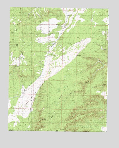
Yellowjacket Canyon, UT USGS Topographic Map
Click on map above to begin viewing in our Map Viewer.

This topographic map contains these locations and features:
Feature Name Type Latitude Longitude GNIS ID View Map
Chris SpringSpringN37.0120°W112.7084°1435301View Map
Coral Pink Sand Dunes CampgroundLocaleN37.0347°W112.7341°1435347View Map
Coral Pink Sand Dunes State ReserveParkN37.0386°W112.7158°1450309View Map
Cougar CanyonValleyN37.0069°W112.6416°1435359View Map
Ed Lamb PointCapeN37.0008°W112.6899°1427745View Map
Harris SpringsSpringN37.0858°W112.7448°1428552View Map
Indian Canyon Pictograph SiteLocaleN37.0739°W112.6441°1435735View Map
Moquith MountainsRangeN37.0180°W112.6966°44990View Map
Ponderosa Grove CampgroundLocaleN37.0886°W112.6730°1436157View Map
Sand SpringSpringN37.0758°W112.6661°1432206View Map
Sand Springs Overnight CampgroundLocaleN37.0772°W112.6655°1436308View Map
South Fork Indian CanyonValleyN37.0711°W112.6374°1432690View Map
Water CanyonValleyN37.0678°W112.6302°1433992View Map
Willow SpringSpringN37.0650°W112.7438°1436654View Map
Yellowjacket Picnic SiteParkN37.0775°W112.7041°1436673View Map
Yellowjacket SpringSpringN37.1058°W112.6897°1434507View Map

Note: Coordinates in the location and feature list above are referenced to NAD83 datum.


Copyright (C) 2008-2024 Ryan Niemi / Sunset Dynamics ... All Rights Reserved