TopoQuest Logo
Do you find TopoQuest useful?
Help keep TopoQuest running and adding new maps/features by donating!
Bitcoin:  19c7KJd3qBynnjoSw5npx9KScwjBe4ifkT
Litecoin:  LXs6TkuXGGXo1vDsWCkWVdjQX94eUKd6ui
Home View Maps Find Maps Find Places Resources & Links


Yale Dam, Washington Topographic Map

USGS Map Title: Yale Dam, WA
USGS Map MRC: 45122H3
DRG (GeoTIFF) Download: o45122h3.tif


Neighboring USGS Topographic Map Quads:


  Lakeview Peak, WA  
46122A4
 

  Cougar, WA  
46122A3
 

  Mount Mitchell, WA  
46122A2
 

  Amboy, WA  
45122H4
 

  Yale Dam, WA  
45122H3
 

  Siouxon Peak, WA  
45122H2
 

  Yacolt, WA  
45122G4
 

  Dole, WA  
45122G3
 

  Gumboot Mountain, WA  
45122G2


Map MRC Location:

N46°
W123°
N46°
W122°
H8 H7 H6 H5 H4 H3 H2 H1
G8 G7 G6 G5 G4 G3 G2 G1
F8 F7 F6 F5 F4 F3 F2 F1
E8 E7 E6 E5 E4 E3 E2 E1
D8 D7 D6 D5 D4 D3 D2 D1
C8 C7 C6 C5 C4 C3 C2 C1
B8 B7 B6 B5 B4 B3 B2 B1
A8 A7 A6 A5 A4 A3 A2 A1
N45°
W123°
N45°
W122°

Yale Dam, WA USGS 1:24K Topographic Map Preview:
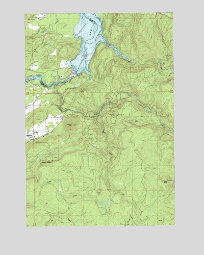
Yale Dam, WA USGS Topographic Map
Click on map above to begin viewing in our Map Viewer.

This topographic map contains these locations and features:
Feature Name Type Latitude Longitude GNIS ID View Map
Canyon CreekStreamN45.9579°W122.3498°1517349View Map
Chelatchie Prarie Mill PondReservoirN45.9265°W122.3745°1532067View Map
Chelatchie Prarie Mill Pond DamDamN45.9265°W122.3745°1532066View Map
Cowlitz - Skamania Fire District 7 Station 74BuildingN45.9672°W122.3725°2643872View Map
Fly CreekStreamN45.9401°W122.3148°1519663View Map
Green KnobSummitN45.9015°W122.2570°1520294View Map
Little Fly CreekStreamN45.8804°W122.2887°1522214View Map
Lost LakeLakeN45.9365°W122.2848°1522480View Map
North Country Emergency Medical Services Cresap Bay StationBuildingN45.9673°W122.3725°2643372View Map
North Siouxon CreekStreamN45.9693°W122.2609°1523909View Map
Saddle DamDamN45.9698°W122.3401°1528804View Map
Saddle Dam CampgroundLocaleN45.9679°W122.3404°1529524View Map
Siouxon CreekStreamN45.9721°W122.2845°1525819View Map
Speelyai Hill ViewpointLocaleN45.9890°W122.3543°1529526View Map
Tumtum MountainSummitN45.9346°W122.3359°1527446View Map
Yacolt DivisionCivilN45.9148°W122.3733°1939681View Map
Yale DamDamN45.9643°W122.3326°1528346View Map

Note: Coordinates in the location and feature list above are referenced to NAD83 datum.


Copyright (C) 2008-2024 Ryan Niemi / Sunset Dynamics ... All Rights Reserved