TopoQuest Logo
Do you find TopoQuest useful?
Help keep TopoQuest running and adding new maps/features by donating!
Bitcoin:  19c7KJd3qBynnjoSw5npx9KScwjBe4ifkT
Litecoin:  LXs6TkuXGGXo1vDsWCkWVdjQX94eUKd6ui
Home View Maps Find Maps Find Places Resources & Links


Yainax Butte, Oregon Topographic Map

USGS Map Title: Yainax Butte, OR
USGS Map MRC: 42121C3
DRG (GeoTIFF) Download: o42121c3.tif


Neighboring USGS Topographic Map Quads:


  Sprague River East, OR  
42121D4
 

  Beatty, OR  
42121D3
 

  Ferguson Mountain, OR  
42121D2
 

  Yonna, OR  
42121C4
 

  Yainax Butte, OR  
42121C3
 

  Dry Prairie, OR  
42121C2
 

  Bonanza, OR  
42121B4
 

  Lorella, OR  
42121B3
 

  Goodlow Mountain, OR  
42121B2


Map MRC Location:

N43°
W122°
N43°
W121°
H8 H7 H6 H5 H4 H3 H2 H1
G8 G7 G6 G5 G4 G3 G2 G1
F8 F7 F6 F5 F4 F3 F2 F1
E8 E7 E6 E5 E4 E3 E2 E1
D8 D7 D6 D5 D4 D3 D2 D1
C8 C7 C6 C5 C4 C3 C2 C1
B8 B7 B6 B5 B4 B3 B2 B1
A8 A7 A6 A5 A4 A3 A2 A1
N42°
W122°
N42°
W121°

Yainax Butte, OR USGS 1:24K Topographic Map Preview:
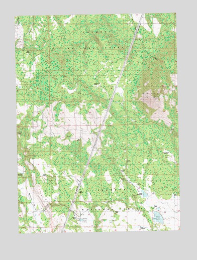
Yainax Butte, OR USGS Topographic Map
Click on map above to begin viewing in our Map Viewer.

This topographic map contains these locations and features:
Feature Name Type Latitude Longitude GNIS ID View Map
Aleys SpringSpringN42.2741°W121.3273°1133402View Map
Barrel SpringSpringN42.2901°W121.2913°1117257View Map
Bechdoldt FlatFlatN42.2699°W121.3661°1117466View Map
Bechdoldt GulchValleyN42.2610°W121.3622°1155319View Map
Bechdoldt ReservoirReservoirN42.2845°W121.3723°1117467View Map
Bull SpringSpringN42.3028°W121.3272°1118291View Map
Cedar SpringSpringN42.3071°W121.2569°1118763View Map
Cold SpringSpringN42.3302°W121.3284°1119102View Map
Coyote FlatFlatN42.2785°W121.3278°1119463View Map
Deer SpringSpringN42.3541°W121.3644°1119840View Map
Field SpringSpringN42.2769°W121.2845°1120700View Map
Indian SpringSpringN42.3086°W121.3726°1133403View Map
J PondLakeN42.2561°W121.3042°1133406View Map
John SpringSpringN42.3611°W121.2821°1122455View Map
Keno DamDamN42.2694°W121.2782°1133571View Map
Keno Guard StationLocaleN42.2649°W121.2817°1122690View Map
Keno ReservoirReservoirN42.2712°W121.2785°1122691View Map
Keno SpringSpringN42.2694°W121.2555°1161404View Map
Keno Springs RanchLocaleN42.2704°W121.2558°1122692View Map
Kitts MillLocaleN42.2943°W121.2814°1122787View Map
Mallory ReservoirReservoirN42.2575°W121.2681°1123718View Map
May ReservoirReservoirN42.2691°W121.3465°1133401View Map
McCartie ReservoirReservoirN42.2849°W121.2947°1123902View Map
McCartie SpringSpringN42.2837°W121.2946°1133407View Map
Mortar PointCapeN42.2615°W121.2714°1124375View Map
Mortar PrairieFlatN42.2568°W121.2594°1133119View Map
Mud SpringSpringN42.2838°W121.3544°1124473View Map
Rena ReservoirReservoirN42.2526°W121.2819°1133405View Map
Rocky CanyonValleyN42.2610°W121.3594°1167636View Map
Rocky PondLakeN42.2609°W121.3015°1133400View Map
Round PondReservoirN42.2582°W121.3303°1161689View Map
Round PrairieFlatN42.2568°W121.3231°1126330View Map
Sawmill FieldFlatN42.2743°W121.2850°1126619View Map
Sawmill SpringSpringN42.2806°W121.2926°1161499View Map
Sunset PrairieFlatN42.2907°W121.2564°1127753View Map
Sunset Prairie ReservoirReservoirN42.2953°W121.2611°1133404View Map
Tamarack SpringSpringN42.3341°W121.3152°1127880View Map
West Keno SpringsSpringN42.2660°W121.2650°1160775View Map
Yainax ButteSummitN42.3263°W121.2689°1129347View Map

Note: Coordinates in the location and feature list above are referenced to NAD83 datum.


Copyright (C) 2008-2024 Ryan Niemi / Sunset Dynamics ... All Rights Reserved