TopoQuest Logo
Do you find TopoQuest useful?
Help keep TopoQuest running and adding new maps/features by donating!
Bitcoin:  19c7KJd3qBynnjoSw5npx9KScwjBe4ifkT
Litecoin:  LXs6TkuXGGXo1vDsWCkWVdjQX94eUKd6ui
Home View Maps Find Maps Find Places Resources & Links


Wortham, Mississippi Topographic Map

USGS Map Title: Wortham, MS
USGS Map MRC: 30089E2
DRG (GeoTIFF) Download: o30089e2.tif


Neighboring USGS Topographic Map Quads:


  Silver Run, MS  
30089F3
 

  McHenry, MS  
30089F2
 

  Airey, MS  
30089F1
 

  Sellers, MS  
30089E3
 

  Wortham, MS  
30089E2
 

  Success, MS  
30089E1
 

  Dedeaux, MS  
30089D3
 

  Gulfport NW, MS  
30089D2
 

  Gulfport North, MS  
30089D1


Map MRC Location:

N31°
W90°
N31°
W89°
H8 H7 H6 H5 H4 H3 H2 H1
G8 G7 G6 G5 G4 G3 G2 G1
F8 F7 F6 F5 F4 F3 F2 F1
E8 E7 E6 E5 E4 E3 E2 E1
D8 D7 D6 D5 D4 D3 D2 D1
C8 C7 C6 C5 C4 C3 C2 C1
B8 B7 B6 B5 B4 B3 B2 B1
A8 A7 A6 A5 A4 A3 A2 A1
N30°
W90°
N30°
W89°

Wortham, MS USGS 1:24K Topographic Map Preview:
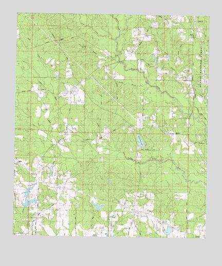
Wortham, MS USGS Topographic Map
Click on map above to begin viewing in our Map Viewer.

This topographic map contains these locations and features:
Feature Name Type Latitude Longitude GNIS ID View Map
Advance SchoolSchoolN30.6105°W89.2225°692377View Map
Big Biloxi Recreation AreaParkN30.5696°W89.1306°711182View Map
Big Hill Mobile Home ParkPopulated PlaceN30.5083°W89.2332°2596254View Map
Bully CreekStreamN30.5969°W89.2328°705660View Map
Cal Maine Lake DamDamN30.5202°W89.1917°695282View Map
Campground Baptist ChurchChurchN30.5195°W89.1896°2596128View Map
Cedar Dale ChurchChurchN30.5946°W89.1384°705406View Map
Central School (historical)SchoolN30.5346°W89.2359°705407View Map
Crow CreekStreamN30.6116°W89.1859°693021View Map
Dye CemeteryCemeteryN30.6046°W89.1753°705413View Map
Extended Hands Assembly of God ChurchChurchN30.5261°W89.1701°2596818View Map
Finley CemeteryCemeteryN30.5121°W89.1681°693215View Map
Full Gospel Mission ChurchChurchN30.5591°W89.1459°705415View Map
Fulton Pond DamDamN30.6202°W89.1634°695294View Map
Galilee ChurchChurchN30.6102°W89.2228°705416View Map
Harrison County FairgroundsLocaleN30.5058°W89.1797°2596300View Map
Harrison County Farm Lake DamDamN30.5002°W89.1717°695277View Map
Harrison County Fire Service - Lizana Volunteer Fire Department Station 1 Lizana School RoadBuildingN30.5277°W89.2343°2332776View Map
Harrison County Fire Service - Lizana Volunteer Fire Department Station 2 West Wortham RoadBuildingN30.5667°W89.1803°2332818View Map
Harrison County Fire Services AdministrationBuildingN30.5677°W89.1817°2332838View Map
Hickory CreekStreamN30.6155°W89.1834°693461View Map
Homestead Mobile Home ParkPopulated PlaceN30.5090°W89.1576°2596166View Map
Honey BranchStreamN30.5794°W89.1467°693518View Map
HoveyPopulated PlaceN30.6146°W89.1334°693544View Map
Ladner Lake DamDamN30.5885°W89.2250°695287View Map
Lakeview Independent Baptist ChurchChurchN30.5044°W89.1451°2597069View Map
Live Oak CemeteryCemeteryN30.5669°W89.1664°672728View Map
Living Word Church of SaucierChurchN30.6140°W89.1319°2596337View Map
Lizana Baptist ChurchChurchN30.5302°W89.2262°705419View Map
Lizana CemeteryCemeteryN30.5966°W89.2273°693797View Map
Lizana Elementary SchoolSchoolN30.5100°W89.2357°711608View Map
Lyman Census Designated PlaceCensusN30.5044°W89.1348°2403249View Map
Morgan Lake DamDamN30.6085°W89.1417°695292View Map
Morris Lake DamDamN30.5319°W89.1884°695283View Map
Paul McGill Lake DamDamN30.5035°W89.1517°695278View Map
Pleasant Hill ChurchChurchN30.6221°W89.1331°705425View Map
Redmonds Crossing (historical)LocaleN30.5674°W89.1367°710396View Map
Riverline LakeReservoirN30.5541°W89.1684°705428View Map
Riverline Lake DamDamN30.5519°W89.1684°695284View Map
Saint Ann ChurchChurchN30.5341°W89.2373°694639View Map
Saucier Census Designated PlaceCensusN30.6239°W89.1431°2402825View Map
Scarborough Lake DamDamN30.6002°W89.1500°695289View Map
Shade Tree FieldAirportN30.5127°W89.1475°2676415View Map
Supervisor District 2CivilN30.5362°W89.1845°711872View Map
Wedgeworth CemeteryCemeteryN30.6132°W89.1673°695110View Map
Windy Hill Lake DamDamN30.5152°W89.2417°695280View Map
WorthamPopulated PlaceN30.5546°W89.1325°695219View Map

Note: Coordinates in the location and feature list above are referenced to NAD83 datum.


Copyright (C) 2008-2024 Ryan Niemi / Sunset Dynamics ... All Rights Reserved