TopoQuest Logo
Do you find TopoQuest useful?
Help keep TopoQuest running and adding new maps/features by donating!
Bitcoin:  19c7KJd3qBynnjoSw5npx9KScwjBe4ifkT
Litecoin:  LXs6TkuXGGXo1vDsWCkWVdjQX94eUKd6ui
Home View Maps Find Maps Find Places Resources & Links


Woodville NE, Michigan Topographic Map

USGS Map Title: Woodville NE, MI
USGS Map MRC: 43085F5
DRG (GeoTIFF) Download: o43085f5.tif


Neighboring USGS Topographic Map Quads:


  Whipple Lake, MI  
43085G6
 

  Reed City South, MI  
43085G5


  Woodville, MI  
43085F6
 

  Woodville NE, MI  
43085F5
 

  Big Rapids, MI  
43085F4
 

  Big Prairie, MI  
43085E6
 

  Big Bend, MI  
43085E5
 

  Stanwood, MI  
43085E4


Map MRC Location:

N44°
W86°
N44°
W85°
H8 H7 H6 H5 H4 H3 H2 H1
G8 G7 G6 G5 G4 G3 G2 G1
F8 F7 F6 F5 F4 F3 F2 F1
E8 E7 E6 E5 E4 E3 E2 E1
D8 D7 D6 D5 D4 D3 D2 D1
C8 C7 C6 C5 C4 C3 C2 C1
B8 B7 B6 B5 B4 B3 B2 B1
A8 A7 A6 A5 A4 A3 A2 A1
N43°
W86°
N43°
W85°

Woodville NE, MI USGS 1:24K Topographic Map Preview:
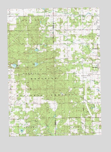
Woodville NE, MI USGS Topographic Map
Click on map above to begin viewing in our Map Viewer.

This topographic map contains these locations and features:
Feature Name Type Latitude Longitude GNIS ID View Map
Big Rapids High SchoolSchoolN43.6817°W85.5058°2518972View Map
Big Rapids Rest AreaLocaleN43.6569°W85.5217°2541668View Map
Bisel LakeLakeN43.6307°W85.6078°1619221View Map
Charter Township of Big RapidsCivilN43.6832°W85.5065°1625935View Map
Cobb SchoolSchoolN43.6859°W85.5242°1619543View Map
Good Shepherd Lutheran ChurchChurchN43.7286°W85.5006°2518885View Map
Green SchoolSchoolN43.7431°W85.5431°1620079View Map
Hatfield ChurchChurchN43.6564°W85.5870°1620144View Map
Havenview Mobile Home CourtPopulated PlaceN43.7347°W85.5058°2518948View Map
Hillside Baptist ChurchChurchN43.6569°W85.5864°2518884View Map
Hungerford CemeteryCemeteryN43.6936°W85.6231°1620278View Map
Hungerford LakeLakeN43.6945°W85.6164°1620279View Map
Hungerford Post Office (historical)Post OfficeN43.6917°W85.6153°2541833View Map
Hungerford Station (historical)LocaleN43.6919°W85.6153°2541799View Map
Interchange 139CrossingN43.6861°W85.5200°2541707View Map
Interchange 142CrossingN43.7431°W85.5308°2541687View Map
Jehovah's WitnessesChurchN43.7147°W85.5172°2518891View Map
Katke Golf CourseLocaleN43.6869°W85.5056°2518974View Map
Mount Camp CemeteryCemeteryN43.7139°W85.5162°1620914View Map
Mud LakeLakeN43.7092°W85.5860°1620931View Map
New Directions High SchoolSchoolN43.6817°W85.5125°2518973View Map
Resurrection Life ChurchChurchN43.6850°W85.5133°2518882View Map
Roben-Hood AirportAirportN43.7262°W85.5102°1623805View Map
Township of NorwichCivilN43.6852°W85.6220°1626824View Map
Turnbull LakeLakeN43.6953°W85.5869°1621972View Map
Van Gilder CemeteryCemeteryN43.7147°W85.5586°2519059View Map
Vangilder SchoolSchoolN43.7145°W85.5445°1622017View Map
WAAQ-FM (Big Rapids)TowerN43.6836°W85.5823°1625662View Map

Note: Coordinates in the location and feature list above are referenced to NAD83 datum.


Copyright (C) 2008-2024 Ryan Niemi / Sunset Dynamics ... All Rights Reserved