TopoQuest Logo
Do you find TopoQuest useful?
Help keep TopoQuest running and adding new maps/features by donating!
Bitcoin:  19c7KJd3qBynnjoSw5npx9KScwjBe4ifkT
Litecoin:  LXs6TkuXGGXo1vDsWCkWVdjQX94eUKd6ui
Home View Maps Find Maps Find Places Resources & Links


Wolf Creek, Montana Topographic Map

USGS Map Title: Wolf Creek, MT
USGS Map MRC: 47112A1
DRG (GeoTIFF) Download: o47112a1.tif


Neighboring USGS Topographic Map Quads:


  Comb Rock, MT  
47112B2
 

  Coburn Mountain, MT  
47112B1
 

  Mid Canon, MT  
47111B8
 

  Roberts Mountain, MT  
47112A2
 

  Wolf Creek, MT  
47112A1
 

  Craig, MT  
47111A8
 

  Mitchell Mountain, MT  
46112H2
 

  Sheep Creek, MT  
46112H1
 

  Beartooth Mountain, MT  
46111H8


Map MRC Location:

N48°
W113°
N48°
W112°
H8 H7 H6 H5 H4 H3 H2 H1
G8 G7 G6 G5 G4 G3 G2 G1
F8 F7 F6 F5 F4 F3 F2 F1
E8 E7 E6 E5 E4 E3 E2 E1
D8 D7 D6 D5 D4 D3 D2 D1
C8 C7 C6 C5 C4 C3 C2 C1
B8 B7 B6 B5 B4 B3 B2 B1
A8 A7 A6 A5 A4 A3 A2 A1
N47°
W113°
N47°
W112°

Wolf Creek, MT USGS 1:24K Topographic Map Preview:
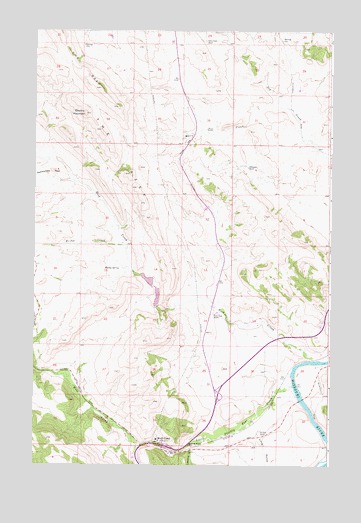
Wolf Creek, MT USGS Topographic Map
Click on map above to begin viewing in our Map Viewer.

This topographic map contains these locations and features:
Feature Name Type Latitude Longitude GNIS ID View Map
15N04W03BB__01 WellWellN47.0166°W112.1000°820170View Map
Acres GulchValleyN47.0191°W112.0003°800334View Map
Bridge CreekStreamN47.0622°W112.0864°800497View Map
Carterville / Wolf Creek CemeteryCemeteryN47.0068°W112.0855°1789421View Map
Curran-Barrett Number 2 DamDamN47.0549°W112.0792°798357View Map
Deerborn Reservoir DamDamN47.0499°W112.0725°796220View Map
Electric MountainSummitN47.1013°W112.1042°800754View Map
Interchange 226CrossingN47.0055°W112.0703°1789664View Map
Interchange 228CrossingN47.0202°W112.0469°1789665View Map
Lemline GulchValleyN47.0041°W112.0581°801051View Map
Little Prickly Pear CreekStreamN47.0227°W112.0158°801078View Map
Little Prickly Pear Creek BridgeBridgeN47.0041°W112.0675°1789449View Map
Long GulchValleyN47.0088°W112.0308°801095View Map
Montana River Outfitters CampgroundLocaleN47.0061°W112.0692°1789590View Map
Moore CreekStreamN47.1030°W112.0219°801187View Map
Moore GravesCemeteryN47.0969°W112.0530°801188View Map
Moore HillSummitN47.0911°W112.0625°801189View Map
Muddy SpringSpringN47.0565°W112.0891°801202View Map
Nohrgang RanchLocaleN47.0861°W112.0353°801223View Map
Power Post Office (historical)Post OfficeN47.0438°W112.0494°1789275View Map
Retloh Junction (historical)LocaleN47.0249°W112.0189°1789150View Map
Rock CreekStreamN47.0302°W112.0075°801373View Map
Rock Creek (historical)LocaleN47.0438°W112.0494°1789276View Map
Rock Creek RanchLocaleN47.0436°W112.0481°801377View Map
Sacred Heart Catholic ChurchChurchN47.0069°W112.0722°1789359View Map
Sentinel RanchLocaleN47.0094°W112.0292°801428View Map
Sentinel RockPillarN47.0058°W112.0597°801429View Map
Spring Creek Post Office (historical)Post OfficeN47.0416°W112.0111°1789250View Map
Sunny Crest RanchLocaleN47.1222°W112.0539°801569View Map
The ReefRidgeN47.1138°W112.1108°801596View Map
Wolf CreekLocaleN47.0061°W112.0692°1789230View Map
Wolf CreekPopulated PlaceN47.0061°W112.0692°801711View Map
Wolf CreekStreamN47.0055°W112.0800°801712View Map
Wolf Creek - Craig Fire Service Area Station 1BuildingN47.0051°W112.0714°1789327View Map
Wolf Creek BridgeBridgeN47.0063°W112.0800°1789448View Map
Wolf Creek Bridge Fishing Access SiteLocaleN47.0177°W112.0128°1744377View Map
Wolf Creek Elementary SchoolSchoolN47.0069°W112.0731°1789390View Map
Wolf Creek Post OfficePost OfficeN47.0061°W112.0694°1789231View Map

Note: Coordinates in the location and feature list above are referenced to NAD83 datum.


Copyright (C) 2008-2024 Ryan Niemi / Sunset Dynamics ... All Rights Reserved