TopoQuest Logo
Do you find TopoQuest useful?
Help keep TopoQuest running and adding new maps/features by donating!
Bitcoin:  19c7KJd3qBynnjoSw5npx9KScwjBe4ifkT
Litecoin:  LXs6TkuXGGXo1vDsWCkWVdjQX94eUKd6ui
Home View Maps Find Maps Find Places Resources & Links


Windy Peak, Wyoming Topographic Map

USGS Map Title: Windy Peak, WY
USGS Map MRC: 42105C5
DRG (GeoTIFF) Download: o42105c5.tif


Neighboring USGS Topographic Map Quads:


  School Section Mountain, WY  
42105D6
 

  Saddleback Mountain, WY  
42105D5
 

  Braae, WY  
42105D4
 

  Toltec, WY  
42105C6
 

  Windy Peak, WY  
42105C5
 

  Laramie Peak, WY  
42105C4
 

  Cottonwood Creek, WY  
42105B6
 

  Cow Creek Mountain, WY  
42105B5
 

  South Mountain, WY  
42105B4


Map MRC Location:

N43°
W106°
N43°
W105°
H8 H7 H6 H5 H4 H3 H2 H1
G8 G7 G6 G5 G4 G3 G2 G1
F8 F7 F6 F5 F4 F3 F2 F1
E8 E7 E6 E5 E4 E3 E2 E1
D8 D7 D6 D5 D4 D3 D2 D1
C8 C7 C6 C5 C4 C3 C2 C1
B8 B7 B6 B5 B4 B3 B2 B1
A8 A7 A6 A5 A4 A3 A2 A1
N42°
W106°
N42°
W105°

Windy Peak, WY USGS 1:24K Topographic Map Preview:
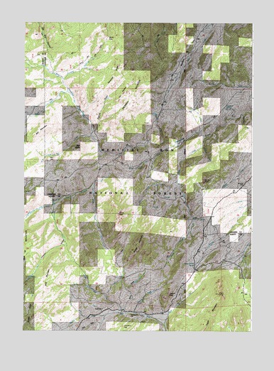
Windy Peak, WY USGS Topographic Map
Click on map above to begin viewing in our Map Viewer.

This topographic map contains these locations and features:
Feature Name Type Latitude Longitude GNIS ID View Map
Bar M MountainSummitN42.2852°W105.6217°1597917View Map
Beaver CreekStreamN42.3286°W105.5247°1585301View Map
Beaver MountainSummitN42.2841°W105.5614°1585325View Map
Bell and Scranton Number 2 DamDamN42.3150°W105.6222°1605789View Map
Bell and Scranton Number 2 ReservoirReservoirN42.3150°W105.6222°1605790View Map
Bell ButteSummitN42.3244°W105.5936°1585363View Map
Bell CreekStreamN42.3289°W105.5880°1585364View Map
Bell HillSummitN42.3197°W105.6108°1585367View Map
Bell MountainSummitN42.3319°W105.6142°1585369View Map
Bobcat CreekStreamN42.3277°W105.5472°1585722View Map
Bouncing RockLocaleN42.3097°W105.5042°1585809View Map
Buzzard CreekStreamN42.3252°W105.5255°1586222View Map
Buzzard PeakSummitN42.3114°W105.5258°1586223View Map
Camp CreekStreamN42.3261°W105.5392°1586299View Map
Devils PassGapN42.3689°W105.5778°1587566View Map
Eagle MountainSummitN42.2650°W105.5180°1587984View Map
Eagle PeakSummitN42.2650°W105.5180°1587988View Map
East Windy CreekStreamN42.3108°W105.5400°1588151View Map
Graveyard HillSummitN42.2561°W105.5664°1589085View Map
Grouse CreekStreamN42.2572°W105.5708°1589169View Map
Happy CreekStreamN42.3314°W105.5275°1589301View Map
Jackrabbit CreekStreamN42.2572°W105.5642°1590023View Map
Jaybird PeakSummitN42.2644°W105.5453°1590068View Map
Monday CreekStreamN42.3302°W105.5005°1601512View Map
Nine DrawValleyN42.2530°W105.5831°1592043View Map
North Horseshoe CreekStreamN42.3214°W105.5717°1601834View Map
Poor Mans PeakSummitN42.2516°W105.5703°1592953View Map
Porcupine CreekStreamN42.3525°W105.6033°1592957View Map
Prager SchoolSchoolN42.2586°W105.5817°1593012View Map
Pugilist GulchValleyN42.3314°W105.5855°1593054View Map
Sawtooth RidgeRidgeN42.3580°W105.5719°1593976View Map
Sheldon CreekStreamN42.2561°W105.5800°1594229View Map
Shepherd SpringsSpringN42.3405°W105.5153°1594247View Map
Silver Tip CreekStreamN42.2519°W105.5472°1594353View Map
Skunk CreekStreamN42.3472°W105.6011°1602953View Map
Slick MountainSummitN42.2752°W105.6108°1594454View Map
South Horseshoe CreekStreamN42.3214°W105.5717°1594702View Map
Stove DrawValleyN42.2580°W105.5692°1595096View Map
Stratton CreekStreamN42.3014°W105.6089°1603403View Map
The NeedlesSummitN42.3466°W105.5675°1595394View Map
Thirtytwo CanyonValleyN42.2989°W105.6086°1603628View Map
Thirtytwo CreekStreamN42.3014°W105.6089°1603629View Map
Trethway MountainSummitN42.3469°W105.5678°1595696View Map
Wagon Wheel SpringSpringN42.2770°W105.5309°1595975View Map
Windy CreekStreamN42.3091°W105.5861°1596530View Map
Windy PeakSummitN42.2975°W105.5730°1596537View Map

Note: Coordinates in the location and feature list above are referenced to NAD83 datum.


Copyright (C) 2008-2024 Ryan Niemi / Sunset Dynamics ... All Rights Reserved