TopoQuest Logo
Do you find TopoQuest useful?
Help keep TopoQuest running and adding new maps/features by donating!
Bitcoin:  19c7KJd3qBynnjoSw5npx9KScwjBe4ifkT
Litecoin:  LXs6TkuXGGXo1vDsWCkWVdjQX94eUKd6ui
Home View Maps Find Maps Find Places Resources & Links


White Rock Peak, Nevada Topographic Map

USGS Map Title: White Rock Peak, NV
USGS Map MRC: 38114B1
DRG (GeoTIFF) Download: o38114b1.tif


Neighboring USGS Topographic Map Quads:


  Miller Canyon, NV  
38114C2
 

  Gleason Basin, NV  
38114C1
 

  Miners Cabin Wash, UT  
38113C8
 

  Buck Wash Well, NV  
38114B2
 

  White Rock Peak, NV  
38114B1
 

  Atchison Creek, UT  
38113B8
 

  Eagle Valley Reservoir, NV  
38114A2
 

  Rice Mountain, UT  
38114A1
 

  Steamboat Mountain SW, UT  
38113A8


Map MRC Location:

N39°
W115°
N39°
W114°
H8 H7 H6 H5 H4 H3 H2 H1
G8 G7 G6 G5 G4 G3 G2 G1
F8 F7 F6 F5 F4 F3 F2 F1
E8 E7 E6 E5 E4 E3 E2 E1
D8 D7 D6 D5 D4 D3 D2 D1
C8 C7 C6 C5 C4 C3 C2 C1
B8 B7 B6 B5 B4 B3 B2 B1
A8 A7 A6 A5 A4 A3 A2 A1
N38°
W115°
N38°
W114°

White Rock Peak, NV USGS 1:24K Topographic Map Preview:
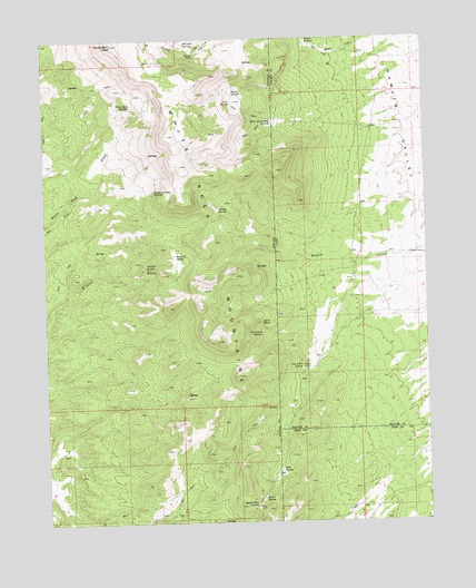
White Rock Peak, NV USGS Topographic Map
Click on map above to begin viewing in our Map Viewer.

This topographic map contains these locations and features:
Feature Name Type Latitude Longitude GNIS ID View Map
Barrel SpringSpringN38.1310°W114.0553°838606View Map
Devil RockPillarN38.1769°W114.0558°840022View Map
Devil Rock SpringsSpringN38.1738°W114.0555°840023View Map
Lake SpringSpringN38.2336°W114.0650°841551View Map
Log Cabin SpringSpringN38.1646°W114.0421°1429852View Map
Meadow SpringSpringN38.1940°W114.0830°842041View Map
Mud SpringSpringN38.1387°W114.0492°1430560View Map
Quaking Aspen SpringsSpringN38.2109°W114.0896°843024View Map
Reeds CabinLocaleN38.1647°W114.0419°1431732View Map
Reeds Cabin SummitGapN38.1294°W114.0575°843185View Map
Ripgut SpringsSpringN38.2488°W114.0391°1431850View Map
Riprap SpringsSpringN38.2360°W114.0649°845236View Map
Sawmill SpringsSpringN38.2489°W114.0796°843523View Map
Scottys CabinLocaleN38.2463°W114.0772°856367View Map
South Camp SpringSpringN38.1907°W114.0540°851063View Map
Ticapoo SpringSpringN38.1283°W114.1036°851062View Map
White Rock Cabin SpringsSpringN38.2286°W114.0516°844789View Map
White Rock MountainsRangeN38.2488°W114.1030°845288View Map
White Rock PeakSummitN38.2488°W114.1033°845740View Map
White Rock Range WildernessReserveN38.1898°W114.0906°2575160View Map
White Rock SpringsSpringN38.2328°W114.0964°845290View Map
Wildcat SpringSpringN38.1908°W114.0926°844868View Map
Willow SpringSpringN38.2059°W114.0688°844933View Map

Note: Coordinates in the location and feature list above are referenced to NAD83 datum.


Copyright (C) 2008-2024 Ryan Niemi / Sunset Dynamics ... All Rights Reserved